
This map of residential sub-areas in the DC metro region was produced by the Federal Housing Administration in 1937. The map categorizes neighborhoods into grades that represent how worthy they were for investment and insured mortgage lending. The grading system was directly influenced by race and class.
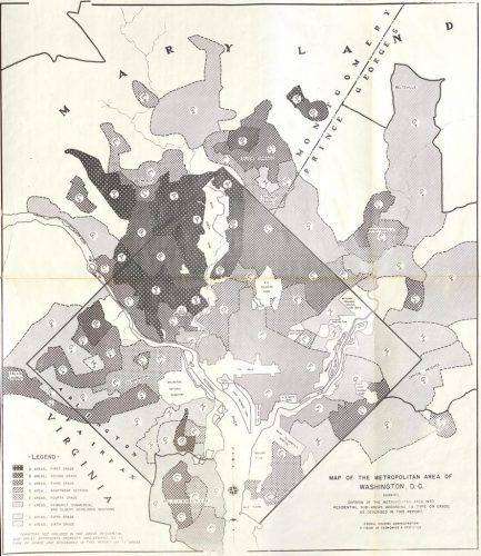
Montgomery County is visible on this map. The higher graded regions (which are shaded darker) include Bethesda, Chevy Chase, and a portion of Silver Spring. Neighborhoods that had higher concentrations of African Americans were assigned the lowest grades (shaded lighter).
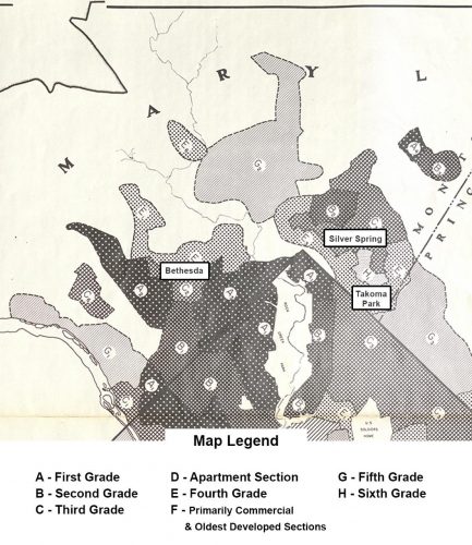
Other parts of the county are unmarked because they were rural with limited development at the time.
Source: Mapping Segregation in DC project/National Archives
By Nyrene Monforte
Recent Stories
A Gaithersburg woman is $200,000 richer after purchasing winning Powerball lottery tickets from two separate retailers in Montgomery Village. Full story below courtesy MD Lottery:

Montgomery County has announced that all nine of its golf courses have achieved “Certified Audubon Cooperative Sanctuary” for environmental excellence.
Wootton High School principal Douglas Nelson sent a message to the Wootton High School community on Monday that was originally sent out on April 18th, but may not have been…
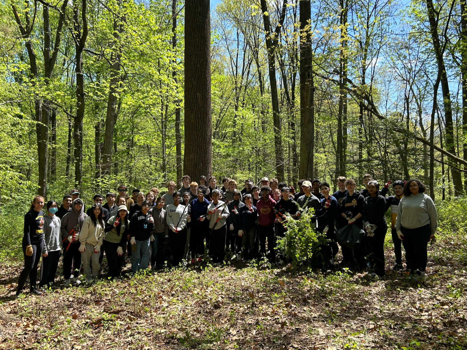
Wheaton High School’s National Honor Society has partnered with the City of Rockville Government to clear the area that used to be Avery Road Colored Cemetery behind Croydon Creek Nature…
17th Annual Kensington Day of the Book Festival
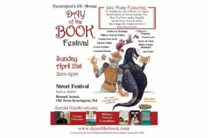
Now in its 17th year, the Kensington Day of the Book Festival is a family-friendly street festival featuring 150+ renowned authors, poets, and literary organizations. Enjoy live music on five stages, special guest speakers, military veteran writers and comedians, poetry readings, cookbook demos, children's program, and much more.
Admission is free, and attendees will also be able to explore a marketplace of books and food offerings from local vendors.
Not your average book festival! This festival offers something for everyone!
17th Annual Kensington Day of the Book Festival
Sunday, April 21, 2024, 11am-4pm (held rain or shine!)
Howard Avenue, Kensington, MD 20895
www.dayofthebook.com
Instagram: @kensingtonbookfestival
Contact: Elisenda Sola-Sole, Festival Director
301-949-9416 (text preferred)
FEST OF SPRING Caribbean Wine Food & Music Festival

Get ready to experience the vibrant colors, tantalizing flavors, and infectious rhythms of the Caribbean at the FEST OF SPRING Caribbean Wine Food & Music Festival! Hosted by RHU LLC, this exciting festival is set to take place on May 18, 2024, at the picturesque 16700 Barnesville Rd in Boyds, MD.
Step into a world where the Caribbean spirit comes alive! From 12:00 PM onwards, immerse yourself in a sensory journey that celebrates the unique culture, cuisine, and music of the Caribbean. Whether you're an African American, a Reggae or Soca music enthusiast, a wine lover, or part of the vibrant Caribbean diaspora, this festival promises to delight and captivate you in every way.
Let the enticing aromas of mouthwatering Caribbean dishes tantalize your taste buds. Feast on traditional delicacies prepared by expert chefs, showcasing the rich and diverse culinary heritage of the Caribbean. Indulge in flavorful jerk chicken, succulent seafood, and delectable plantain dishes that will transport you straight to the islands.
Accompanying the culinary extravaganza is a carefully curated selection of premium wines, ensuring the perfect pairing for your palate. Sip on fine wines from renowned vineyards, each sip a reflection of the Caribbean's vibrant spirit. Discover new flavors, expand your wine knowledge, and savor unforgettable moments with every glass.
As the sun sets, get ready to groove to the infectious rhythms of Caribbean music. Feel the pulsating beats of reggae, soca, dancehall, and calypso, moving your body to the lively melodies. Live performances by talented musicians and performers will keep the energy high, ensuring a night of unforgettable entertainment.
Don't miss this opportunity to embrace the Caribbean spirit and celebrate the arrival of spring in style! Tickets are available on AllEvents, so secure your spot today. Join us at the FEST OF SPRING Caribbean Wine Food & Music Festival, where cultures collide and unforgettable memories are made.
LIVE PERFORMANCES By: CULTURE Feat. Kenyatta Hill, EXCO LEVI, IMAGE BAND, RAS LIDJ REGG'GO with Special Guest SUGAR BEAR FROM E.U. & MORE! & MORE!
MUSIC By: DJ ABLAZE, DJ SMALLY & NAJ SUPREME
2 NIGHT Camping packages available: RV/CAMPER $200 | TENTS $150 Starting on Friday May 17 @ 5pm | 30 RV SPACES | 30+ TENT SPACES
KIDS 12 & UNDER FREE!!!