
Areal Flood Watch in effect for Central and Southeast Montgomery from 10am Friday morning until 6pm Friday evening.
Rainfall amounts around 1 to 2 inches are most likely
with isolated amounts of 2 to 4 inches possible. Heavy amounts of rain will cause creeks and streams to slowly rise, possibly out of their banks, as well as the potential for flooding in urban areas.
It is advised to monitor later forecasts and be alert for possible Flood Warnings. Those living in areas prone to flooding should be prepared to take action should flooding develop.
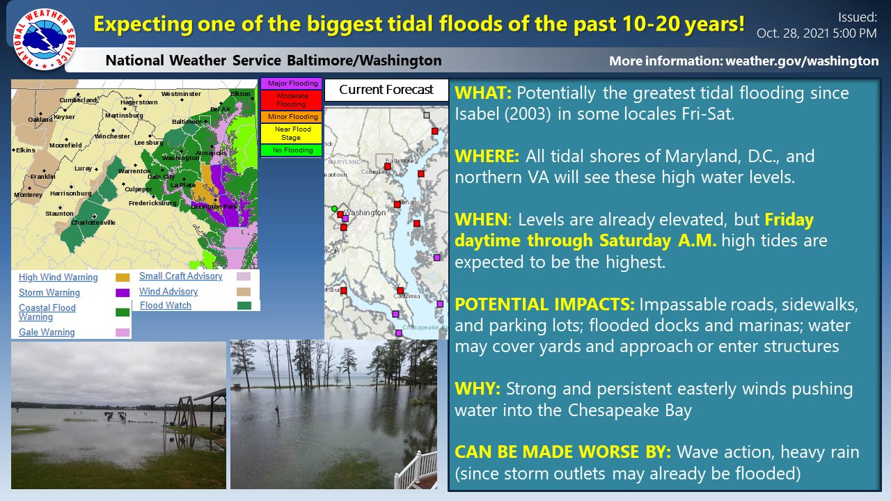
The National Weather Service is referring to this event as “one of the biggest tidal flood events of the past 10-20 years.”
Harford County Schools, NE of Baltimore City, have announced they’ll be closed on Friday.
While major coastal/tidal flooding will be the main story with this system, Flood Watches & Wind Advisories/Warnings have also been issued in other portions of the area. Check https://t.co/jmfOhAnmF3 for the latest at your location! #MDwx #VAwx #DCwx #WVwx pic.twitter.com/S86PX8hI32
— NWS Baltimore-Washington (@NWS_BaltWash) October 28, 2021
Recent Stories

The Biden Administration has announced final rules that require airlines to provide automatic cash refunds to passengers when owed and protect consumers from costly surprise airline fees. “These rules will…
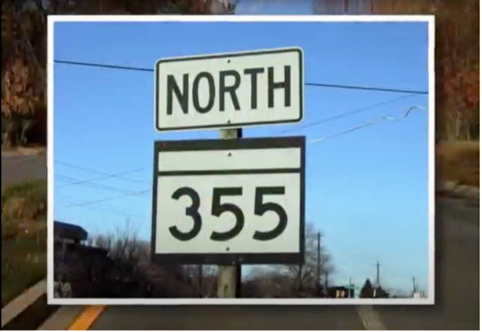
Montgomery History will host “The Great Road: 355 from Georgetown to Frederick”, a free online presentation beginning April 29.
The Montgomery County Commission for Women has announced it will be hosting five free career seminars this spring.

The Maryland State Police released a news statement on Wednesday, April 24, seeking public assistance as investigators continue their search for a 10-year-old boy who was reported missing over 55…
FEST OF SPRING Caribbean Wine Food & Music Festival

Get ready to experience the vibrant colors, tantalizing flavors, and infectious rhythms of the Caribbean at the FEST OF SPRING Caribbean Wine Food & Music Festival! Hosted by RHU LLC, this exciting festival is set to take place on May 18, 2024, at the picturesque 16700 Barnesville Rd in Boyds, MD.
Step into a world where the Caribbean spirit comes alive! From 12:00 PM onwards, immerse yourself in a sensory journey that celebrates the unique culture, cuisine, and music of the Caribbean. Whether you're an African American, a Reggae or Soca music enthusiast, a wine lover, or part of the vibrant Caribbean diaspora, this festival promises to delight and captivate you in every way.
Let the enticing aromas of mouthwatering Caribbean dishes tantalize your taste buds. Feast on traditional delicacies prepared by expert chefs, showcasing the rich and diverse culinary heritage of the Caribbean. Indulge in flavorful jerk chicken, succulent seafood, and delectable plantain dishes that will transport you straight to the islands.
Accompanying the culinary extravaganza is a carefully curated selection of premium wines, ensuring the perfect pairing for your palate. Sip on fine wines from renowned vineyards, each sip a reflection of the Caribbean's vibrant spirit. Discover new flavors, expand your wine knowledge, and savor unforgettable moments with every glass.
As the sun sets, get ready to groove to the infectious rhythms of Caribbean music. Feel the pulsating beats of reggae, soca, dancehall, and calypso, moving your body to the lively melodies. Live performances by talented musicians and performers will keep the energy high, ensuring a night of unforgettable entertainment.
Don't miss this opportunity to embrace the Caribbean spirit and celebrate the arrival of spring in style! Tickets are available on AllEvents, so secure your spot today. Join us at the FEST OF SPRING Caribbean Wine Food & Music Festival, where cultures collide and unforgettable memories are made.
LIVE PERFORMANCES By: CULTURE Feat. Kenyatta Hill, EXCO LEVI, IMAGE BAND, RAS LIDJ REGG'GO with Special Guest SUGAR BEAR FROM E.U. & MORE! & MORE!
MUSIC By: DJ ABLAZE, DJ SMALLY & NAJ SUPREME
2 NIGHT Camping packages available: RV/CAMPER $200 | TENTS $150 Starting on Friday May 17 @ 5pm | 30 RV SPACES | 30+ TENT SPACES
KIDS 12 & UNDER FREE!!!