
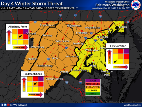
There is now an “enhanced risk” for a Day 3 (Wednesday into Thursday) and Day 4 (Thursday into Friday) winter storm threat, according to the National Weather Service. Per the images seen below, the enhanced threat covers half of Montgomery County while the other half is under a “slight risk”.
MoCoSnow report from Monday morning: We’ve been watching the possibility of winter weather early on Thursday morning and there’s currently a possibility for a little ice in the early to mid-morning. Things have gone from possible snow to all rain to some ice, so there’s still a little time for this to get figured out before there’s any certainty behind what kind of event this will be.
This morning the GFS (American model) shows the surface low a little further east than it was last night, which means we could see a period of ice or snow early on Thursday before everything switches over to rain. If the low stays closer to the coast, as it looked like it would until this morning, then it would likely be too warm for us to see much/any winter precipitation.
For the next couple days we will be watching where this will go. If the Euro (European model) run this afternoon looks more like this GFS run, then ice is certainly in play. As of now, it’s something to keep an eye on with the possibility of a little ice on Thursday morning.

Recent Stories
The Maryland State Police have released information regarding its participation in this Saturday’s National Drug Take Back Day.

Transportation Security Administration (TSA) officers have announced that it had intercepted its sixth gun at a security checkpoint so far this month.
Mayor Jud Ashman and members of the City Council hosted the 2024 State of the City address on Thursday, April 18, at Asbury Methodist Village.
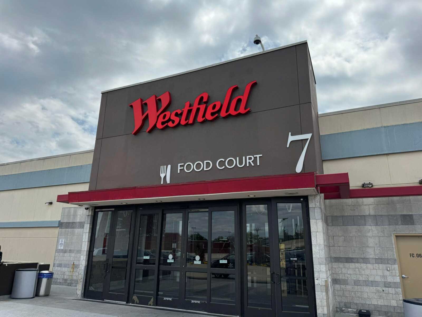
Below is a list of businesses that have recently opened, closed, or are coming soon to Wheaton Mall at 11160 Veirs Mill Rd.
FEST OF SPRING Caribbean Wine Food & Music Festival

Get ready to experience the vibrant colors, tantalizing flavors, and infectious rhythms of the Caribbean at the FEST OF SPRING Caribbean Wine Food & Music Festival! Hosted by RHU LLC, this exciting festival is set to take place on May 18, 2024, at the picturesque 16700 Barnesville Rd in Boyds, MD.
Step into a world where the Caribbean spirit comes alive! From 12:00 PM onwards, immerse yourself in a sensory journey that celebrates the unique culture, cuisine, and music of the Caribbean. Whether you're an African American, a Reggae or Soca music enthusiast, a wine lover, or part of the vibrant Caribbean diaspora, this festival promises to delight and captivate you in every way.
Let the enticing aromas of mouthwatering Caribbean dishes tantalize your taste buds. Feast on traditional delicacies prepared by expert chefs, showcasing the rich and diverse culinary heritage of the Caribbean. Indulge in flavorful jerk chicken, succulent seafood, and delectable plantain dishes that will transport you straight to the islands.
Accompanying the culinary extravaganza is a carefully curated selection of premium wines, ensuring the perfect pairing for your palate. Sip on fine wines from renowned vineyards, each sip a reflection of the Caribbean's vibrant spirit. Discover new flavors, expand your wine knowledge, and savor unforgettable moments with every glass.
As the sun sets, get ready to groove to the infectious rhythms of Caribbean music. Feel the pulsating beats of reggae, soca, dancehall, and calypso, moving your body to the lively melodies. Live performances by talented musicians and performers will keep the energy high, ensuring a night of unforgettable entertainment.
Don't miss this opportunity to embrace the Caribbean spirit and celebrate the arrival of spring in style! Tickets are available on AllEvents, so secure your spot today. Join us at the FEST OF SPRING Caribbean Wine Food & Music Festival, where cultures collide and unforgettable memories are made.
LIVE PERFORMANCES By: CULTURE Feat. Kenyatta Hill, EXCO LEVI, IMAGE BAND, RAS LIDJ REGG'GO with Special Guest SUGAR BEAR FROM E.U. & MORE! & MORE!
MUSIC By: DJ ABLAZE, DJ SMALLY & NAJ SUPREME
2 NIGHT Camping packages available: RV/CAMPER $200 | TENTS $150 Starting on Friday May 17 @ 5pm | 30 RV SPACES | 30+ TENT SPACES
KIDS 12 & UNDER FREE!!!