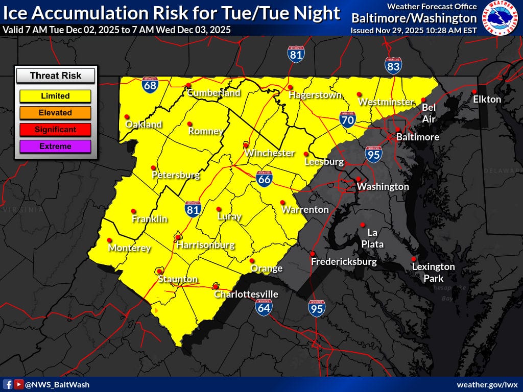
The National Weather Service has issued a “limited snow/sleet risk” for this Monday night into Tuesday morning (featured photo above) along with a limited use risk for Tuesday (photo below).
At this point, it’s more of a “keep an eye on it” situation than a real threat. The NWS has placed the region in its “limited risk” category, meaning a slippery Tuesday morning could happen, but it’s only a possibility.
The NWS says the region could see a mix of rain, snow, and possibly freezing rain early next week as a new storm system tracks toward the Mid-Atlantic. The NWS Forecasters Discussion noted that the next system will move in Monday night and pass over or near the area on Tuesday.
According to the discussion, snow and freezing rain are most likely along and west of the Blue Ridge, where colder air will linger the longest. Forecasters also note that a wintry mix could push farther east toward the I-95 corridor, including portions of Montgomery County, but a cold rain is currently expected to be the primary precipitation type for most of the area.
High temperatures Tuesday are forecast to reach the 30s to low 40s, with overnight lows dropping into the 20s for most of the region and the 30s in the metro areas. The NWS will continue to refine the forecast through the weekend as confidence grows in the storm’s track and temperature profile.