
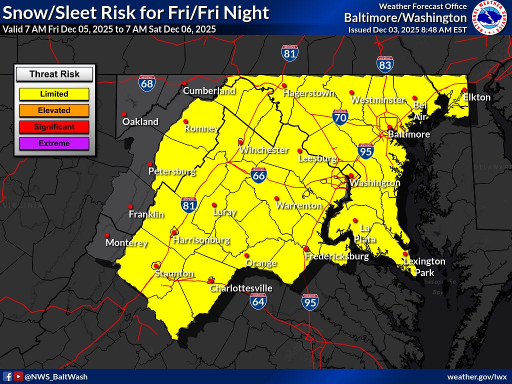
The National Weather Service (NWS) has most of Maryland and Northern Virginia in the “limited” risk category for the threat of snow on Friday, with models showing the potential of a fast storm heading our way ahead of the weekend.
As of now (Wednesday morning), models aren’t agreeing on a solution, but one possibility (European model) shows fast, light snow showers possibly headed our way late Friday morning into Friday evening. Temperatures elate expected to be below freezing so any snow that falls would stick and likely accumulate.
The other possibility (GFS) shows the storm missing us to the south, with only flurries making it up to central Maryland. The NWS Forecasters Discussion writes, “Almost all ensemble and deterministic guidance has enough cold air in place to favor all snow in our FA should moisture make it this far north. There are a few outliers that have rain across the far S of the FA. FWIW, snow and ice has trended up slightly over the past couple of runs. While amounts are forecast to generally be light (an inch or two, perhaps three should a higher end solution verify), the northward shift is notable.”
