The National Weather Service has issued an updated Winter Weather Advisory for the Baltimore-Washington region, including all of Montgomery County, as a quick-moving snow event is expected late Saturday night into early Sunday morning.
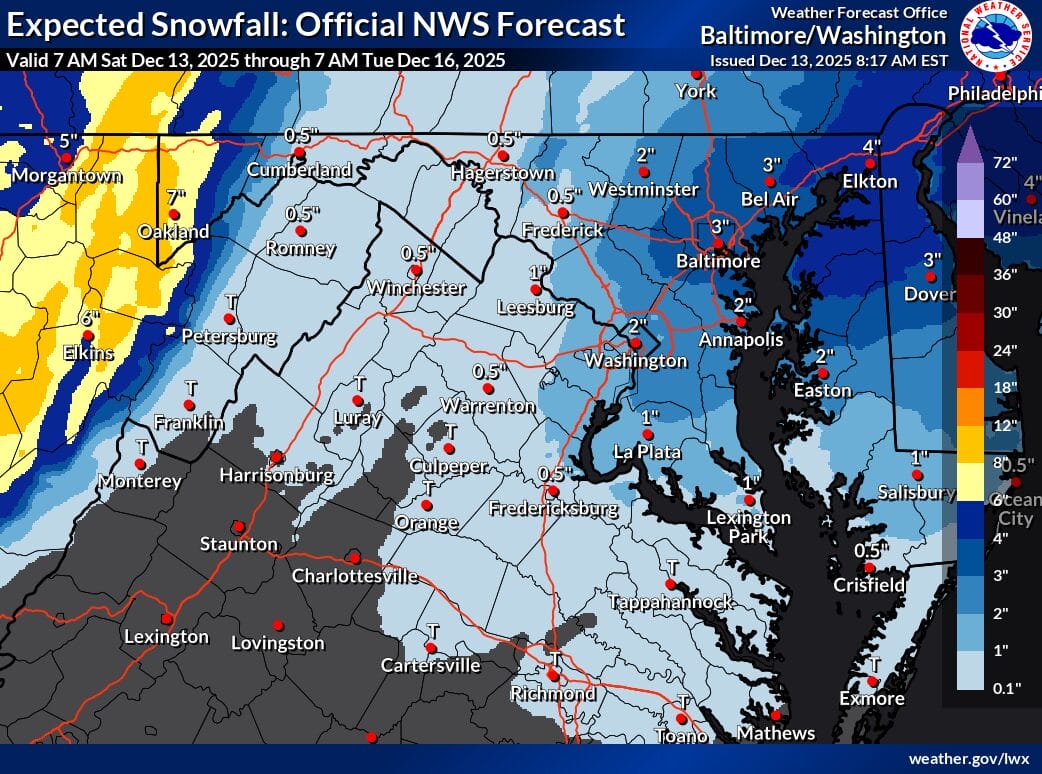
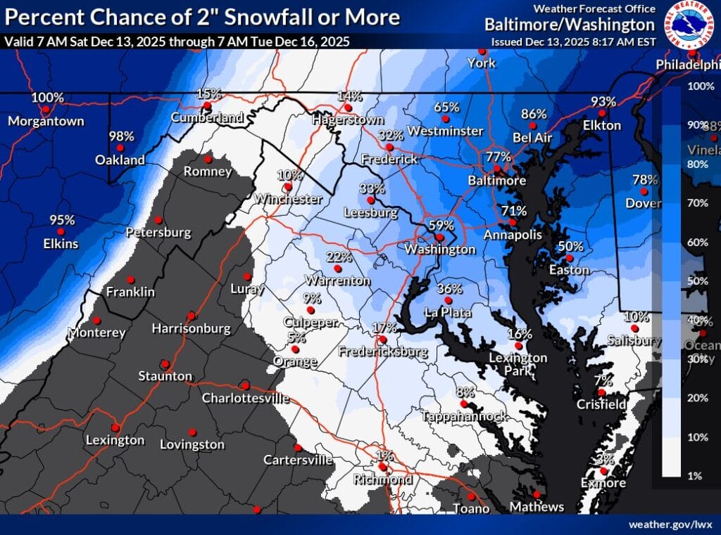
In Montgomery County, snowfall totals are currently forecast in the 1 to 2 inch range, with the eastern half of the county favored to see the higher end of that range. Central Montgomery County and areas near Washington, DC have a 59 percent chance of receiving more than 2 inches of snow, according to the NWS.The eastern side is slightly higher, but that probability drops to around 33 percent in western portions of the county.
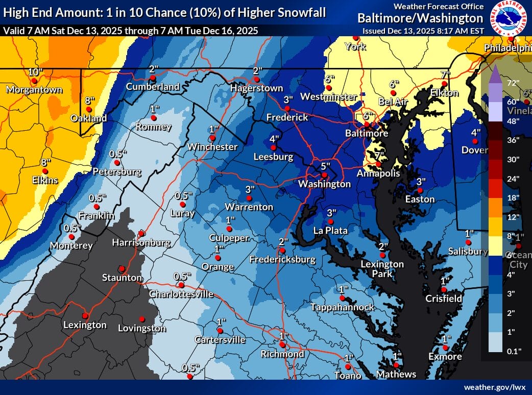
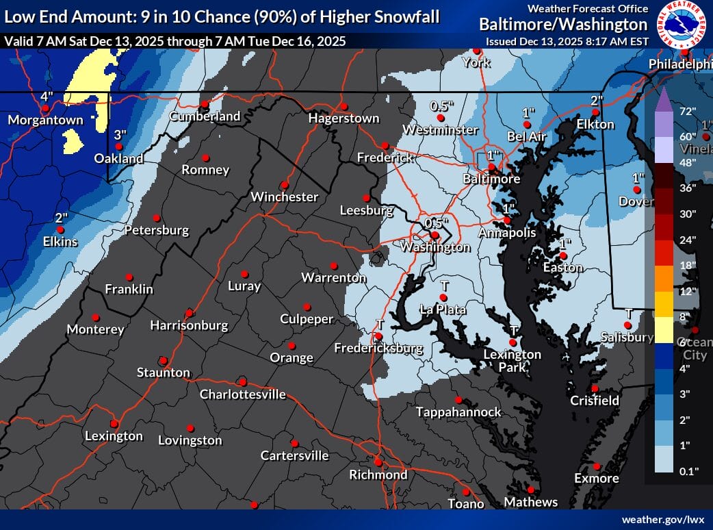
There remains a low-probability but notable upside scenario. The NWS high-end forecast, which represents a 10 percent chance, shows a more widespread 4 to 5 inches of snow across parts of the region. On the opposite end, the low-end scenario, also a 10 percent chance, would result in closer to a half inch of accumulation.
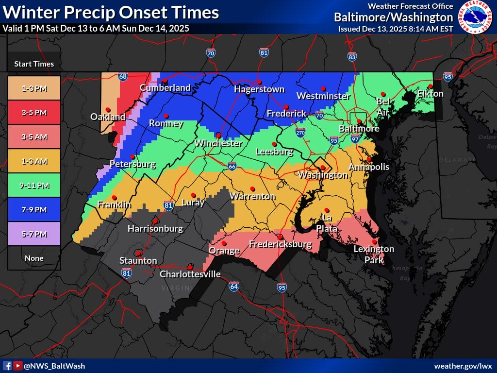
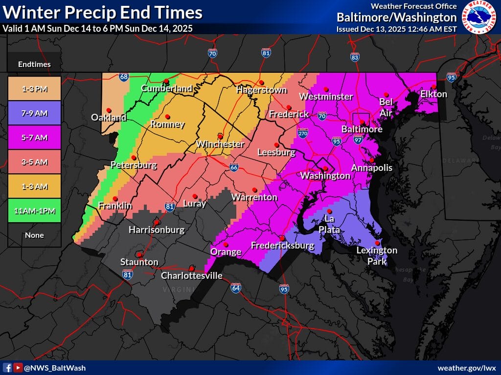
Snow is expected to develop late Saturday night, generally between 9 and 11 pm, after possibly starting as a brief period of rain in some locations. Precipitation should quickly change to snow as colder air moves in. The snow is expected to taper off between 5 am and 7 am Sunday morning.
Forecasters are closely watching the potential for a narrow band of heavier snow to set up overnight. If that band develops over any one area, snowfall rates could briefly become heavier, leading to localized higher totals and reduced visibility.
While accumulations are expected to be modest for most of Montgomery County, temperatures behind the system will be extremely cold. Wind chills late Sunday and into Monday morning could drop into the single digits. If snowfall stays in the 1 to 2 inch range, impacts to the Monday morning commute should be minimal. However, if the higher-end scenario of 4 inches or more were to materialize in parts of the county, lingering slick spots and refreeze issues could impact travel into Monday.
Per the National Weather Service:
“WINTER WEATHER ADVISORY REMAINS IN EFFECT FROM 8 PM THIS EVENING TO 7 AM EST SUNDAY.
WHAT…Snow expected. Total snow accumulations between 1 and 3 inches. Localized totals of 4 to 5 inches are possible, especially across Baltimore and northeastern Maryland.
WHERE…Portions of DC, central, north central, northeast, and northern Maryland, and northern Virginia.
WHEN…From 8 PM this evening to 7 AM EST Sunday.
IMPACTS…Plan on slippery road conditions.
ADDITIONAL DETAILS…Precipitation may briefly start as rain in some locations this evening but quickly turn to snow. A narrow band of heavier snow may develop during the late evening and overnight which could produce more rapid accumulations and visibility less than one half mile.”