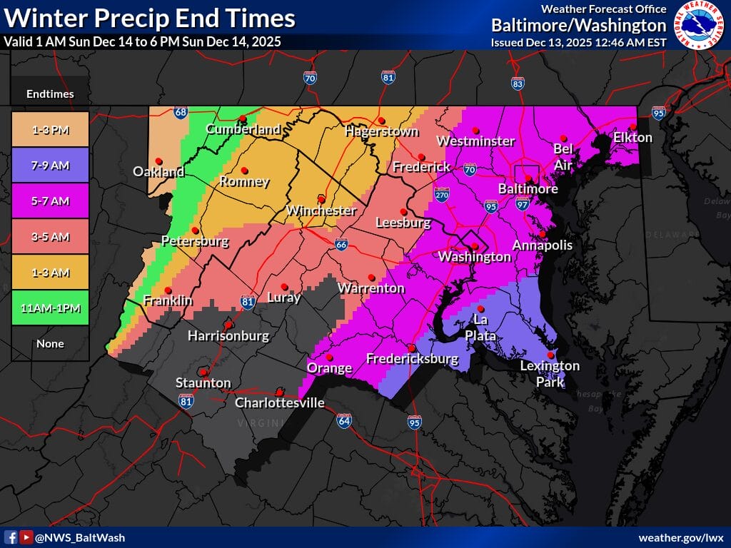
The National Weather Service has extended the Winter Weather Advisory for parts of Maryland through 10 am Sunday, as forecasters continue to monitor a narrow but potentially impactful band of overnight snow.
The advisory now runs from midnight tonight through 10 am Sunday and covers portions of central, northeast, and northern Maryland, as well as Washington, DC and northern Virginia. Snow totals of 1 to 3 inches are expected for most locations within the advisory area. However, localized higher amounts of 4 to 5 inches are possible, especially across Harford and Cecil counties, where confidence is highest for heavier snowfall.
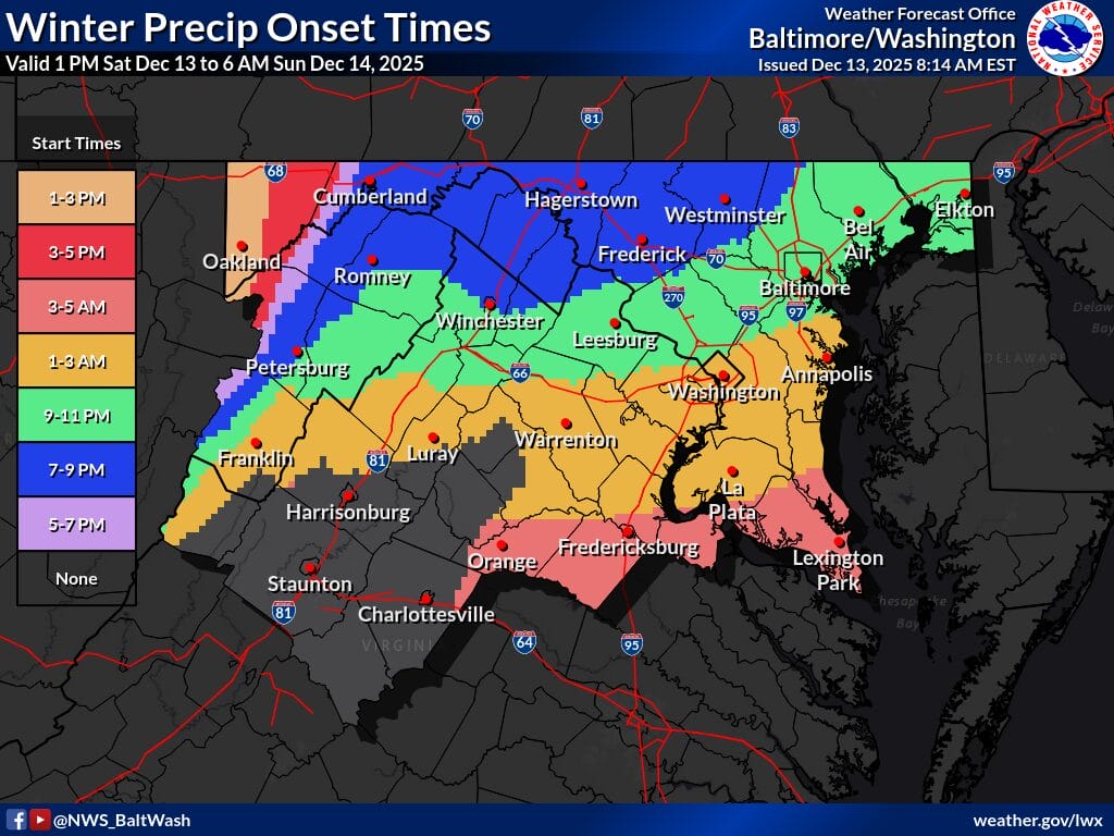
According to the National Weather Service, precipitation may begin as a brief period of rain or a rain-snow mix this evening, particularly along and southeast of the I-95 corridor. That transition should be short-lived as an Arctic front pushes colder air into the region overnight, allowing snow to become the dominant precipitation type.
Light precipitation could begin as early as 7 to 10 pm, but forecasters expect the bulk of the snow to fall between roughly 11 pm and 6 am, with the most intense period likely occurring between 1 and 5 am. During that window, a relatively narrow band of moderate to heavy snow may develop, producing snowfall rates that could approach or briefly exceed one inch per hour in spots.
Because the heavier snow is expected to fall within a narrow band, final totals will depend heavily on where that band ultimately sets up. The latest guidance shows a continued northward shift, with the highest confidence for 3 inches or more from Baltimore north and east into northeastern Maryland and New Jersey.
While most areas should remain within the 1 to 3 inch range, forecasters caution that a higher-end scenario is still possible. In a worst-case outcome, isolated totals approaching 6 inches could occur, primarily northeast of the DC metro area into far northeast Maryland.
The NWS warns that slippery road conditions are likely, especially during the early morning hours on Sunday. Reduced visibility below one-half mile may occur at times within heavier snow bands. Drivers are urged to use caution overnight and early Sunday, particularly on untreated roads, bridges, and overpasses, as conditions may change quickly during the heaviest snowfall window.