
A Winter Weather Advisory has been issued for parts of Maryland and Northern Virginia as a mix of freezing rain and sleet is expected to move into the region on Friday, potentially impacting travel during the afternoon and evening hours.
According to the National Weather Service (NWS) in Baltimore and Washington, D.C., cold air will continue to funnel south into the Mid-Atlantic as high pressure builds across Quebec. At the same time, moisture will overrun a frontal boundary to the south, setting the stage for a wintry mix as warmer air moves in above a sub-freezing surface layer.
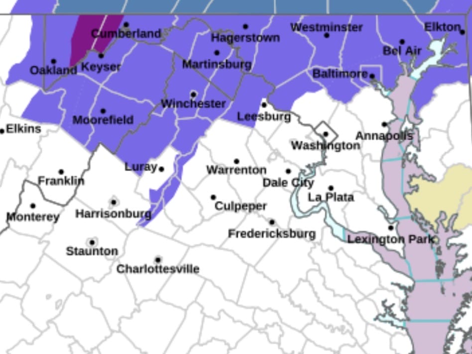
The advisory is in effect from noon Friday through midnight Friday night and includes Frederick, Carroll, northern and southern Baltimore County, northwest Montgomery County, northwest Howard County, central and southeast Howard County, and western Loudoun County.
Forecasters say mixed precipitation is expected, with snow and sleet accumulations up to one inch possible, along with ice accumulations around one-tenth of an inch. Areas south of I-70 are expected to see lighter icing amounts, generally a trace to a few hundredths of an inch.
Precipitation is expected to overspread the area by midday Friday, beginning as sleet or freezing rain. Freezing rain with some sleet mixed in is likely to continue through the afternoon and evening, with a higher chance for sleet closer to the Maryland-Pennsylvania border. Temperatures are expected to hover near the freezing mark throughout the day.
The National Weather Service warns that slippery road conditions are likely, particularly during the Friday evening commute. As the system exits to the northeast late Friday night, some light drizzle or freezing drizzle could linger into the early overnight hours.
Drivers are urged to slow down, allow extra travel time, and use caution on untreated roads, bridges, and overpasses. Updated road conditions can be checked by dialing 511.
