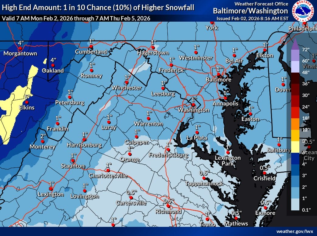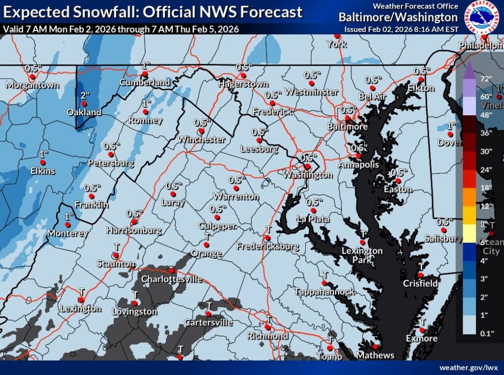
The National Weather Service (NWS) is expecting a light snowfall across much of Maryland and Northern Virginia Tuesday night into early Wednesday morning, with expected snowfall maps showing around half an inch of snow (a 10% chance of higher end totals can reach an inch, per the map below).
Forecasters say the highest confidence outcome for the metro area is a light accumulation, generally close to a half inch, including much of Montgomery County, Washington, D.C., and surrounding suburbs. The NWS is saying this system does not look strong enough to produce meaningful snowfall totals or cause widespread travel impacts. The amount of moisture with the system is limited, which is why forecasters are not expecting winter weather advisories outside of the higher elevations in the mountains at this time.
The timing also works against bigger totals. Snow is expected to move through fairly quickly and should be out of the region by early Wednesday morning, possibly even sooner. Once the system exits, colder air will move in, but by then the snow will already be gone.
NBC4 meteorologist Doug Kammerer shared a recent run of the European weather model that shows slightly higher numbers, with a little over half an inch of snow for Montgomery County and just over an inch in Washington, D.C. Even with that scenario, this remains a light snow event rather than a plowable or disruptive storm.
As always with marginal systems, small changes in temperature or timing could affect final totals, but at this point, the expectation is for a minor snowfall with limited impacts.