The National Weather Service shared an updated forecast indicating that snow is expected to move into the region later this evening and continue through early Wednesday morning, potentially impacting the morning commute. A light coating of snow is possible for much of the area south of Interstate 70, with drivers urged to use extra caution during early travel.
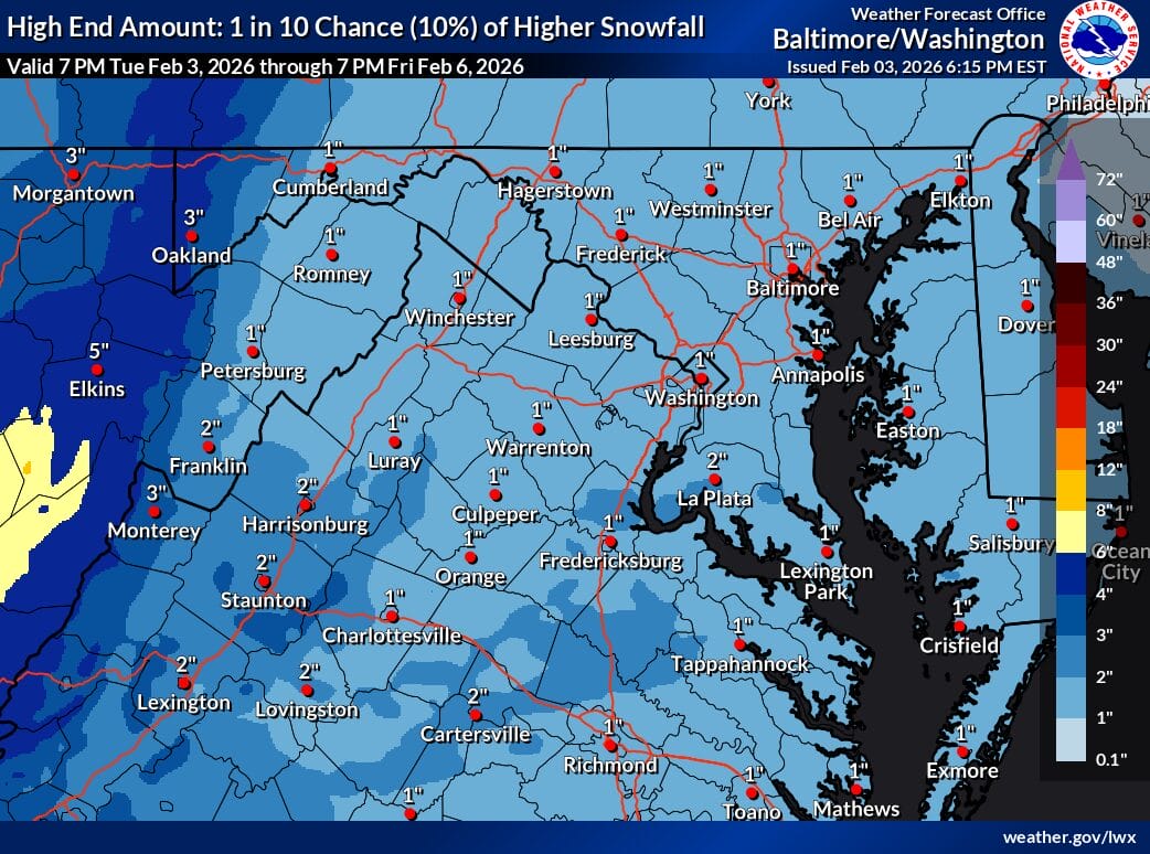
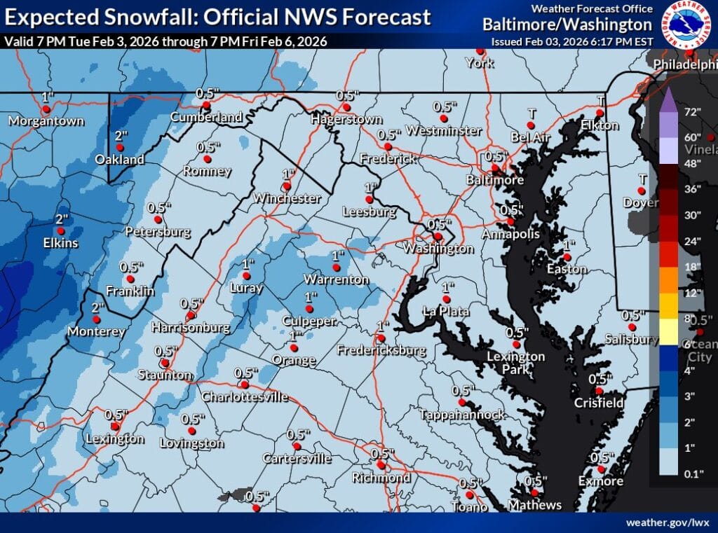
According to the latest expected snowfall map, most of the region is forecast to receive between a half inch and one inch of snow. There is a low-end scenario showing little to no accumulation for much of the area, while the high-end scenario gives about a 10 percent chance of totals reaching around one inch across the region.
A Special Weather Statement issued by the National Weather Service notes that light snow is likely tonight, with total accumulations ranging from a coating to one inch. The affected areas include the Washington and Baltimore metropolitan regions, northern Virginia, central and southern Maryland, and the Virginia Piedmont.
Snow is expected to fall between 9pm this evening and 5am Wednesday. Slippery road conditions are possible overnight and into the Wednesday morning commute, particularly on untreated roads and elevated surfaces.