
NBC4 meteorologist Doug Kammerer says another potential snow event is on the table for this weekend (likely Sunday), with the Euro AI ensemble mean showing 5 to 7 inches of snow across much of Maryland and Northern Virginia.
In a post shared alongside a snowfall map, Kammerer cautioned that while the signal is there, several factors could limit accumulation or impact. One challenge is timing, with warmer conditions expected ahead of the system, which can make it difficult for snow to stick. Another factor is the storm’s origin, as it is forecast to move east from the Pacific straight across the country. Systems with that track often struggle to bring cold air into place unless they strengthen near the coast.
Despite those concerns, Kammerer noted that multiple models are showing a meaningful snow event for the Mid-Atlantic on Sunday. The map he shared is based on the European AI ensemble mean, which runs the model many times and averages the results. That guidance suggests a solid chance for accumulating snow if conditions align.
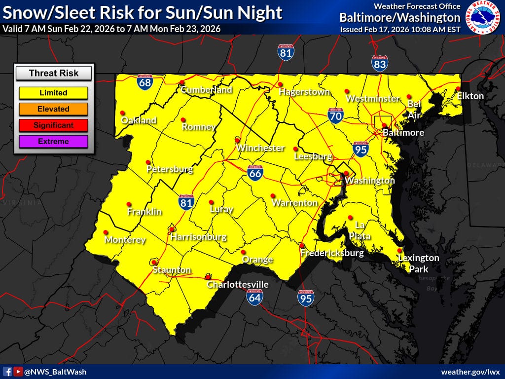
Kammerer emphasized that confidence remains low at this point and said he is not getting overly excited yet, but is watching the setup closely as the weekend approaches. As seen in the featured photo, the National Weather Service has placed the entire region in the “limited threat risk” category.
