Forecast models continue to show a wide range of outcomes for a potential winter storm late Sunday into Monday, which is why official snowfall projections remain conservative for now. While some guidance suggests the possibility of heavier snow, confidence remains low, especially east of the mountains and below 1500 feet.
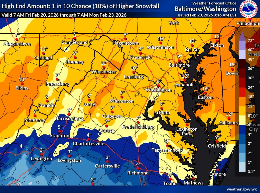
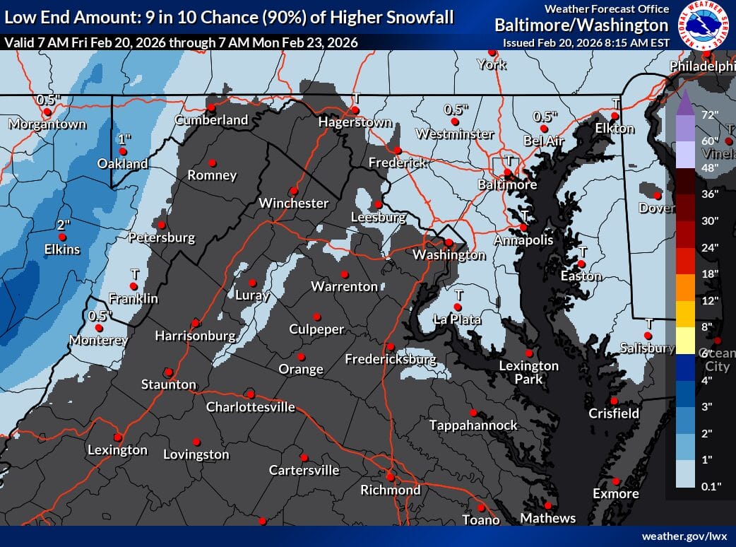
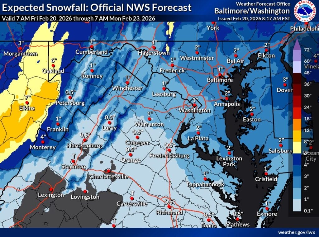
The National Weather Service currently lists 1-2 inches as the expected snowfall amount for much of the region, even though probabilistic guidance technically spans from near zero to much higher totals. That wide spread of 0-10 inches on their different maps is where the familiar joke comes from, but it reflects uncertainty rather than a realistic forecast range.
According to the NWS forecaster’s discussion, recent model runs show subtle consistency but continued uncertainty tied to the storm track, strength, and availability of cold air. Most guidance brings a low pressure system from the Southeast toward the North Carolina coast before moving offshore near the Delmarva late Saturday night into Sunday. Small shifts of just 25 to 50 miles could be the difference between little to no wintry precipitation or a more impactful event, particularly along and east of I-95.
The highest snowfall scenarios remain tied to outlier solutions, primarily from the GFS and its ensemble members, which continue to advertise 10 inches or more across parts of the region. However, the majority of other guidance, including the Euro, UKMET, NAM, Canadian models, and the National Blend of Models, supports a more modest outcome and keeps totals much lower, especially near the coast.
NWS forecasters outline three main scenarios going forward: a storm that develops too late and too far offshore, producing little impact; a weaker offshore system that still brings some snow via an inverted trough; or a stronger low that tracks closer to the Delmarva and produces more widespread snowfall. At this point, none of those scenarios can be ruled out.
With the system still about 60 hours away, the National Weather Service emphasizes a wait-and-see approach. While there is no signal to overreact, having basic winter weather preparations in place is advised in case a higher-end outcome begins to look more likely.