
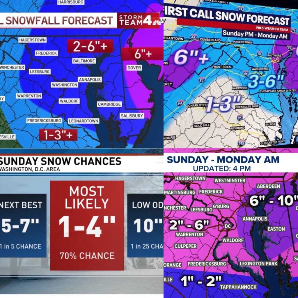
A Winter Storm Watch is now in effect from Sunday afternoon through Monday morning for a large portion of Maryland and Northern Virginia, and the region’s four major TV weather teams have released their first call snowfall maps. While details are still being refined, all indications point to a potentially impactful event, especially late Sunday into early Monday.
NBC4’s initial forecast places much of the area in the 2 to 6 inches or more range, with higher totals possible east of the metro. FOX5 is fairly similar, showing widespread 3 to 6 inch totals across much of central Maryland and Northern Virginia. WUSA9 also has most of the region in the 2 to 6 inch range, aligning closely with NBC4 and FOX5.
ABC7 is currently the most conservative of the four, emphasizing probabilities rather than fixed totals. Their forecast gives the DC metro area a 70 percent chance of seeing 1 to 4 inches of snow, with higher amounts still possible but considered less likely at this time.
The National Weather Service says confidence is increasing that this will be a disruptive system, even though exact snowfall totals remain uncertain. In its Winter Storm Watch, the NWS notes that heavy snow is possible across portions of central, northeast, and northern Maryland, as well as northern Virginia. Snow may begin as early as Sunday morning, but the heaviest snow and coldest temperatures are most likely from late Sunday afternoon through early Monday morning.
Travel could become very difficult, particularly Sunday night into the Monday morning commute, and hazardous conditions may significantly impact roads during that time frame. As the storm gets closer, snowfall ranges and impacts will continue to be refined.
