
A Winter Storm Watch is in effect from Sunday afternoon through Monday morning as NBC4 meteorologist Doug Kammerer says forecast confidence remains unusually low just 36 hours out from the next potential storm.
Kammerer noted that major differences between weather models this close to an event are striking and make this a particularly difficult forecast for the DC region.
The GFS model has been extremely consistent and continues to show a blockbuster snowstorm scenario. In its latest runs, the model depicts nearly 18 inches of snow in DC, with more than two feet possible on the Delmarva. Kammerer said that if the GFS ends up being even close to correct, he would owe it a huge apology, though he still believes that outcome is likely overdone.
By contrast, the European model has also been consistent but shows a weaker storm overall. The Euro has trended slightly higher in recent runs, now suggesting close to 7 inches of snow in the DC area. Even so, Kammerer said he remains lower than both models due to concerns about warm surface temperatures, rain mixing in, and melting, which could significantly limit accumulation.
Kammerer emphasized that even if the GFS solution ends up being only half right, the region would still be dealing with a significant storm. He described the setup as a classic boom-or-bust situation and acknowledged that his confidence level is lower than usual, despite being relatively close to the event.
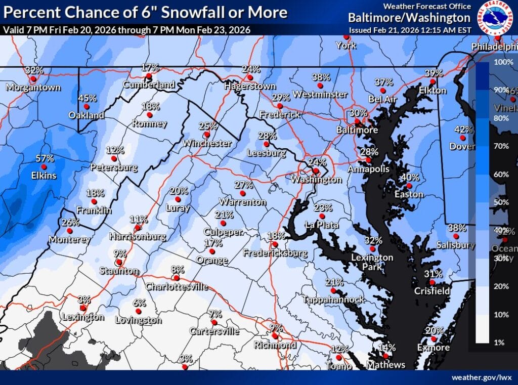
As of the latest National Weather Service probability map released Friday night (featured photo), the chance of six inches or more of snow in the immediate area is around 25 to 30 percent.
