Winter Storm Warnings and Advisories remain in effect as the National Weather Service’s (NWS) projected snow totals have increased across much of Maryland and Northern Virginia.
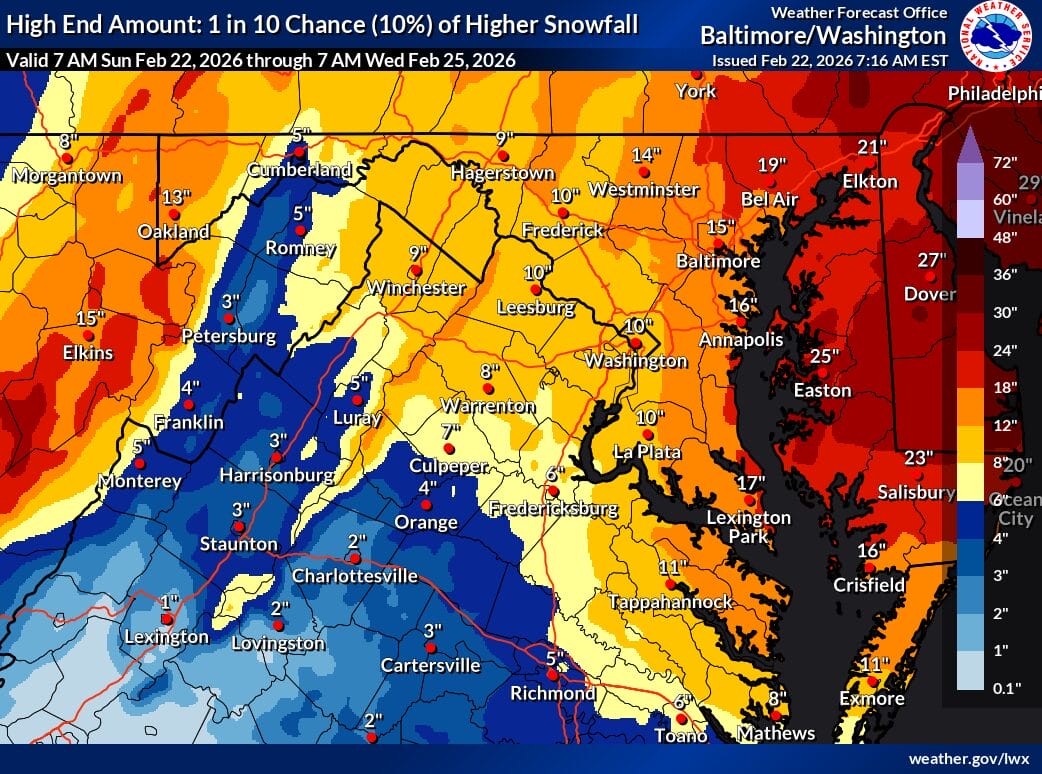
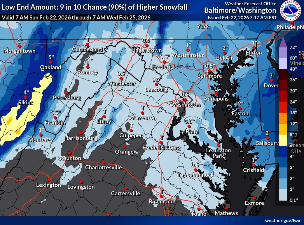
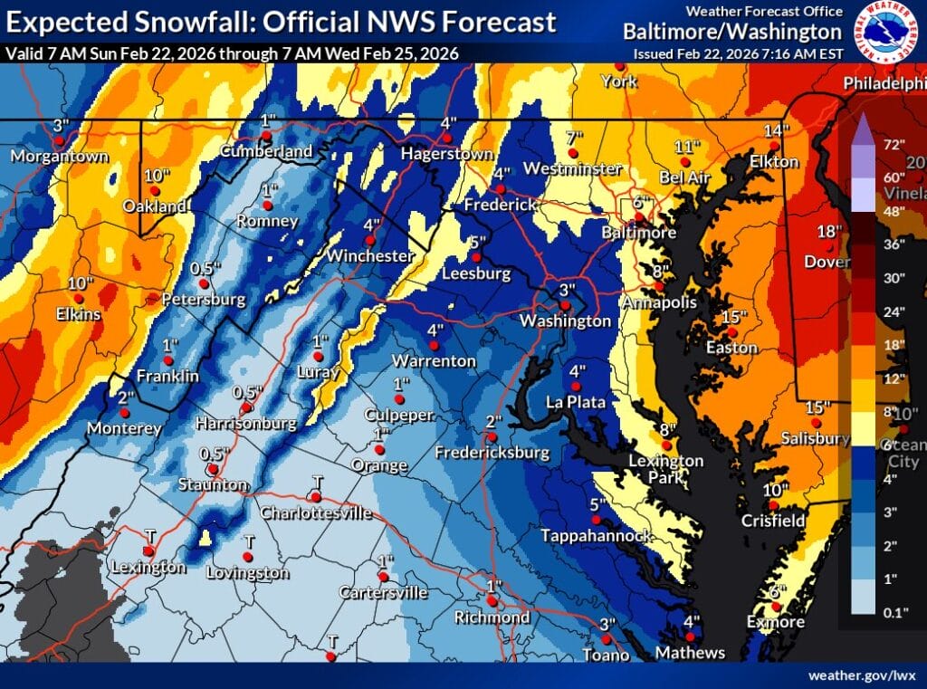
Based on the latest snowfall maps, most of Montgomery County falls into the 4 to 6 inch range. Lower totals are expected in areas such as Bethesda and Silver Spring, while higher amounts are more likely farther north and west, including places like Damascus. The high-end scenario, which represents a 10 percent chance, shows totals in the 10 to 14 inch range, while the low-end scenario shows as little as a half inch to an inch. The maps leave a very wide potential range overall, but with roughly an 80 percent chance that most of the county ends up near 4 to 6 inches.
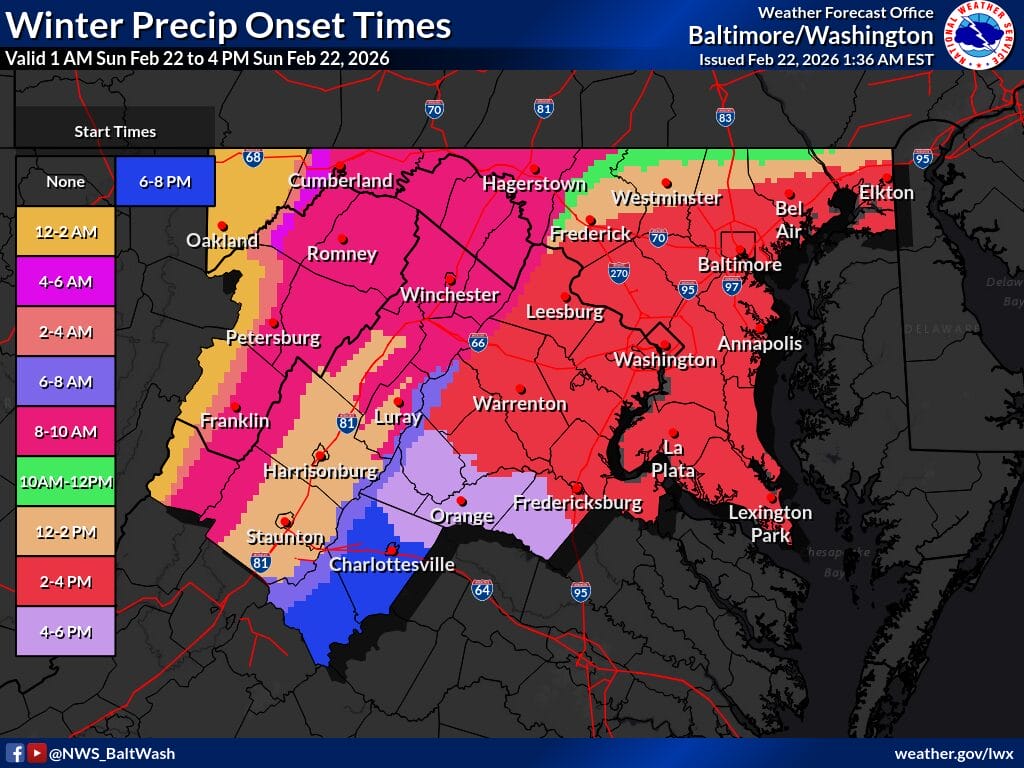
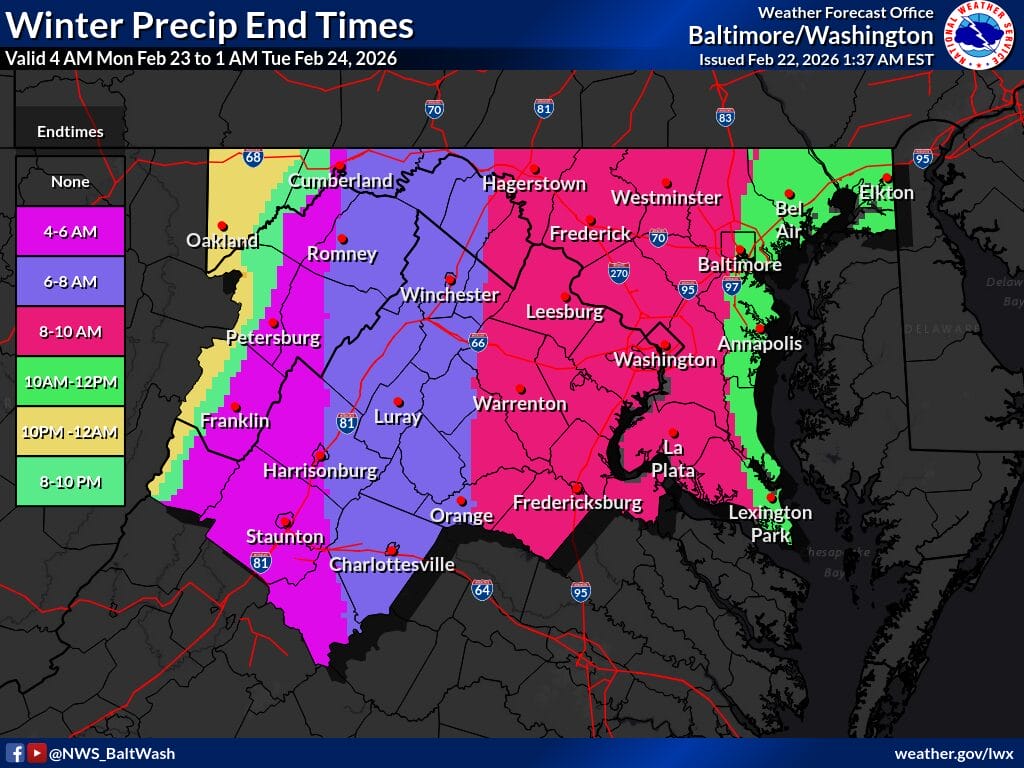
Based on the onset and end time maps, precipitation is expected to begin Sunday afternoon, with most of the region seeing rain or a rain and snow mix initially before transitioning to all snow Sunday evening and overnight. Snow is expected to taper off by early Monday, though exact end times vary by location.
According to the forecaster’s discussion, surface temperatures will initially be in the mid to upper 30s at lower elevations and may remain there through mid to late afternoon, before about 6pm. As a result, many areas will experience several hours of mixed rain and snow, sometimes referred to as “white rain,” which is unlikely to accumulate and will mainly result in wet roads. Temperatures are expected to fall later in the afternoon and evening as the storm strengthens, allowing precipitation to change over to all snow.
Forecasters also note that snowfall will have a wet and heavy character due to the high liquid content. This type of snow is harder to shovel and can be more physically demanding, often better suited to plowing or snow blowers than manual removal.