
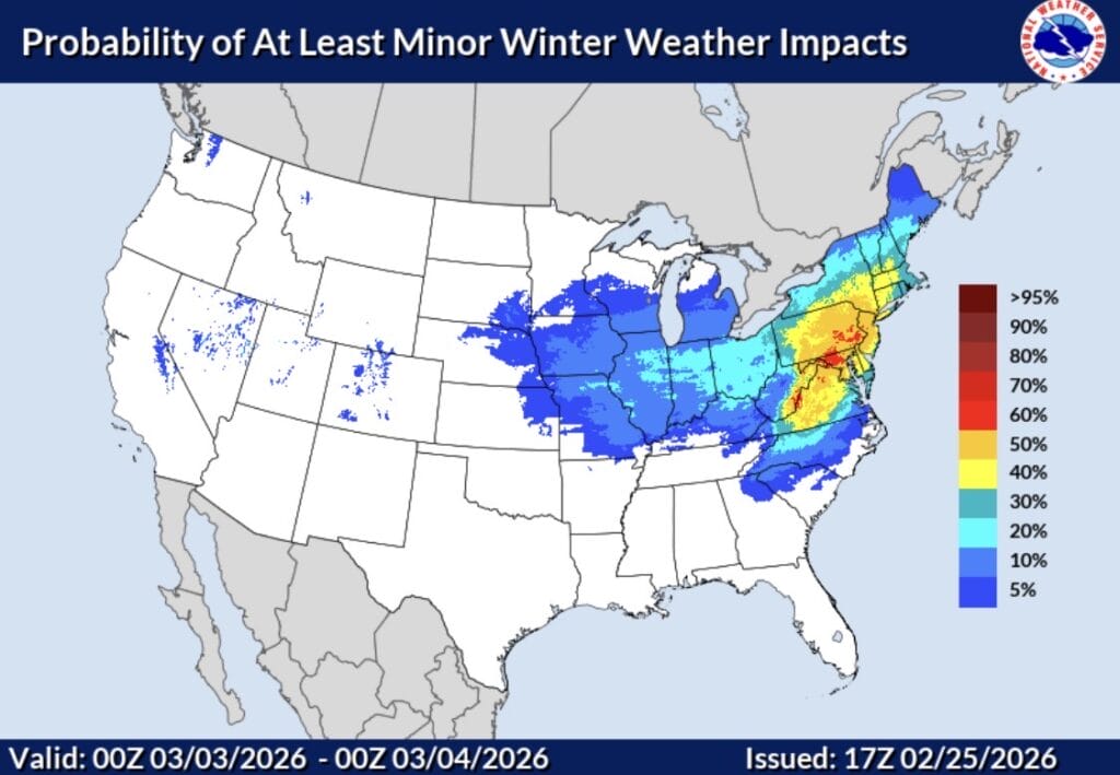
The National Weather Service has released a new map (featured photo) showing the “probability of at least minor winter weather impacts” for Monday, March 2, with most of Maryland now falling in the 50 to 70 percent range.
The outlook is still several days out, but confidence is beginning to increase as forecast models continue to show a consistent signal. NBC4 meteorologist Doug Kammerer shared the latest runs of both the GFS and European models, which are now in agreement on an impactful snow event for the region.
The GFS is currently showing approximately 5 to 7 inches of snow, while the European model is slightly lower, forecasting around 4 to 6 inches. While neither solution points to a major storm, both suggest enough accumulation to cause travel and operational disruptions.
Kammerer noted that temperatures are expected to climb to near 60 degrees in many areas on Saturday before colder air moves in ahead of the system. He said the potential snow could become impactful Monday night into Tuesday, while cautioning that details may still change as the event approaches.
For now, this remains a situation to monitor closely, especially given the sharp temperature swing expected from the weekend into early next week.
