
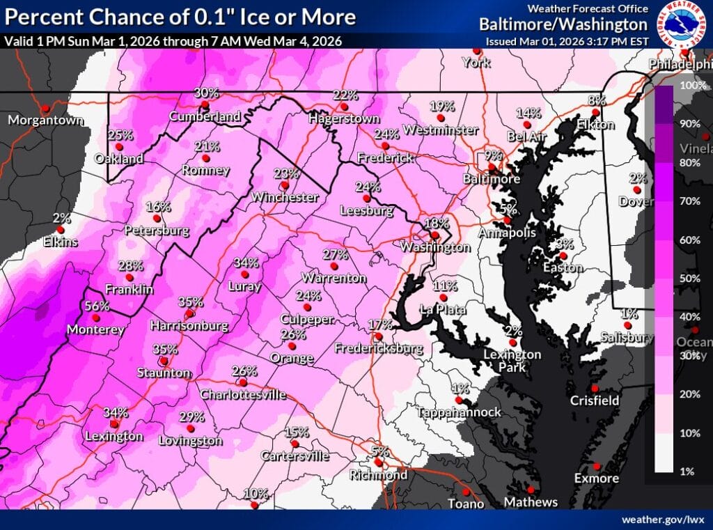
A light wintry mix could lead to slippery travel across parts of the region late Monday night into Tuesday morning, according to the National Weather Service (NWS).
The NWS forecaster’s discussion says a wave of precipitation is expected to move in after midnight Monday night. As warmer air moves in aloft, precipitation is likely to turn into a mix, with any icing mainly confined to areas west of I-95 and focused on elevated surfaces and higher elevations. While surface temperatures should rise above freezing by midday Tuesday, forecasters note that cold air damming could keep some locations near freezing through Tuesday morning.
By Tuesday afternoon, temperatures are expected to climb above freezing across the area, with precipitation transitioning to plain rain before pushing north. At this time, any wintry impacts are expected to remain below warning criteria, though winter weather advisories for a wintry mix may still be needed in some locations.
FOX5 meteorologist Mike Thomas echoed that assessment, noting there is still a threat for snow showers on Monday and light icing Tuesday morning, but with a relatively quick changeover to rain. He added that a few delays Tuesday morning would not be surprising, particularly in areas northwest of I-95, though widespread closures appear less likely.
Drivers are encouraged to use caution during the late night and early morning hours, especially on bridges, overpasses, and untreated surfaces where light icing could develop before temperatures rise.
