A period of freezing rain is increasingly likely across parts of the region late Monday night into Tuesday morning, with the National Weather Service (NWS) flagging ice as the primary concern rather than snow.
Per the NWS forecaster’s discussion, not much snow is likely on Monday with the first wave that dried out in models a couple days ago. Guidance shows a second, stronger disturbance overspreading the area Monday night, bringing expanding precipitation as warmer air moves in aloft while colder air lingers closer to the surface. That setup favors a mix of precipitation types, but forecasters say snow and sleet accumulations should remain limited, with freezing rain posing the greater hazard.
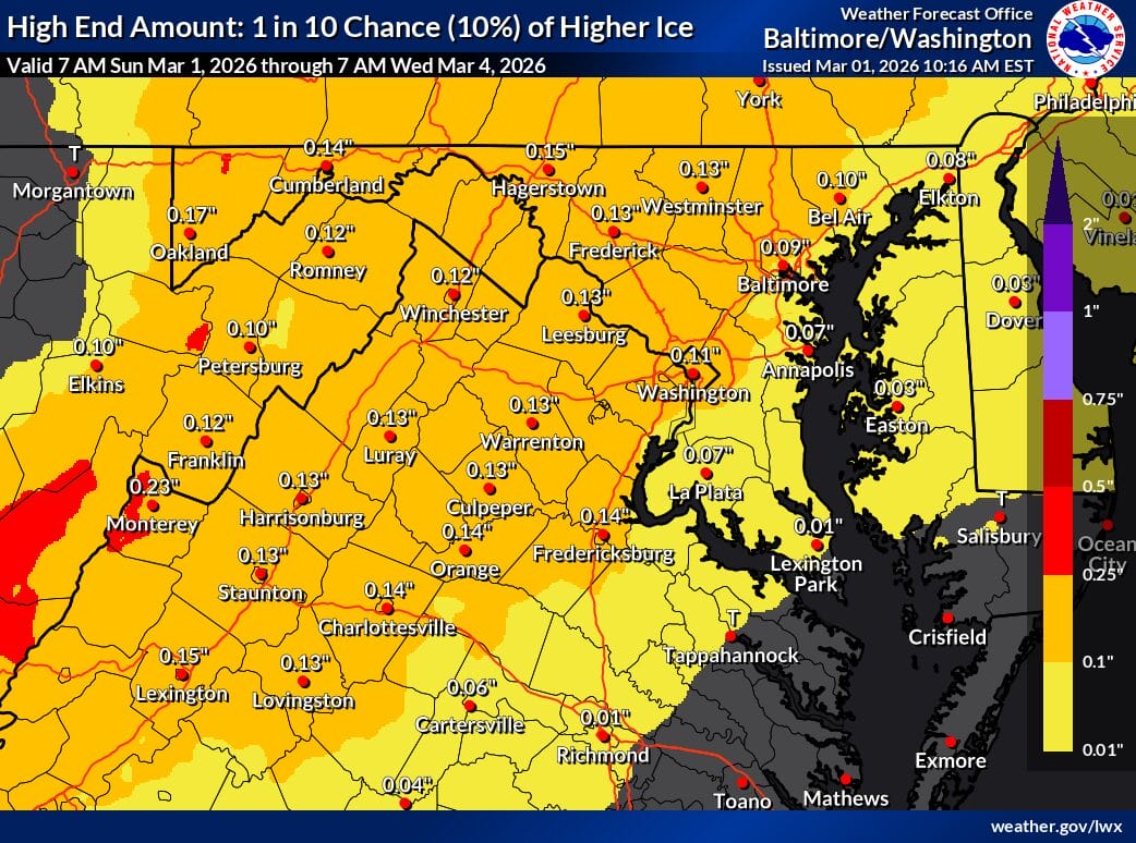
Under the current forecast, most lower-elevation locations are expected to see little more than a light glaze if icing occurs at all. Climatologically colder areas northwest of I-95 are more likely to remain near or below freezing the longest, increasing the chance for ice accumulation, especially in higher terrain. In those areas, ice totals could reach roughly one tenth to two tenths of an inch, which would remain within winter weather advisory criteria.
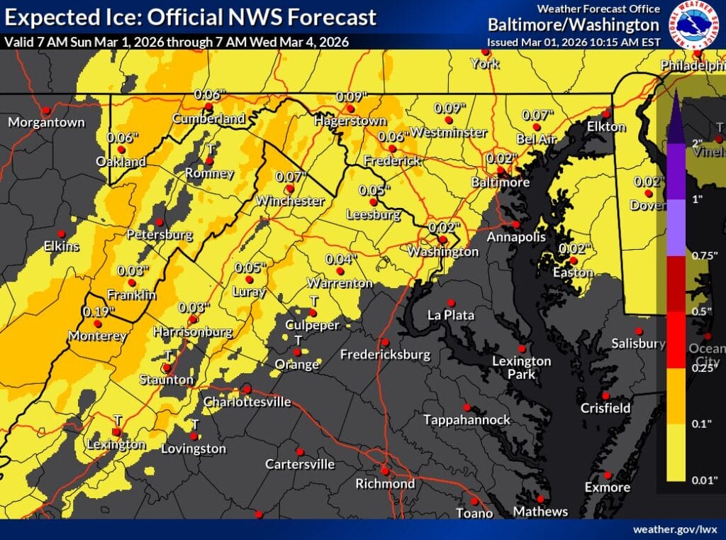
The official ice forecast generally shows amounts under one tenth of an inch across much of central Maryland, the DC metro, and northern Virginia, with slightly higher totals across the ridges to the west. A higher-end scenario (map below), representing a 10 percent chance, illustrates the potential for more widespread ice totals near or above one tenth of an inch in those colder, higher-elevation areas if surface temperatures remain locked in longer than expected.
Forecasters caution that ice amounts will hinge on just how quickly surface temperatures fall Monday night and how long they stay below freezing into Tuesday morning. Even light glazing can create slick roads, especially on untreated surfaces, bridges, and elevated roadways.