
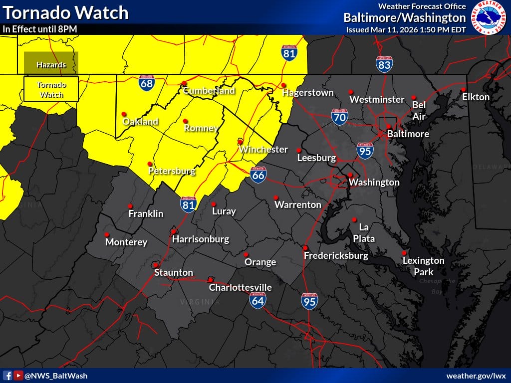
The National Weather Service has issued a Tornado Watch for parts of western Maryland as severe storms move through the region Wednesday afternoon and evening. A Hazardous Weather Outlook has been issued for other parts of the state, including Montgomery County.
The Tornado Watch is in effect until 8pm for Allegany, Garrett, and Washington counties in western Maryland. According to the National Weather Service, severe thunderstorms developing this afternoon and evening could produce damaging wind gusts between 60 and 70 mph, large hail, and a few tornadoes. Forecasters say some tornadoes could be strong. The Tornado Watch also includes parts of eastern West Virginia and the northern Shenandoah Valley of Virginia.
Elsewhere across central Maryland and the Washington, D.C. region, including Montgomery and Frederick counties, a few severe thunderstorms are possible through about 8pm. These storms could bring damaging wind gusts up to 60 to 70 mph, large hail, and a possible tornado.
Residents are encouraged to monitor the latest forecasts and have a way to receive weather warnings quickly if conditions worsen. Looking ahead, strong winds may also be possible later in the week. Wind gusts up to 50 mph are possible Friday into Friday night along the Blue Ridge and in the Potomac Highlands, which could lead to isolated wind damage and power outages.
