The National Weather Service (NWS) has put out “key messages” for the upcoming winter storm that’s possible for our area on Sunday, January 5th into Monday, January 6th.
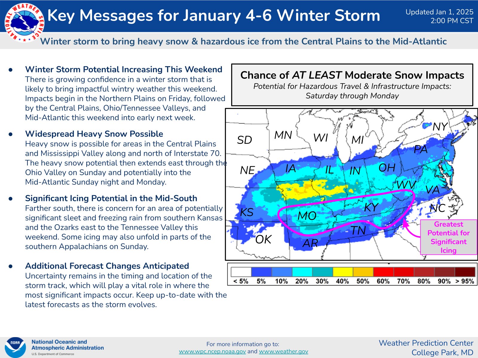
Per the NWS, “There is growing confidence in a winter storm that is likely to bring impactful wintry weather this weekend. Impacts begin in the Northern Plains on Friday, followed by the Central Plains, Ohio/Tennessee Valleys, and Mid-Atlantic this weekend into early next week.
Widespread Heavy Snow Possible. Heavy snow is possible for areas in the Central Plains and Mississippi Valley along and north of Interstate 70. The heavy snow potential then extends east through the Ohio Valley on Sunday and potentially into the Mid-Atlantic Sunday night and Monday.
Additional Forecast Changes Anticipated: Uncertainty remains in the timing and location of the storm track, which will play a vital role in where the most significant impacts occur.”
The National Weather Service often relies on the National Blend of Models (NBM) for their snowfall forecasts. FOX 5 meteorologist Mike Thomas shared today that it currently shows an “average of 4-6″+ for our region on Monday BUT I will caution we are still very early in the snow totals game, so don’t carve them in stone just yet.”
Hard to hate the NBM (National Blend Of Models, which is the model that NWS typically utilizes in their snowfall forecasts) upward trend in snowfall amounts for Monday. Shows average of 4-6"+ for our region on Monday BUT I will caution we are still very early in the snow totals… pic.twitter.com/l5ejioxIGh
— Mike Thomas (@MikeTFox5) January 1, 2025