
Rain and snow are expected to move into the region late tonight and continue through Sunday, with light accumulations possible across parts of Maryland.
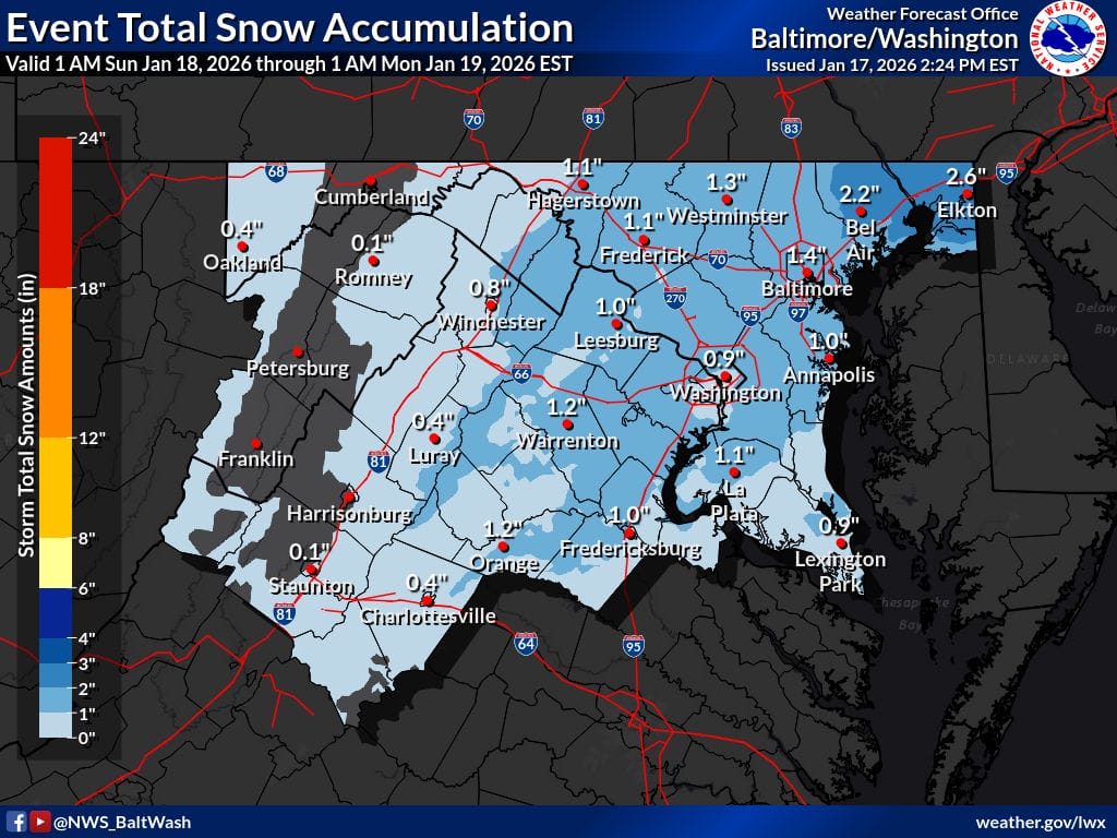
According to the National Weather Service Baltimore/Washington office, precipitation will begin in south-central Virginia late tonight, spreading east and north toward the I-95 corridor before sunrise Sunday. Most areas are expected to see a slushy coating up to 1 inch of snow, with locally higher totals possible across northeast Maryland.
The forecast shows accumulating snow mainly from early Sunday morning through early afternoon. The heaviest period is expected between 5am and noon, with precipitation tapering off by mid to late afternoon.
Snowfall totals across central Maryland, including the I-95 metro areas, generally range from a coating to around 1 inch. Higher totals of 1 to 3 inches are possible in parts of northeast Maryland, including Cecil and Harford counties, where a Winter Weather Advisory is in effect from 4am to 6pm Sunday.
Temperatures are expected to remain near or just above freezing, which should limit significant accumulation but could still lead to slick road conditions, especially during periods of heavier snow.
The National Weather Service notes a low to moderate travel impact risk, with hazardous travel possible on major roadways including I-83, I-95, I-70, I-695, I-495, MD-97, US-1, and I-66/US-50. Reduced visibility may occur at times, with snowfall rates approaching 0.25 inches per hour.
Drivers are urged to use caution during the morning hours Sunday, particularly on bridges, overpasses, and untreated roads.
