
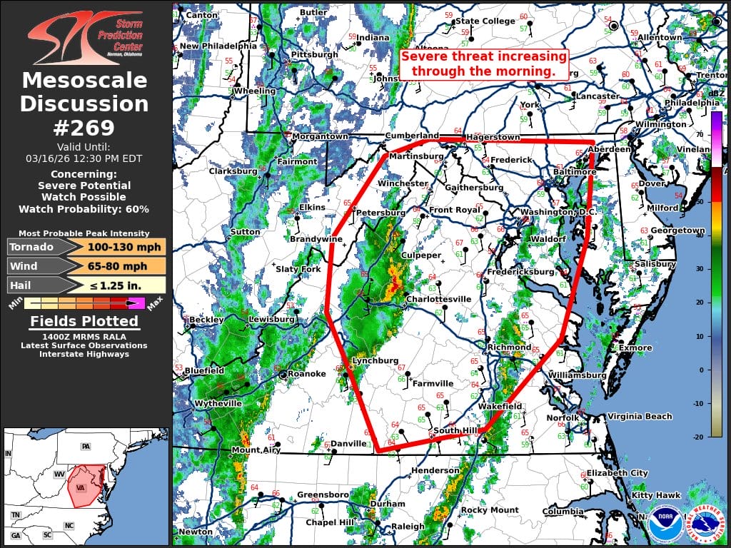
The Storm Prediction Center is warning that the severe weather threat across the region is increasing through the morning, with meteorologists noting that a tornado watch could be issued for the area within the next few hours.
FOX5 meteorologist Mike Thomas shared an update on social media highlighting the latest discussion from the Storm Prediction Center, which notes that atmospheric conditions are becoming more favorable for severe storms as the day progresses.
“Low-level shear, already strong at 12Z, will continue to strengthen through the day. Therefore, any stronger/deeper updrafts could have some tornado threat late this morning into the early afternoon,” the discussion states.
Forecasters say the primary concern remains the potential for damaging winds and embedded tornadoes later this afternoon as a secondary mid-level jet streak moves east of the Appalachians and wind fields strengthen rapidly across the region.
Earlier storm activity moving through the area this morning may temporarily disrupt the warm sector, which could slightly limit instability in the short term. However, meteorologists emphasize that the strongest forcing for severe storms is still expected later in the day as the main line of storms develops and pushes east.
The Storm Prediction Center’s mesoscale discussion indicates a 60 percent probability that a severe thunderstorm watch will be issued, with the most probable hazards including tornadoes capable of producing winds of 100-130 mph, damaging wind gusts of 65-80 mph, and hail up to 1.25 inches in diameter.
Residents are urged to stay weather aware throughout the day as conditions continue to evolve and the risk for severe weather increases.
