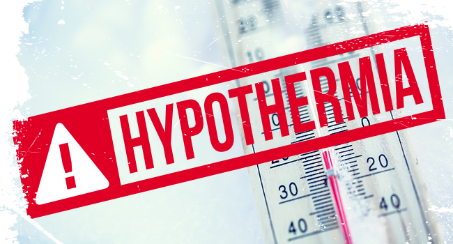
Per the National Weather Service: “Today will bring the last mild day for a while with highs in the 60s to low 70s (Mountains: mid 40s-mid 50s). Some showers are possible as the next system rolls through. Behind the cold front, conditions turn much colder with brisk NW winds for Sunday.

Temperatures in most of MoCo are expected to be in the mid to high 60s today before moving to highs in the 40s and lower 50s for the next couple weeks. Sunday get to about 50° with a breeze that’ll make it feel even colder (low to mid 40s). The week is expected to start off with highs in the mid to upper 40s on Monday (with subs home) and Tuesday will bring similar temps with a chance of showers in the afternoon– everyone’s favorite…cold rain.


Montgomery County has activated a Hypothermia Alert for extreme cold for Wednesday 11/9 from 3AM until 8AM. Expect the wind chill to be below 32 degrees. Wear layers if you go outside. Per Montgomery County:

A Hypothermia Alert is issued for the County when forecasted temperatures, and/or wind chill, in at least part of the County fall below 32 degrees creating a hazardous situation in which hypothermia and frostbite are likely.


Per the National Weather Service (Baltimore/Washington): “Even with above average temperatures today, autumn is here! As leaves continue to fall, remember that wet leaves on the road make the roads slippery and dangerous. Daylight saving time is here after we all moved our clocks back an hour last night. Sunset will be at 5:04PM today.”

Fall Driving Hazards:


Fox 5 has released its 2022-2023 Winter Weather Outlook forecast and they’re expecting “similar levels of snowfall to last winter, perhaps a little more in the immediate DC area with 9-18” of snow” without any blizzards anticipated and increased snow risks in the second half of the winter, according to meteorologist Mike Thomas.

The outlook discusses a La Niña weather pattern that we are currently in the midst of, as we have been for the last two winters (13.2” last year and 5.4” the year before). La Niñas usually lead to warmer weather for our area with just one La Niña winter producing with none bringing more than average snowfall since the year 2000.


On Sunday, November 6, 2022, at 2:00am we “Fall Back” as Daylight Saving Time ends.  While many of us enjoy the extra hour of sleep and lament the loss of longer days, this may be the last time if the “Sunshine Protection Act” passes through the house and moves on to President Biden. The bill would make Daylight Saving permanent and put an end to having to change your clocks twice a year. According to the H.R.69 – Sunshine Protection Act of 2021, this bill makes daylight savings time the new, permanent standard time. States with areas exempt from daylight savings time may choose the standard time for those areas.

As mentioned above, the bill still has to be approved by the U.S. House of Representatives and signed into law by President Joe Biden, and that process has appeared to hit a “brick wall,” according to a July article by the The Hill. The article states that there are fundamental disagreements with the language of the bill, such as whether daylight saving or standard should be the permanent time, and the House having other priorities are the main reasons why the Sunshine Protection Act seems to have hit a snag.


A pleasant week of weather is expected for the area this week with highs around 65° on Monday with clouds in the morning before clearing up a bit in the afternoon. There’s also a slight chance of rain early on.

Tuesday and Wednesday are both expected to reach the low to mid 70s with a mix of clouds and sun on Tuesday and more sun than clouds on Wednesday. Thursday is expected to be a mostly sunny day with highs in the upper 60s and the workweek wends with Friday getting up to about 60° with partly sunny skies.


The Farmers’ Almanac has released its 2022-2023 extended winter outlook. MoCo and almost all of Maryland seem to fall under the “Significant Shivers, Slushy, Icy, Snowy” category. Just to our south and west is the “Unreasonably Cold, Snowy” category, which means that we may have a good amount of winter precipitation for the first time in a few years, according to the forecast.

“The Farmers’ Almanac suggests a stormy winter in on schedule especially for the eastern half of the country. For some areas this may mean snow, but for others it will result in more slush and mush.”


After a string of pleasant days, including highs in the upper 60s today (Monday, October 17), temperatures are expected to take a bit of a nosedive mid-week with high expected to be in the mid to upper 50s.

Monday is expected to reach 67° with clouds and a slight chance of rain. Tuesday will get to about 55° with a breeze that’ll make it feel even cooler and more like November . Wednesday will be about the same as Tuesday without the breeze, but will still feel cool with highs around 56°. Thursday will be mostly sunny with temperatures getting up to about 59°. Friday looks to be pleasant with sunny skies and temps in the mid 60s. As of now, the weekend is also looking nice with sunny skies and temperatures around 70° on Saturday and mid 60s on Sunday.


Summer officially comes to an end as the autumnal, fall, or September equinox arrives at 9:04pm Thursday night. This makes the official start of fall in the Northern Hemisphere and Mother Nature is complying as highs are expected to be in the mid-60s in our area on Friday.

We’ve had a couple chillier mornings lately and highs today reached the mid 70s, but Friday is expected to remain below 70 all day. Overnight temperatures into Friday morning are expected to drop into the 50s and feel like the low 40s. Mostly sunny skies are expected, which will make the cooler day feel not-so-bad.


There’s a flood warning in effect for parts of Montgomery County until 11:30am Tuesday morning. Flooding caused by excessive rainfall is expected in portions of central Maryland and north central Maryland, including the following counties: in central Maryland, Howard and Montgomery.

Between 1.5 and 3 inches of rain have fallen. Additional rainfall amounts of 0.5 to 1.5 inches are possible in the warned area. Some locations that will experience flooding include, Germantown, Frederick, Rockville, Gaithersburg, Leesburg, Olney, Westminster, Damascus, Lowes Island, Poolesville, Aspen Hill, Potomac, North Bethesda, Montgomery Village, North Potomac, Ballenger Creek, Redland, Great Falls, Mount Airy, and Walkersville.


View More Stories