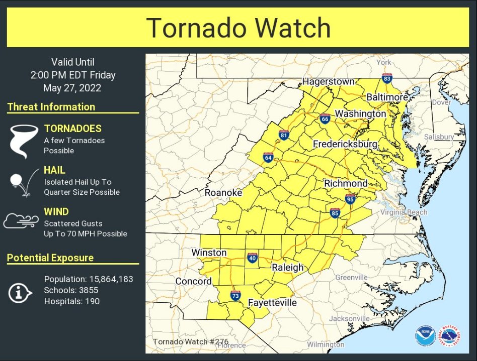
A Tornado Watch has been issued for parts of District of Columbia, Maryland, North Carolina, Virginia and West Virginia until 2 PM EDT. This Watch includes Montgomery County.

According to the National Weather Service, a few tornadoes are possible during this time in the Watch area. Isolated hail up to a quarter size is possible and scattered gusts of up to 70 mph winds are possible.
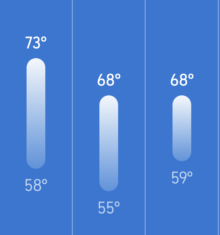

After three consecutive days with highs in the 90s and the heat index at or above 100°, highs today will be in the low to mid 70s with consecutive cooler days coming up on Tuesday and Wednesday.

Cooler and unsettled weather should be expected to start the week with a cloudy day expected today and rain possible later in the day. Rain is more likely on and off throughout the day on Tuesday with temperatures reaching the upper 60s. Wednesday is also expected to be cloudy with less of a chance of rain and temperatures again reaching the upper 60s.


As we get closer to the end of the week, temperatures continue to creep up. Many of us woke up with temperatures in the mid to upper 50s this morning, but things will warm up fairly quickly as highs are expected to get into the mid 80s today with the sun mixing in later this afternoon.

Friday, Saturday, and Sunday continue to trend a bit warmer with Friday reaching the low to mid 90s with partly sunny skies. The humidity will make it feel even hotter (likely 95° or more). Highs on Saturday are now expected to reach the mid to upper 90s with the mostly sunny skies and the humidity making it feel like it’s 105° or hotter. Sunday is expected to reach the mid 90s With a mix of sun and clouds and thunderstorms possible late in the day. The humidity will make it feel like it’s in the upper 90s.


As always, our area has been on a weather roller coaster this spring with recent highs in the 50s, 80s, and everything in between. Coming off of a sever weather threat, high temperatures should remain between the mid 70s and low 80s for the next three days, but Friday and Saturday will be unseasonably warm.

Today (Tuesday) we are expecting a mostly sunny and warm day with temperatures reaching near 80° and feeling about 85. Tomorrow (Wednesday) will bring us a mix of sun and clouds and temperatures reaching the mid-70s. Thursday will likely start off cloudy and warm with showers possible and temperatures reaching the low 80s.


Coming off of a weekend of high temperatures in the low 50s, a steady and chilly rain, and Flood Warnings, many of us will appreciate today’s 65° and sunny more than usual. While we’ll still be about 10° cooler than our average high in the month of May, today will feel a lot warmer than the last two days did with the “RealFeel” at about 73°. Temperatures are expected to climb throughout the week with no rain currently in the forecast until next weekend aside from a slight chance on Thursday or Friday.

Tuesday is expected to be another pleasant day with temperatures reaching the upper 60s and feeling like the mid 70s. Wednesday should bring high temps back into the low 70s with the “RealFeel”pushing 80°. Thursday and Friday should be a couple degrees warmer with a slightly elevated chance or rain (about 25% as of now) and more rain seems to be in the forecast this upcoming weekend, but temperatures arguing to be 20-25° warmer than this past weekend so it won’t be as miserable.


Tomorrow we’ll be a week into May, but it may not feel that way as temperatures aren’t expected to go higher than the low 50s at any point this weekend. Rain has moved into the area and is likely to fall off and on throughout the day today with temperatures getting to about 60°.

This weekend will bring more rain and temperatures are likely to remain between 40° and 54° on both Saturday and Sunday. We’ll see a slight warm up on Monday after the rain clears out and highs reach the upper 50s and then a slow climb throughout the week before highs are once again in the 70s by the end of the week.


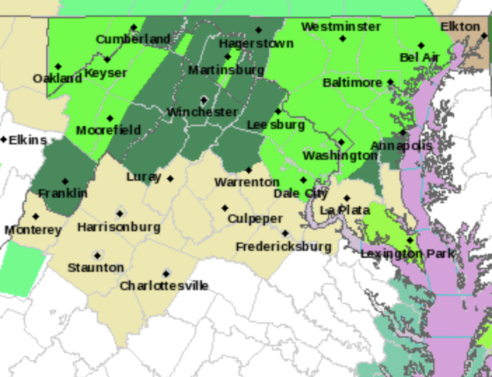
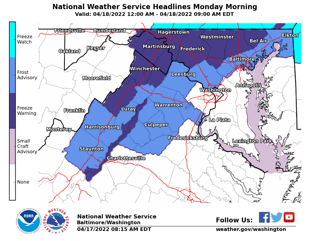
There is a Freeze Warning in effect from 1am until 9am Thursday morning for northwest Montgomery County, which includes Germantown, Clarksburg, Poolesville, Damascus and some surrounding areas. A Freeze Watch is also in effect for late Thursday through Friday morning. Additional information below, courtesy of the National Weather Service:

* WHAT…For the Freeze Warning, sub-freezing temperatures as low as 31 expected. For the Freeze Watch, sub-freezing temperatures as low as 31 possible.


We’ve had a small streak of cooler days, but things should get a little more comfortable today as highs are expected to hover around 60° with plenty of sunshine.

Each day this week should get warmer with Thursday expected to get to the low/mid 60s with a mix of clouds and sun and a small chance of rain.


Coming off of a warm day where temperatures hovered around 80°, today is expected to be the warmest day of the year so far with temperatures reaching the low to mid 80s for many of us.

Temperatures are expected to be in the 60s by 8am, 70s by 11am and into the 80s this afternoon with the “real feel” a few degrees warmer. Skies are expected to be sunny with a few clouds mixing in.


View More Stories