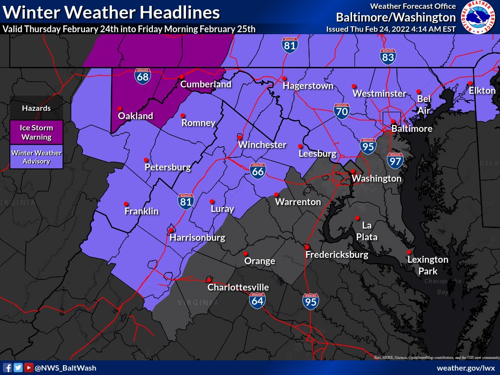
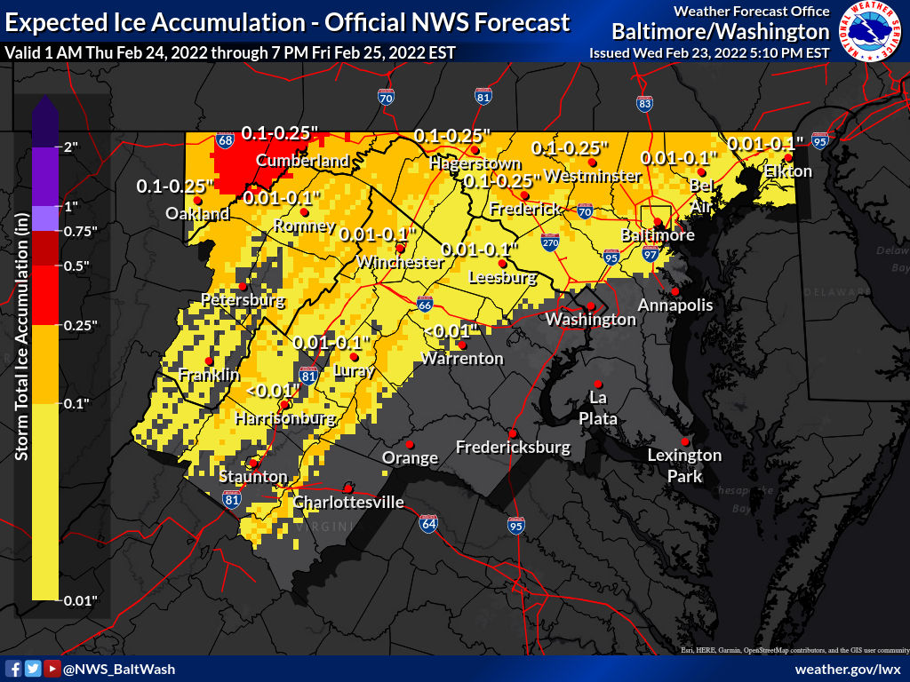
Today we enjoyed temperatures in the upper 60s and lower 70s, giving the area a taste of spring. Temperatures are expected to crash overnight, dropping to/around the freezing mark mid-morning Thursday morning. Highs tomorrow will likely be around 35 degrees with temperatures hovering around freezing again Thursday night when the precipitation begins and go back up to about 35 degrees in the morning. Right now, temperatures don’t support much ice, but it’s still possible things are a little cooler than expected.

The most recent map from the National Weather Service, seen in our featured photo, shows almost all of MoCo getting a trace of ice with a sprinkle of northern areas getting up to a tenth of an inch.


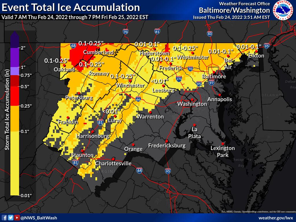
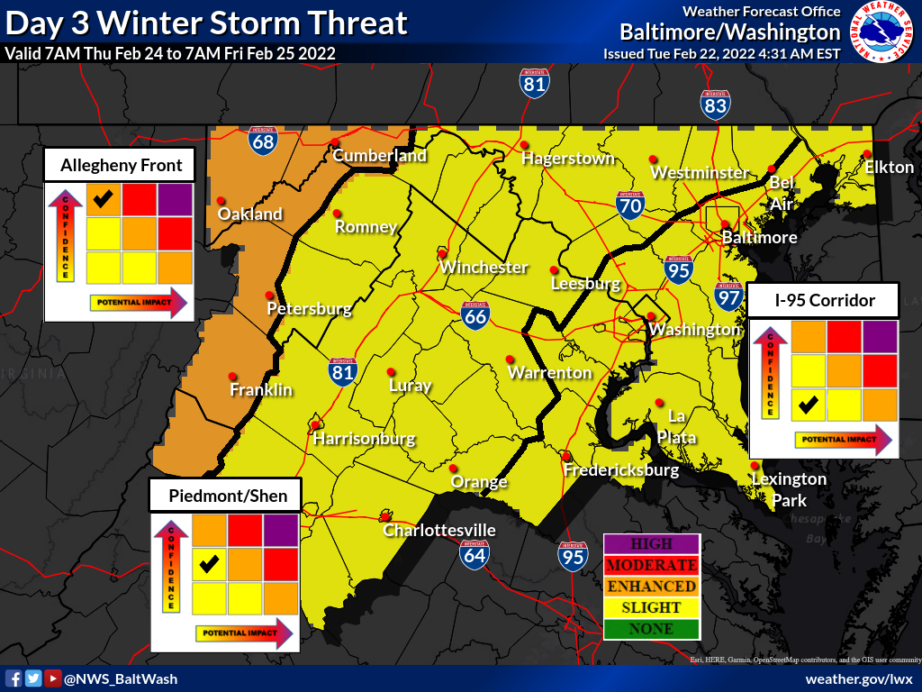
The National Weather Service has Montgomery County in the “Slight Winter Storm Threat” category for potential winter weather Thursday into Friday.

As of now, not much is expected for Montgomery County, with the threat of ice accumulation staying north for the most part. As you can see in the map below, some of the yellow goes into MoCo with Damascus possible having to deal with very light ice (one hundredth of an inch).


Snow totals are in from across the county after this morning’s light snow that caused minimal disruption across the area. The forecast for this storm was pretty accurate, as temperatures dropped overnight bringing light snow into the area for approximately 1-2” across the board with some areas a little higher.

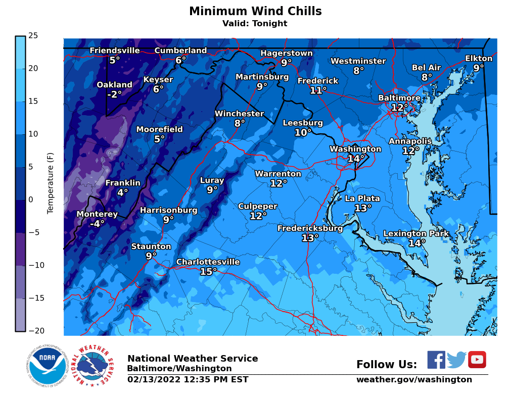
The totals below come from the National Weather Service from various times throughout the morning and afternoon. Wind chills tonight will be in the teens.


Temperatures are expected to reach 60 again today with a mild, breezy and dry day expected. Temperatures will fall rapidly tonight, with overnight rain likely changing to snow for most of the area by early Sunday morning.

The latest map by the National Weather Service has all of MoCo in the 1-2″ range, with ~55% chance at over an inch of snow. This won’t be a crippling storm, but more likely just some flakes to set the mood for the Super Bowl. Temperatures will hover around freezing throughout the day tomorrow and will drop below freezing tomorrow night.


Today will likely be the best day of our recent string of warmer days with highs potentially reaching the mid- 60s as we continue our mid-February taste of spring.

Tomorrow will also be warmer than average too, with temperatures reaching the mid to upper 50s. There has been potential for winter weather late Saturday and Sunday that has gone back and forth between giving us a few inches of snow and not bringing much our way in recent days.


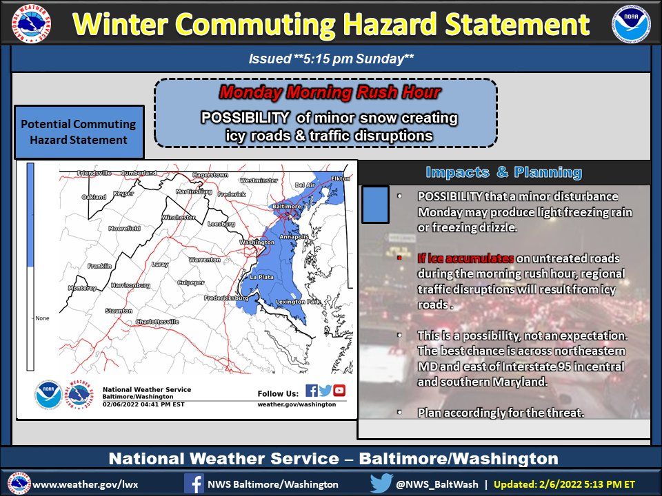
The ‘Special Weather Statement’ from earlier today has been update to no longer include C/SE MoCo. It now covers areas as close as Prince George’s County with potential for hazardous commuting conditions for the Monday morning commute.

Per the National Weather Service for ‘Special Weather Statement’ areas (shown in featured photo):


The National Weather Service has released a ‘Special Weather Statement’ for the area, which includes Central/SE Montgomery County. The full statement can be seen below:

“There is a potential for hazardous commuting conditions for the Monday morning commute.


View More Stories