A Winter Storm Watch has been issued for all of Montgomery County from 1pm on Sunday, January 16th until 7am on Monday, January 17th.
We’ll have an update and the latest maps from the NWS and major networks ready to go tonight.


A Winter Storm Watch has been issued for all of Montgomery County from 1pm on Sunday, January 16th until 7am on Monday, January 17th.
We’ll have an update and the latest maps from the NWS and major networks ready to go tonight.
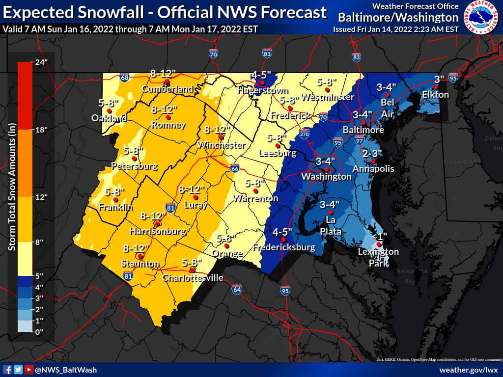
A Winter Storm Watch has been issued as close as Frederick County. The reason MoCo is not yet under anything is because a Watch is issued when there is confidence for 5 inches or more. As of now, the National Weather Service has most of MoCo in the 4-5″ range, with a south/east MoCo in the 3-4” range, and Upper MoCo in the 5-8’”range. The Watch areas will likely turn into Winter Storm Warnings, and we can easily see a Watch put in place later today, especially for Upper MoCo if the confidence for more snow is there. Either way, I suspect at least an Advisory for all of MoCo.
Fox 5 has weighed in with its First Call Map and approximately 2/3 of MoCo is in the 4-8” range with South/East MoCo in the 2-4” range.
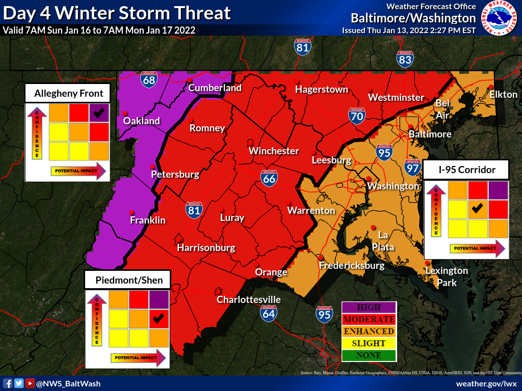
The National Weather Service still has half of MoCo in the moderate winter storm threat category and the other half in the enhanced category for a potential storm on Sunday into Monday.
Here’s what we know, so far. Cold air will be in place as temperatures on Saturday will reach a high in the mid 20s and drop into the teens early Sunday morning with highs in the mid to high 20s.

The National Weather Service has increased the risk for Sunday’s potential winter storm to moderate for Upper MoCo and enhanced for C/SE MoCo. Per their map in our featured photo, the confidence for the winter storm has also increased to moderate for upper MoCo and enhanced for C/SE MoCo.
We have to remember that we’re discussing a storm that hasn’t even formed yet, so a lot can change. To help people understand, I always compare tracking a storm to the score of the game when your favorite team is upsetting the best team in the league. When we’re five days out, it’s early in the first quarter. Each model shows you a different aspect or perspective of the game. You can be happy with what’s happening from one or all perspectives, but you know there’s a good chance it won’t end up that way.

The National Weather Service has a slight winter storm threat for our areas on days 6 and 7, for potential winter weather this upcoming Sunday and Monday.
As it looks now the threat seems to be between Saturday night and Sunday night (and potentially Monday night), but anyone who has experienced winter in the area knows how quickly things can change when it comes to potential winter weather.

The Winter Weather Advisory has been extended until 1pm for Upper Montgomery County (Germantown, Clarksburg, Damascus, Poolesville, etc.).
Temperatures have gone a or freezing in most Central/SE MoCo locations, but will take a little longer to get there in upper Montgomery county, so the National Weather Service has extended the advisory.
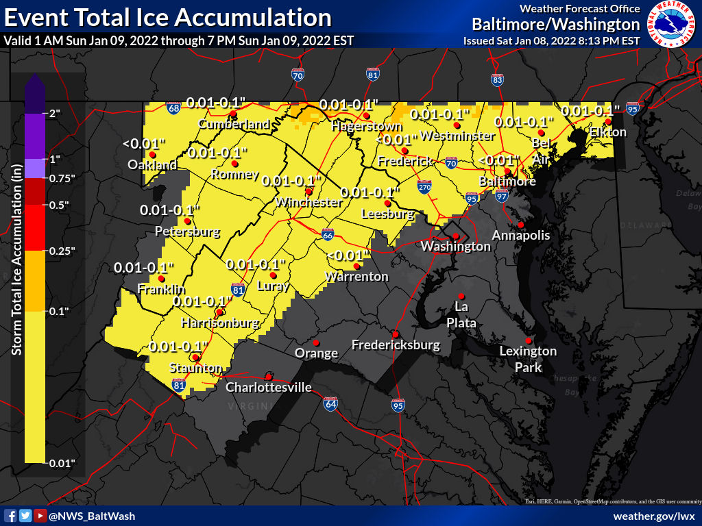
A Winter Weather Advisory is in effect from 6am until noon on Sunday morning.
Temperatures will likely remain below freezing h til the late morning, which could cause for some slick spots in MoCo until about noon.
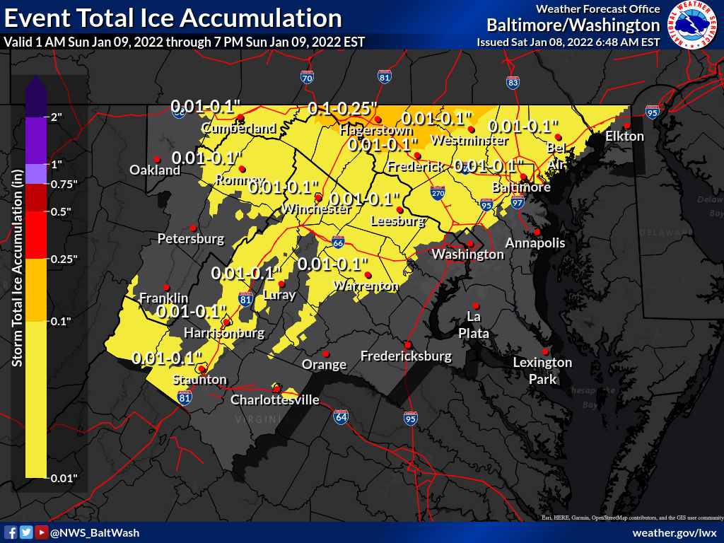
A Winter Weather Advisory is in effect from 6am until noon on Sunday morning.
Per the National Weather Service:

Below you’ll see some preliminary snowfall reports, per the National Weather Service. Leading the way are areas like Olney, Damascus, Poolesville, and Clarksburg with over 5 inches (note: not every area in MoCo is listed):

The National Weather Service made additional changes to the snow maps after 10pm tonight.
As you can see above, totals are slightly higher than a few hours ago. 3-4 inches now expected for all of MoCo with the reasonable worst case scenario map st 5-8 inches.
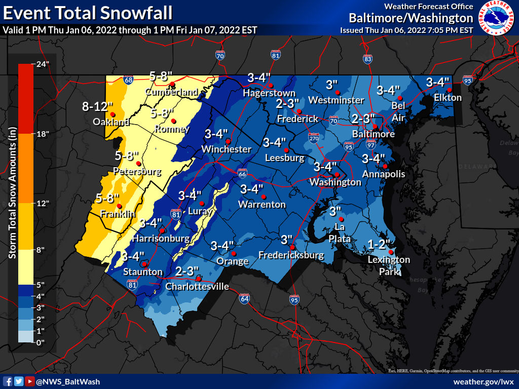
The National Weather Service has made some last minute updates and has put out new maps for the storm expected to arrive in a couple hours.
In the latest updates you’ll see the top third and bottom third of MoCo in the 3-4” range with central MoCo in the 2-3” range.