The National Weather Service (NWS) has released its first maps for snow that’s expected to come our way before sunrise on Friday morning.
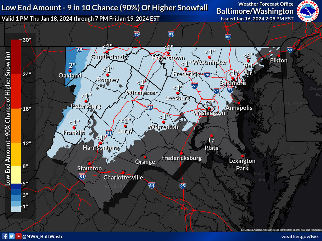
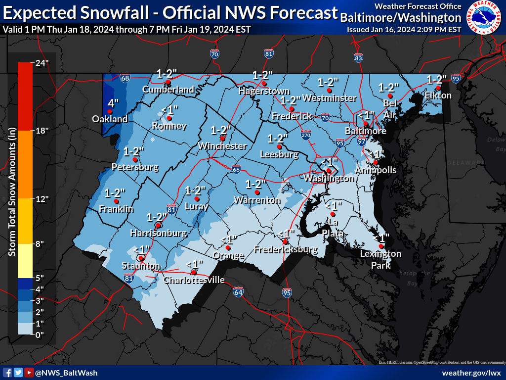
The “Expected Snowfall” map shows a widespread 1-2 inches as the most likely scenario. The way things look now (Tuesday afternoon), snow may move into the area either late Thursday or early Friday. It’s expected to be light, with the “Reasonable Worst Case Scenario” map showing 2-4 inches for most areas and the “Low End Amount” map showing less than an inch for everyone (both maps below).
We’ll continue to monitor this event and provide you with updates as things start to get a little clearer. This one looks to be less about how much snow and more about when it falls in regards to the impact it could have on schools this Friday.
A Pencil Prediction for Wednesday, January 17th will be out later this evening/tonight.