
Almost all major weather models are now showing a strong signal for significant snow impacting the region this coming weekend. Some model outputs are displaying extreme scenarios, including snowfall totals measured in feet, but forecasters caution that the event is still roughly five days away, leaving plenty of time for the setup to shift.
NBC4 meteorologist Doug Kammerer addressed the growing attention around the potential storm on Monday afternoon, emphasizing both the strength of the signal and the uncertainty that remains.
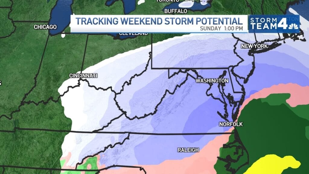
“You are going to be hearing about a weekend storm a lot over the next week,” Kammerer said. “This is the European model and yes, it has a very strong snowstorm for the weekend. Most of the models do, but as always, we will need to watch this all week. Your apps will tell you one thing, social media will tell you another.”
Kammerer noted that while the setup is exciting for snow lovers, it is far from locked in. He encouraged viewers to rely on trusted forecasts rather than individual app snapshots or viral social media posts, adding that he planned to break down the situation further during a Facebook Live discussion.
Meteorologist Ryan Maue also weighed in on social media, highlighting just how aggressive some of the model guidance has become. Referencing the AIFS-Single run from the ECMWF (Euro AI) model, Maue wrote that it “unloads everything it has on the Eastern U.S. with gargantuan snowfall amounts,” calling the output difficult to even contemplate.
In a follow-up post, Maue described what he called “unprecedented ferocious weather model output,” noting that one scenario depicts two consecutive mega blizzards capable of burying Washington, New York City, and Boston under three to five feet of snow by the end of January.
It is important to stress that these model depictions are not forecasts. Extreme solutions often appear several days out and can weaken, shift, or disappear entirely as the event draws closer. Still, the consistency of a strong winter storm signal across multiple models has caught the attention of meteorologists.
