
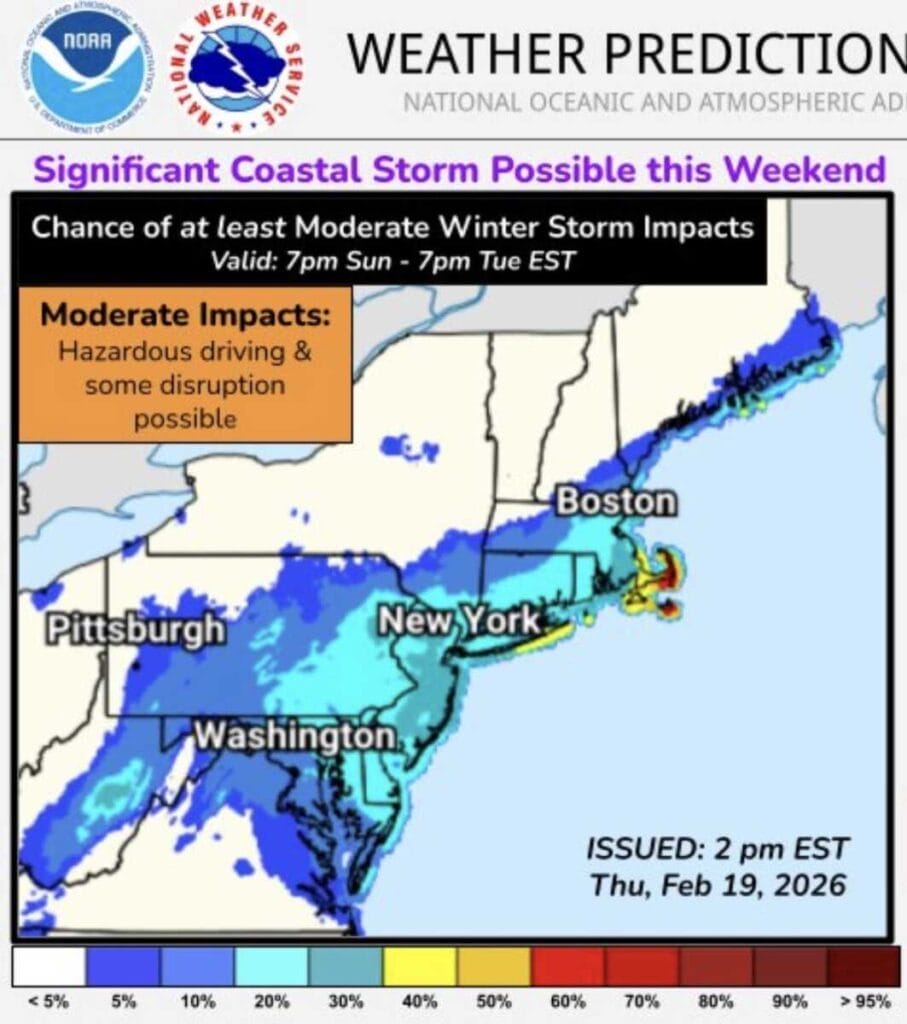
Forecast uncertainty remains high as the National Weather Service Weather Prediction Center highlights the potential for a coastal storm to develop near the East Coast late this weekend, with confidence in storm formation higher than confidence in specific local impacts. Officials caution that small shifts in the storm’s track could mean anything from minimal impacts to accumulating snow and strong winds.
In its latest outlook, the Weather Prediction Center notes that low pressure is expected to develop near the Mid Atlantic coast late this weekend and strengthen rapidly offshore Sunday into Monday. Even with an offshore track, increasing winds and hazardous marine conditions are possible. What remains unclear is the exact track of the system and how snow and wind may combine to affect travel, infrastructure, and coastal areas.
The uncertainty is on full display in the latest model guidance. The most recent run of the GFS, which has struggled with accuracy at times this winter, shows extreme snowfall totals of up to three feet across parts of Maryland and Northern Virginia. The European model paints a much different picture, showing a more modest 1 to 4 inches for most of the region.
NBC4 meteorologist Doug Kammerer addressed the stark contrast on social media, calling the situation “model mayhem.” Kammerer said the GFS is depicting what it claims would be the biggest storm of all time for the DC region, while the European model shows just 1 to 3 inches. He attributed the nearly three foot difference to what he believes is a fundamental failure in the American model, noting that it has performed poorly this winter and has often been discarded in recent forecasts.
Kammerer said he does not see a record breaking snowstorm for the region and does not expect a high impact event. While he does believe the area will see snow, he said most other models align much more closely with the European solution, which he expects to be closer to reality. He added that the continued issues with the GFS raise serious questions about its performance and reliability moving forward.
The bottom line from forecasters is that while the signal for a storm exists, confidence in exact snowfall totals and impacts remains low. Forecast details are expected to change over the next 24 to 48 hours as the system becomes better sampled and model agreement improves.
