
A wild stretch of weather has begun across the region as severe storms entered the area followed by a brief chance of snow Thursday. NBC4 meteorologist Doug Kammerer noted Wednesday afternoon that the region is seeing a classic seasonal transition pattern.
“March is the battle of the seasons! We have a chance of severe storms today and a chance for snow tomorrow! It won’t be much, but the cold air is making a return. Watch for severe storms this afternoon. There is also a chance of tornadoes today as well,” Kammerer said.
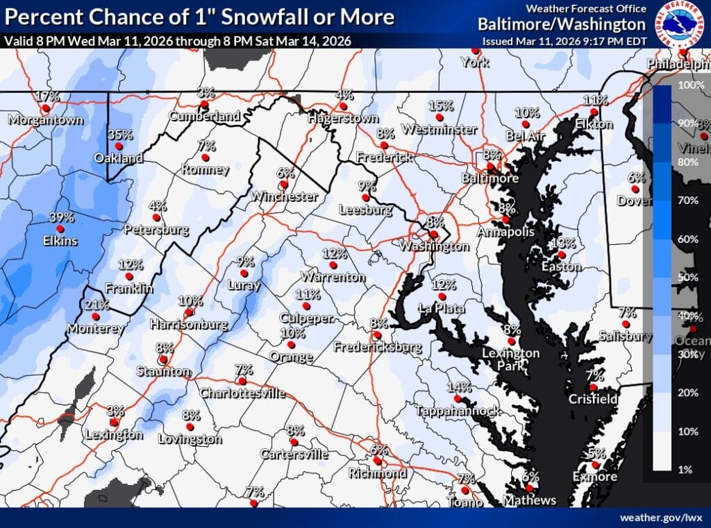
According to the National Weather Service forecaster’s discussion, a potent cold front will move across the region late Wednesday night into early Thursday morning. Temperatures are expected to drop quickly behind the front, with the day’s high temperatures likely occurring around midnight or early Thursday morning before readings steadily fall through the day.
Showers are expected to develop along and behind the cold front as it moves east. As colder air rapidly moves in, some of that precipitation could briefly change over to snow before ending. The NWS shared that any snow would likely be “rate-based,” meaning it could occur during heavier bursts of precipitation despite surface temperatures remaining above freezing in many lower elevation areas.
Because of the recent warm weather and expected ground temperatures, the NWS says impacts from any snow should remain limited.
