MoCo Ads 1979
This week we’re looking back at Montgomery County ads from 1979!


MoCo Ads 1979
This week we’re looking back at Montgomery County ads from 1979!
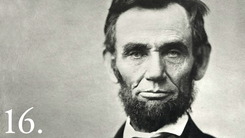
Did Abraham Lincoln spend time at Silver Spring Mansion with the Blairs?
Lincoln and the Blairs were close. The Blairs already had a strong family friendship with the Lincolns in Kentucky. Francis Preston Blair Sr. had advised U.S. presidents before Lincoln, which means that Lincoln and Blair Sr. would most likely have had at least a close work relationship. The two families were clearly political allies since Lincoln made Montgomery Blair, Blair Sr.’s son, the administration’s postmaster general.

Many of you may have spent a sun-splashed day roaming the 18.3-acre grounds of Nike Missile Park in Gaithersburg near Snouffer School Road. However, this site was not always the lovely green space that we see today – and the “Nike” is not referring to the Swoosh we’re all familiar with. Project Nike was an anti-aircraft missile initiative that traces its roots back to 1944, when the U.S. Department of War (now the Department of Defense) tasked its scientists and engineers to develop a widespread anti-aircraft missile system. During the Cold War, tensions were at a fever pitch, and the U.S. military sought to ensure that the nation was protected in the event of an attack.
Previously known as Site W-94 in the Washington-Baltimore Defense Area (BA, W), the Gaithersburg site was one of several Nike facilities across the capital region equipped with anti-aircraft infrastructure for use in the case of airborne attacks. The site was equipped with the Nike Ajax (MIM-3) missile systems, which were the main foundation of the Nike program until the mid-1960s. Once the technology advanced past the Ajax’s point, the Gaithersburg Nike Missile site was deactivated and demolished, with the core site being transferred to the National Park Service and the surrounding areas developed into residential lots. In 1997, the National Park Service then transferred the site to the Maryland-National Capital Park Planning Commission (M-NCPPC), at which point we gained the Nike Missile Park that we know today.
Back in 1990 you could watch Back to the Future at the “Dive-in Move” at Stedwick Pool. In 2020, the classic film was shown at DC Party Box’s drive-in theater in Rockville.
Did you know that the very first Toys R Us was in Rockville?

During the post-war boom in the 1950s, Montgomery County’s population more than doubled in size and rivaled the population booms of Los Angeles and Houston. The number of residents in the County had shot up from 164,401 to 340,928, increasing by 107%.
The thriving job market in MoCo helped facilitate its growing population. In the 1960s, multiple federal government agencies in Montgomery County, such as Walter Reed Hospital Annex and the National Institute of Health, continually employed professional workers. Other private businesses like IBM Federal Systems, Inc. and Johns Hopkins Applied Physics Laboratory were also offering work.
Retro MoCo Ads – 1985
Today we’ll be looking at local ads from thirty-five years ago from the County Courier!
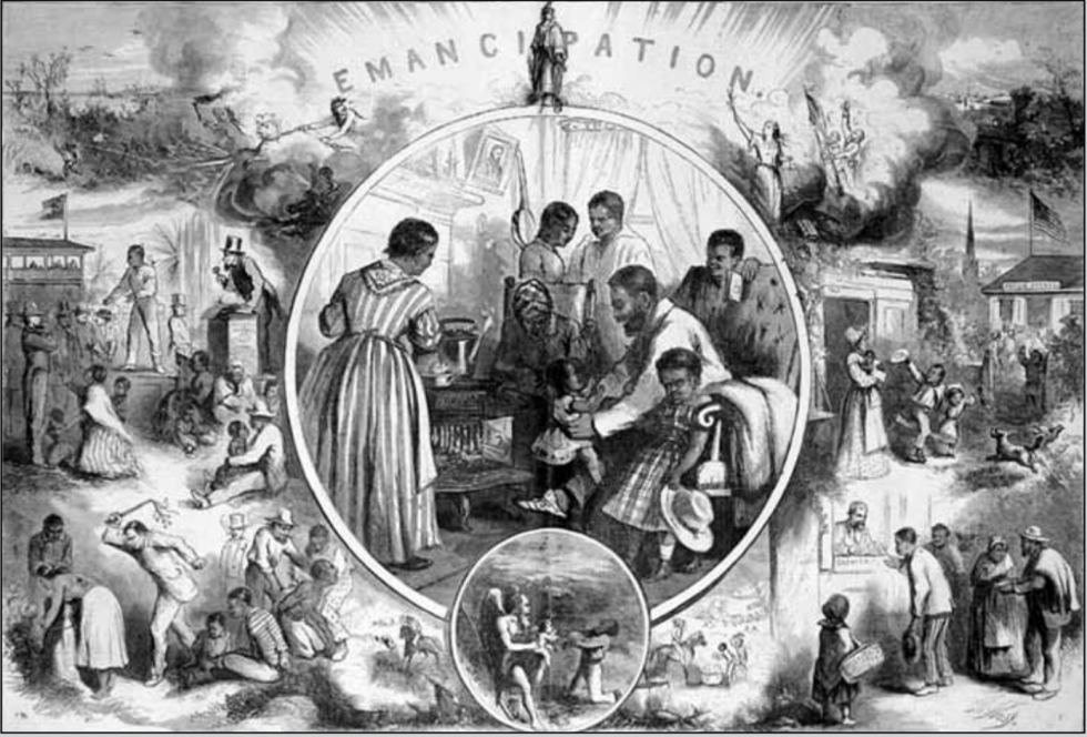
Montgomery History & Germantown Historical Society Host Emancipation Event November 3rd
Montgomery History and the Germantown Historical Society will be hosting a virtual event this Tuesday, November 3rd at 2PM.

“(Don’t Go Back To) Rockville,” R.E.M. Sang in 1984
R.E.M. will go down in rock and roll history for their legendary hit songs. A popular favorite is “It’s the End of the World As We Know It.” When it plays, everyone in the car shouts the chorus and mumbles the rest. But while I was scrolling through a list of R.E.M’s music, I was surprised to find a lesser-known song featuring Montgomery County’s Rockville.
Rachel Carson, Author of “Silent Spring,” Lived in Montgomery County.
In 1956, ecologist and writer Rachel Carson moved into her new house in the White Oak area of Montgomery County at 11701 Berwick Road. She planted evergreen trees in her yard to create a natural wooded area.

A Gaithersburg Observatory Was Part of a Global Scientific Endeavor
Gaithersburg is home to a site instrumental to the development of Earth science: the Gaithersburg International Latitude Observatory.

How much do you know about Montgomery County’s forts?
This map covers the surrounding area of forts Alexander, Franklin, and Ripley, each built within a few miles of Washington D.C. near Glen Echo. Fort Sumner can be seen scribbled on the map in ink. It was connected to the other three forts by trenches. The forts were built as part of D.C.’s defenses during the Civil War. The illustration was created by the United States Army Corps of Engineers.