The First Ever Federal Monuments are on the Border of Montgomery County
There are a total of nine Boundary Stones on the border of DC and Montgomery County, mainly along Western Avenue, Eastern Avenue, and within the Washington Aqueduct.


The First Ever Federal Monuments are on the Border of Montgomery County
There are a total of nine Boundary Stones on the border of DC and Montgomery County, mainly along Western Avenue, Eastern Avenue, and within the Washington Aqueduct.
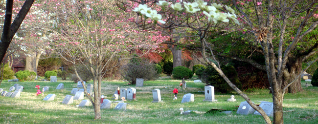
Nestled in the center of Aspen Hill, Md lies the Aspin Hill Memorial Park, the final resting place of more than 53,000 pets and people. Far from a Steven King novel, Aspin Hill Memorial Park is a place that honors the love between people and their pets. It’s owned by the Montgomery County Humane Society and is open to the public year-around.
Founded in 1921, the memorial’s name comes from a dog-kennel in England–this spelling of “Aspin” is not a typo! Aspin Hill Pet Memorial is thought to be the second-oldest pet cemetery in the United States. Typical pets such as dogs and cats are buried there, but animals like horses and monkeys can also be found.

“Flower Girl” in Anti-War Photograph Went to Montgomery College
French photojournalist Marc Riboud was renowned for his work on capturing the Vietnam War. Riboud’s photograph The Ultimate Confrontation: The Flower and the Bayonet, caught international attention and remains an iconic, impactful depiction of the Vietnam War protests.

Brookeville Preserves Its History Through 15 Star Flags
Brookeville’s title as “Capital for a Day” isn’t the only thing that makes Brookeville a uniquely historical site. A flag resembling the Star-Spangled Banner, otherwise known as the 15 star flag or the Great Garrison flag, can be seen lining some streets.

Montgomery County History: Zadok Magruder
Colonel Zadok Magruder High School sits nestled in Derwood with a student body of just under 1,700 (2019-2020 school year numbers courtesy of MCPS). However, some of you may not know much about the man whom Magruder High is named for: Zadok Magruder, who is one of the founding fathers of Montgomery County.
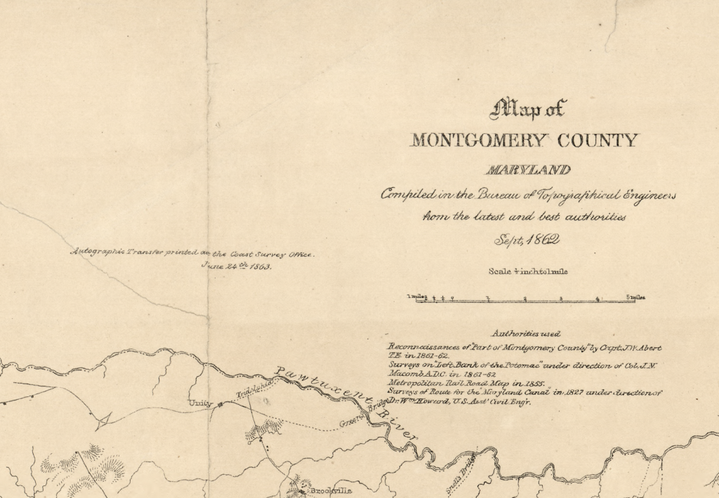
Do you recognize this area? This is a map of Montgomery County in 1863. Created by the Bureau of Topographical Engineers and the United States Coast Survey, this map contains the locations of rural households and natural landmarks, like ravines. This carefully crafted image would’ve been used as a general guide to Montgomery County’s landscape and for military purposes.
If you look closely, you can spot familiar names on the map such as Colesville, Poolsville, Rockville, Gaithersburg, Silver Spring, and even Sligo River.

The Capital of the United States of America was in MoCo on This Day in 1814
Brookeville was settled by Quakers late in the 18th century and was formally incorporated as a town in 1808. Just six years later, it became the “U.S. Capital for a Day.”

“Tip Your Cap” Negro League Exhibit Comes to Sandy Spring Slave Museum
To celebrate the 100th anniversary of Negro League Baseball, the Sandy Spring Slave Museum will host a new exhibit about the Negro Leagues as part of the “Tip Your Cap” initiative.
5 Historical Locations in MoCo That You Probably Didn’t Know Existed
Montgomery County is full of historical landmarks and buildings, many of which are well known outside of the county. But for every notable landmark, there are many more that are often overlooked by the public.
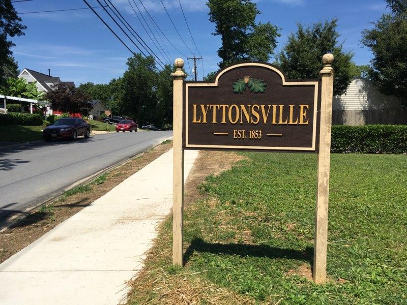
A Piece of MoCo Housing History #2: Lyttonsville
Lyttonsville is a historically Black community that’s situated between current day Bethesda and Silver Spring. It was founded by Samuel Lytton, a free Black laborer working for the Blair family, in 1853. Lyttonsville is one of numerous historically Black communities in Montgomery County. Today, the community has a 17.1 acre park and an elementary school. With the completion of the Purple Line, there will also be two transit stations and a new Ride-On Bus depot.

This map of residential sub-areas in the DC metro region was produced by the Federal Housing Administration in 1937. The map categorizes neighborhoods into grades that represent how worthy they were for investment and insured mortgage lending. The grading system was directly influenced by race and class.
Montgomery County is visible on this map. The higher graded regions (which are shaded darker) include Bethesda, Chevy Chase, and a portion of Silver Spring. Neighborhoods that had higher concentrations of African Americans were assigned the lowest grades (shaded lighter).