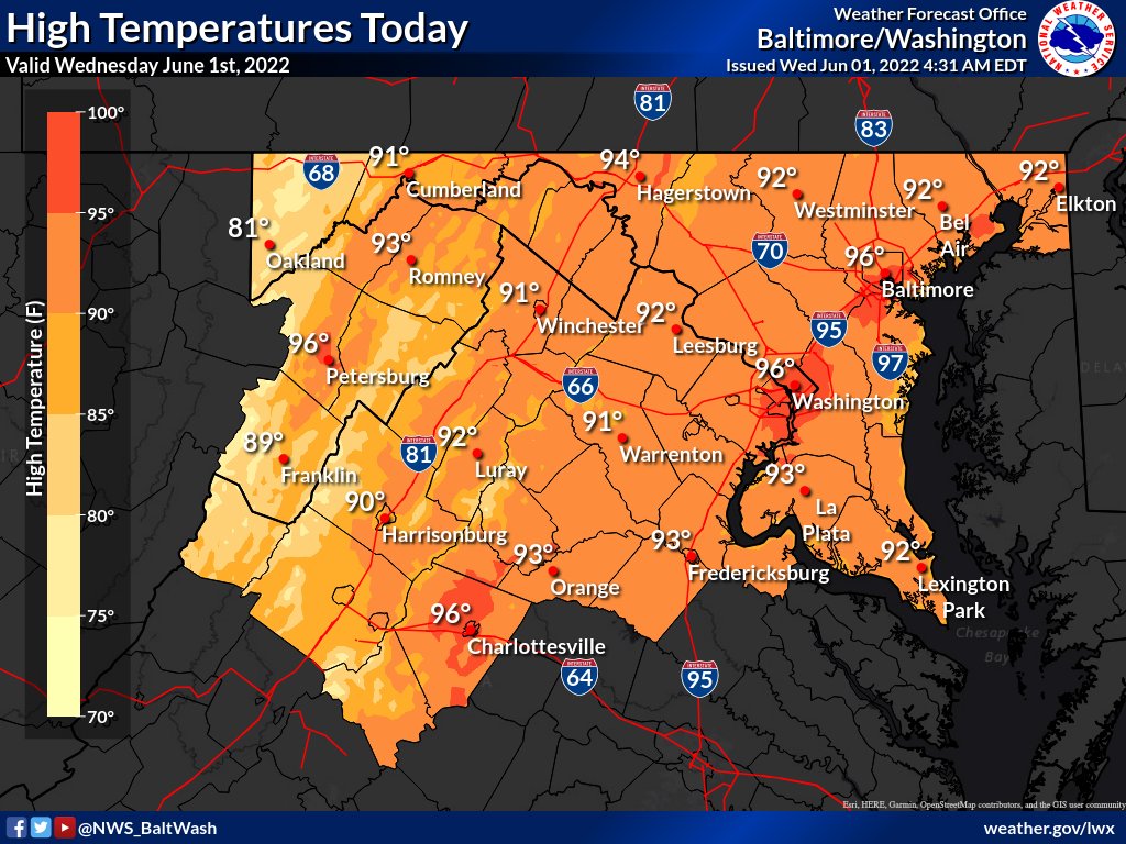
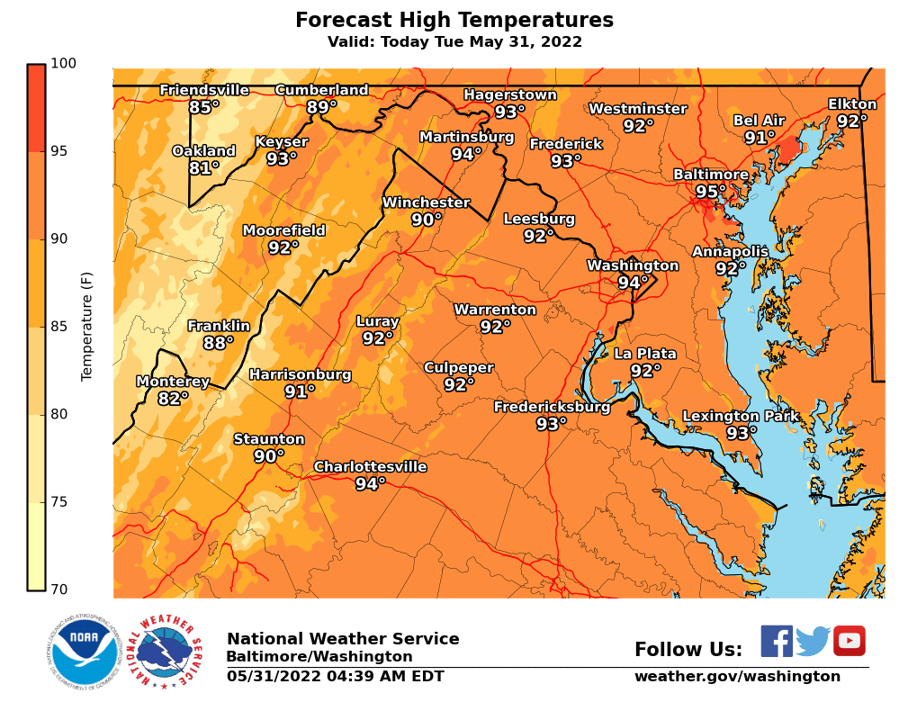
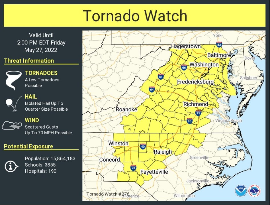
A Severe Thunderstorm Watch is now in effect for our area until 9:00pm. Temperatures are currently in the upper 80s and feel like they’re in the upper 90s. Clouds have already rolled in for most of the county and thunderstorms appear to be on their way.
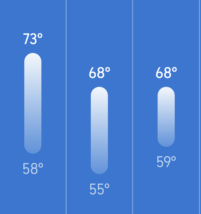
Thunderstorms are possible for the rest of the day, with severe thunderstorms also possible– bringing hail and damaging winds. Things should clear up overnight and into tomorrow morning as Friday is expected to mostly sunny with temperatures reaching around 80°.