Temperatures could reach 70° today, but that is likely to come with gusty south to southwest winds (30-40 mph), according to the National Weather Service.
Per the NWS:


Temperatures could reach 70° today, but that is likely to come with gusty south to southwest winds (30-40 mph), according to the National Weather Service.
Per the NWS:
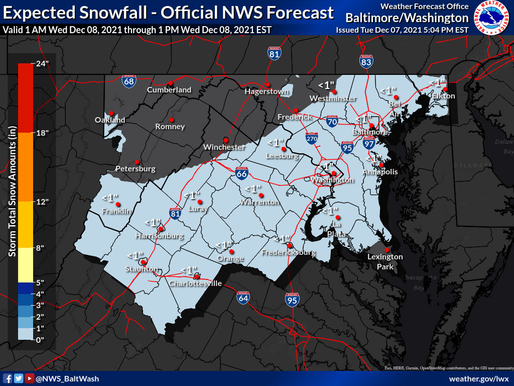
Not much has changed since our previous update letting you know not to expect much out of potential winter weather tomorrow morning.
Flurries or light snow may fall between 7am and 1pm tomorrow. If anything falls, there will more than likely be no disruption to travel as roads will just be wet.

The threat we’ve been watching has almost completely backed off, with very little to no snow expected to fall Wednesday morning.
Per the National Weather Service, less than an inch is expected to fall, with the “high end” amount under an inch as well (10% chance of the high end amount falling).

At 7:35pm, the National Weather Service provided its latest thinking on the potential winter storm set to arrive late Tuesday (December 7th) into Wednesday (December 8th).
“Here’s our latest thinking on the system set to arrive late Tue into Wed. Check out forecast amounts and the higher end potential. Keep in mind, Mon will be warm but it will be short lived as a strong cold front moves through bringing 30-40 mph wind gusts.”
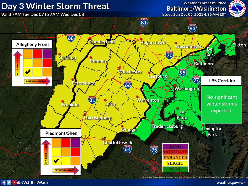
For the first time this season the National Weather Service has our area at a “Slight” risk for a winter storm.
The potential winter weather could come our way Tuesday and Wednesday. Per the NWS, a slight risk means: “If threat materializes, may cause travel disruptions.”

The week will start off with its coldest day, as highs today will likely reach the mid 40s with light winds making it feel a bit cooler. Partly sunny skies are expected.
Temperatures will slowly climb as the week continues, as Tuesday is expected to hit the upper 40s with very little wind. Mostly sunny.

We’re about a month away from winter and the colder weather is starting to catch up. This week will start off with below average temperatures with today coming in close to average as highs will be near 50°. Rain is possible early on, but things will clear up in the afternoon.
Tuesday and Wednesday will be colder with temps in the mid 40s, but Thanksgiving day will bring above average temperatures with highs in the upper 50s.

NBC 4 has released its Snowfall Forecast for this upcoming winter.
Meteorologists Chuck Bell and Doug Kammerer both agree that snowfall is likely to be at or below average due to expected La Niña winter.

Temperatures will feel like mid-November to start the week with highs barely reaching the 50s today and tomorrow.
Mid-week will see a warm up as Wednesday is expected to make it to the mid 60s before Thursday’s climb into the low to mid 70s
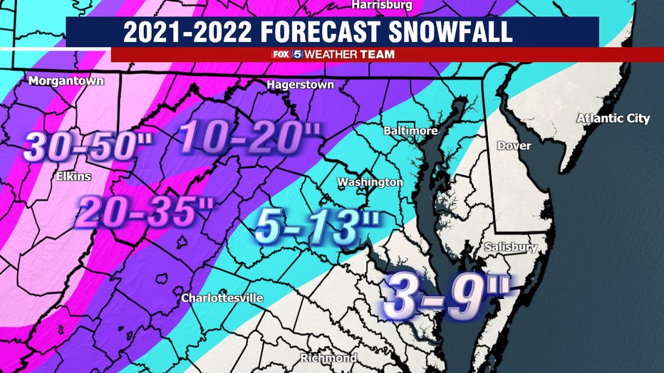
Fox 5 is the first of the major local networks to release a winter outlook and it may be a little disappointing for snow lovers.
Another “La Niña” is expected (like last year), which means the jet stream and severe weather are likely to be farther north, while weather is the south is warmer than usual. We usually have below average snowfall and above average temperatures during La Niña winters.

A Freeze Warning will be in effect for Northwest MoCo and a Frost Advisory will be in effect for Central and Southeast MoCo from 2am until 10am on Wednesday morning.
For the warning areas, (Germantown, Clarksburg, Damascus, Poolesville, etc.) sub-freezing temperatures as low as 29° can be expected.