A potential round of wintry weather remains on the forecast for parts of Maryland and Northern Virginia on Friday, though the latest guidance suggests the overall threat has shifted slightly north compared to earlier projections.
According to the National Weather Service (NWS), recent model trends show the storm track nudging northward, which has led to a downward trend in overall precipitation amounts across areas closer to the Beltway.
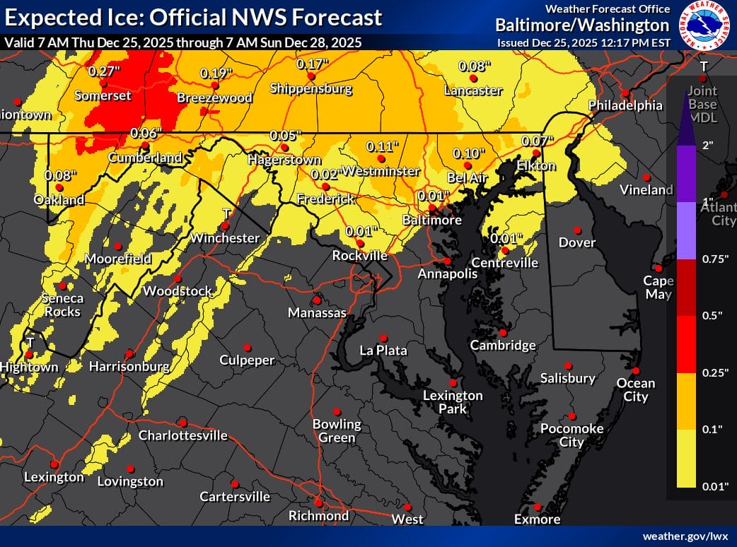
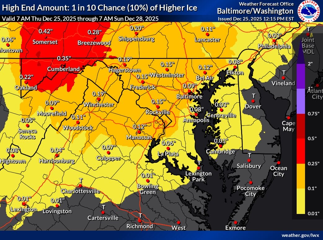
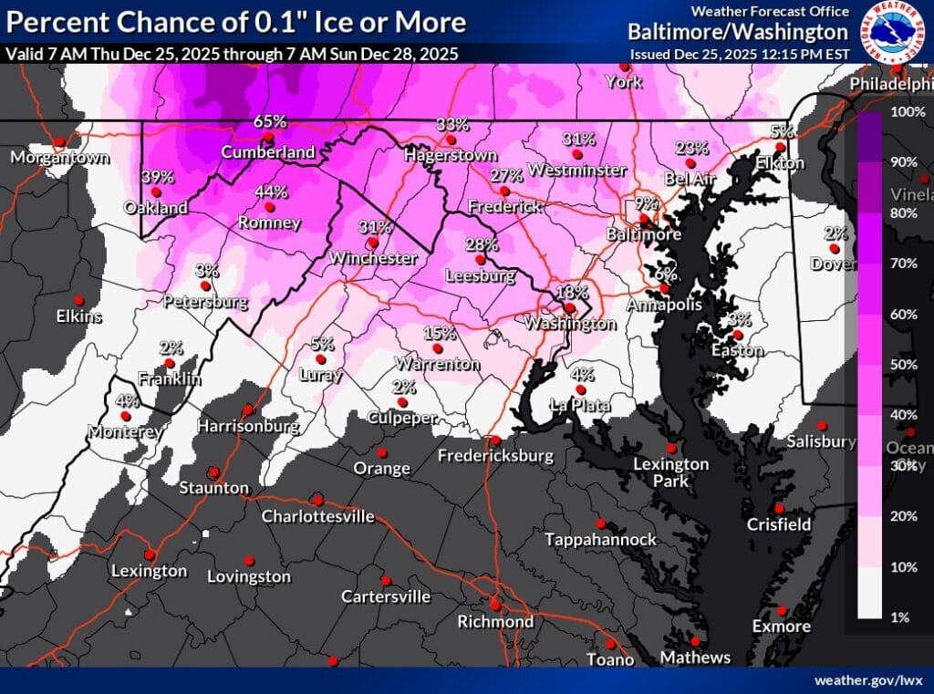
Forecast maps from the NWS indicate that ice accumulation is still possible, particularly north of I-66 and US-50, as well as in higher elevations. Much of central Maryland, including Montgomery County, is currently projected to see light ice accumulations on the lower end of the scale, generally a few hundredths of an inch. While those numbers may seem small, forecasters caution that even a thin glaze of ice can create hazardous travel conditions.
The NWS notes that the atmospheric setup remains favorable for sleet and freezing rain, with cold, dry air near the surface and warmer air aloft. The bulk of the precipitation is expected to fall during the afternoon and evening hours on Friday, with the possibility of lingering drizzle or freezing drizzle overnight as the low pressure system moves offshore.
Because of the evolving nature of the system, the National Weather Service has elected to reassess after another round of model guidance before deciding whether Winter Weather Advisories are needed.