
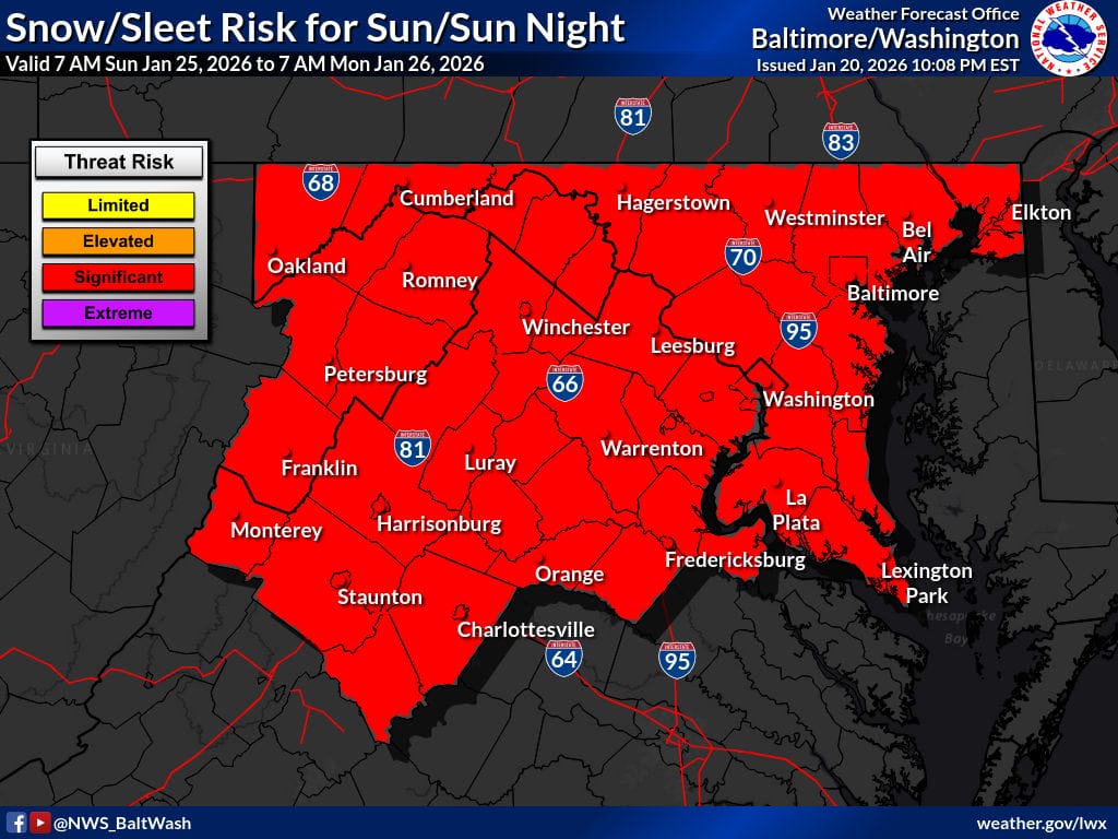
Confidence continues to build for a significant winter storm in the DC region, but FOX5 meteorologist Mike Thomas says the forecast still hinges on fine details.
Thomas noted that over the past 24 hours, National Blend of Models (used by the National Weather Service) data has shown higher snowfall totals, driven more by consolidation among model members than a dramatic upward trend. That clustering increases confidence in a higher-end outcome. He added there has been a slight northward shift late in the runs, which could put DC closer to the jackpot zone, though too much of a shift north would introduce warmer air aloft and increase the risk of sleet mixing in.
One key takeaway, Thomas said, is that the NBM is not using a simple 10:1 snow ratio. Under that more realistic approach, snowfall for DC sits near 15 inches, the highest he has seen since the NBM was introduced. By contrast, the GFS shows 10 to 12 inches using a 10:1 ratio, which Thomas said likely translates closer to 12 to 16 inches once higher snow ratios are considered.
The latest European model run continues to support a strong storm signal but also introduces the possibility of a warm nose later Sunday. That would mean a period of heavy snow followed by sleet, keeping totals from reaching the most aggressive snow maps.
Thomas said the setup still favors a high-impact storm, with final outcomes depending on small shifts in track and temperatures over the next day or two.
