Another round of light snow and increasing winds is expected late Friday into early Saturday as a strong Arctic front moves through much of Maryland and northern Virginia, according to the National Weather Service.
The NWS forecaster’s discussion says deteriorating conditions will begin Friday afternoon, with snow showers developing across much of the Baltimore-Washington region. Light accumulations are possible at most locations, with the highest confidence in generally minor totals. While widespread significant snow is not expected, brief periods of reduced visibility and slick spots are possible, especially during heavier snow showers.
In addition to snow, aviation forecasters note sub-VFR conditions are likely Friday afternoon into Friday night due to falling ceilings and visibility. These lower ceilings and reduced visibility could linger into early Saturday morning.
The bigger impact may come from the wind. Behind the Arctic front, strong northwest winds are expected to develop, with gusts potentially reaching 40 to 50 knots on Saturday. Those winds are forecast to gradually ease Saturday night into Sunday.
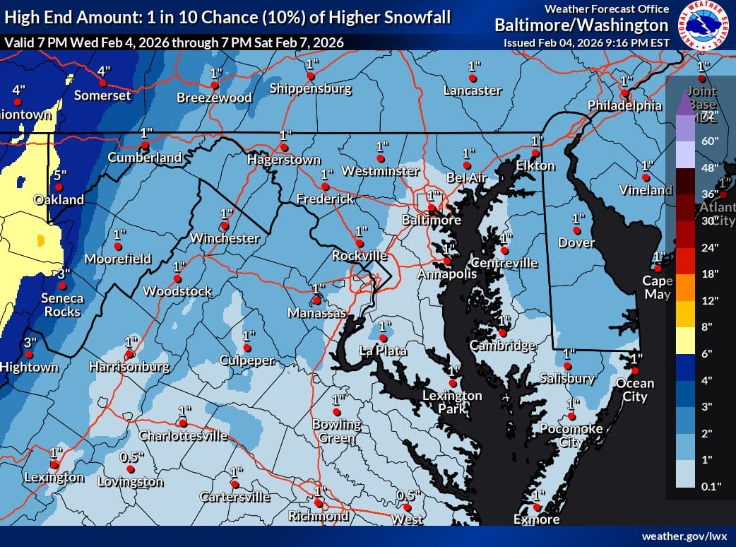
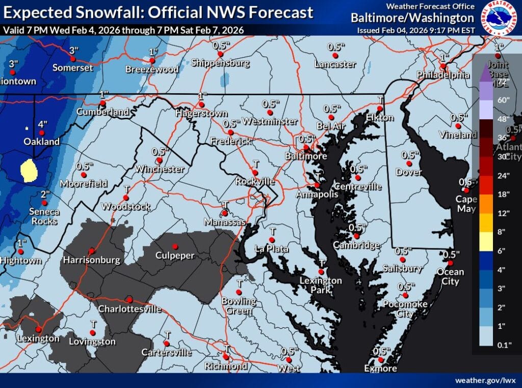
Snowfall projections continue to show most of the region picking up around a dusting to about an inch, with only a low-probability chance of higher amounts. Any snow that does fall is likely to be blown around by strong winds, which could create brief whiteout conditions in exposed areas.
Residents should be prepared for rapidly changing conditions Friday afternoon and evening, particularly for travel, and for very cold, windy weather to follow into the weekend.