
Much of Maryland and Northern Virginia could see snow, sleet, or freezing rain late this week (specifically December 26th), though forecasters caution that confidence remains low as the storm system is still several days away.
According to the National Weather Service Baltimore/Washington office, guidance has shifted noticeably southward with the track of the system over the last few forecast model runs. As a result, many current solutions now show the potential for wintry precipitation across the northern half of the region, generally along and north of the I-66 and U.S. 50 corridor. That includes much of central and western Maryland, the Baltimore and Washington metro areas, and portions of northern Virginia.
If wintry precipitation does develop, most model solutions currently favor freezing rain and sleet as the dominant precipitation types. However, forecasters say snow cannot be completely ruled out, depending on the eventual track and temperature profiles as the system approaches.
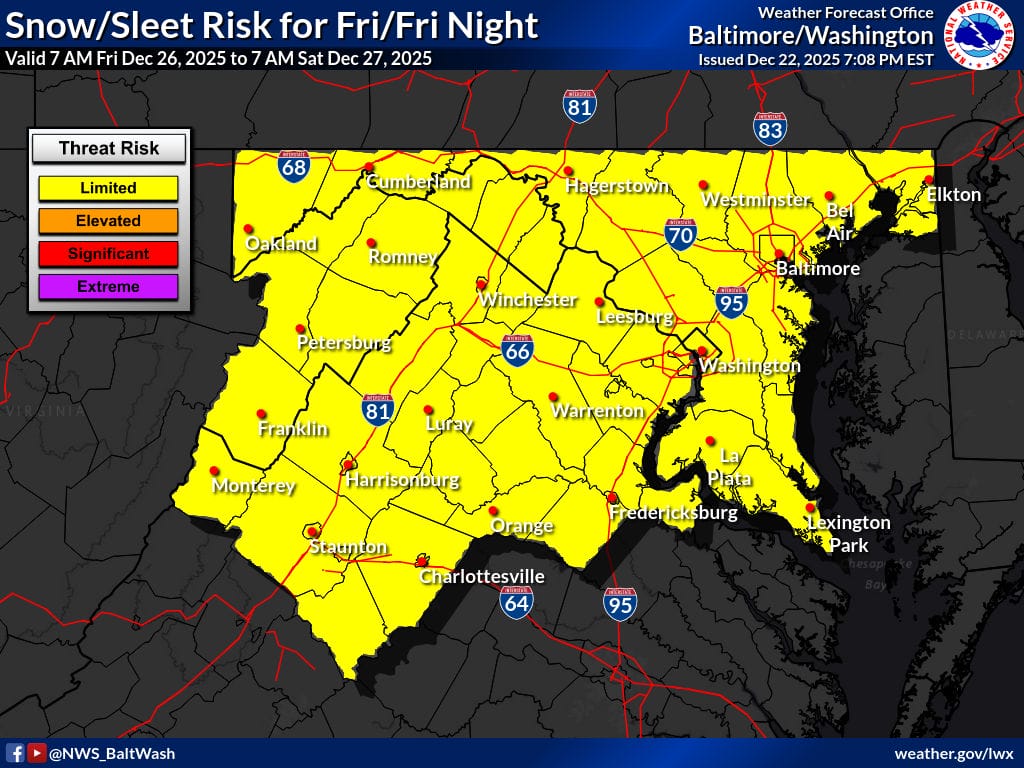
The Weather Service’s latest forecast highlights a “limited” snow and sleet risk for most of Maryland and northern Virginia from early Friday morning through early Saturday. While the overall risk level remains on the lower end for now, even light icing could lead to slick roads and travel issues, especially during overnight and early morning hours.
Forecast uncertainty remains higher than usual due to a very complex upstream weather pattern. The storm system will originate over the North Pacific, where several key atmospheric features are still organizing. Critical pieces of the pattern are currently located west of the California coast, in the Gulf of Alaska, and near the Bering Strait. In addition, another closed upper-level low west of Hawaii could play a major role in how the system evolves as it moves east.
Because those features have yet to fully come together, forecasters note that there could still be significant changes in the storm’s track and precipitation type over the next several model runs. As a result, confidence in specific impacts remains much lower than normal for a forecast this far out.
Residents across Maryland and northern Virginia are encouraged to monitor updates over the coming days, especially those with holiday travel plans. Even small shifts in the storm’s path could mean the difference between cold rain and impactful wintry precipitation.
