White Christmas…?
We’re five days away and there have been rumblings about the possibility of snow on Christmas for a couple days.


White Christmas…?
We’re five days away and there have been rumblings about the possibility of snow on Christmas for a couple days.
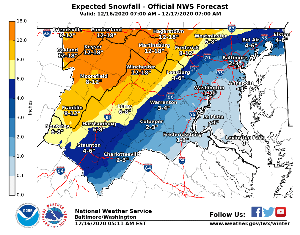
Final Calls for Today’s Winter Storm
The time has come and we are just a couple hours away from the start of our first winter storm of the season.
Wednesday Storm Update (Tuesday Afternoon Update)
You called it! Something we’re all used to in our area has occurred– Winter Disappointment.
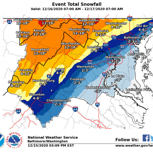
Wednesday, 12/16 Storm (Tuesday Morning Update)
A Winter Storm Watch remains in effect for our area as we are now one day away from the wintry weather.

Montgomery County Public Schools have remained entirely virtual since the start of the school year. So what happens if it snows?
Fox 5 reported the following for Montgomery County:
The National Weather Services Releases First Snow Forecast for Wednesday, 12/16
The Winter Storm Watch has now been extended to include all of MoCo
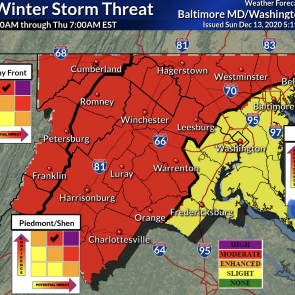
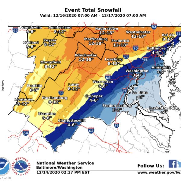
Significant Winter Storm Possible This Week (Sunday Afternoon Update)
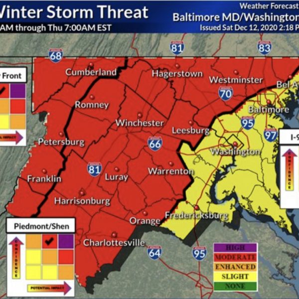
4pm UPDATE: The National Weather Service has increased the level of confidence and possible impact from the “enhanced” to “moderate” zone, which is one step below the most severe– “high” for half of MoCo.
Significant Snow Storm Possible This Wednesday (12/16)