Image courtesy Montgomery County OEMHS


Per Montgomery County:
“As the winter season begins, Montgomery County Executive Marc Elrich and the County’s Office of Emergency Management and Homeland Security (OEMHS) encourage residents to familiarize themselves with what to do before, during and after a winter storm.

0 Comments

According to the Montgomery County Office of Emergency Management and Homeland Security, “Montgomery County has activated a Hypothermia Alert for extreme cold from 9 pm Thur, 11/2 to 9 am Fri, 11/3. Expect the wind chill to be below 32 degrees. Wear layers if you go outside. Take extra precautions if you spend significant time outdoors”

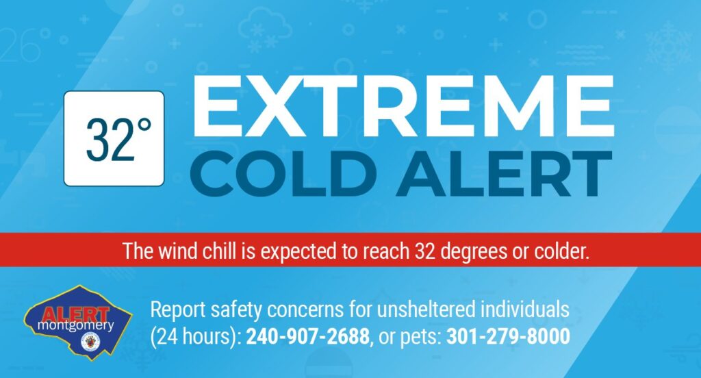
A Hypothermia Alert is issued for the County when forecasted temperatures, and/or wind chill, in at least part of the County fall below 32 degrees creating a hazardous situation in which hypothermia and frostbite are likely.

Cold Emergency Alert could be issued for the County when dangerously cold conditions are present, including, but not limited to, sub-zero temperatures and wind chill for which it will be dangerous to be outdoors for prolonged periods of time.

There is always particular concern for children, seniors, homeless individuals and animals during periods of extreme cold.

  • Neighbors, friends or family members should check on the elderly, especially a senior living alone. Older people are particularly susceptible to hypothermia, even inside their homes and may need assistance.
  • Children engaged in outdoor activities should be carefully monitored by a responsible adult
  • Everyone spending time outside should dress appropriately to protect against the cold
  • Montgomery County provides a variety of sheltering opportunities for the homeless. Call the police non-emergency line, 301-279-8000 if an individual appears to be in danger.
  • Animals should not be left outside unattended.  See more information about animal care below.
  • Residents in need of a place to warm up can visit County facilities such as libraries or recreation centers, or ride a Ride On bus, during normal operating hours.

Alert Montgomery:

For timely severe weather and emergency notifications, go to  alert.montgomerycountymd.gov and sign up for Alert Montgomery. Warnings and emergency updates will be sent directly to your cell phone (text), landline phone,  and/or email address. The service is free, but text charges may apply, so check with your cell phone carrier before selecting text alerts.

Hypothermia:

Extreme cold is a dangerous situation that can bring on health emergencies in susceptible people, such as the very young, seniors, those without shelter or who are stranded, or who live in a home that is poorly insulated and/or without heat. Hypothermia can result from prolonged exposure to the cold. When exposed to cold temperatures, the body begins to lose heat faster than it can be produced. When the body’s store of energy is used up, the result is hypothermia. Because hypothermia can affect the brain, a person may not be aware that it is happening, and not take appropriate steps to prevent damage.

Warning Signs:

  • Shivering, exhaustion
  • Confusion, fumbling hands
  • Memory loss, slurred speech
  • Drowsiness
  • For infants – bright red, cold skin, very low energy

What to do:

  • If you notice any of these signs, take the person’s temperature. If it is below 95 degrees, the situation is an emergency – get medical attention immediately
  • If the person is unconscious and does not seem to have a pulse or is not breathing, call 9-1-1

While waiting medical care:

  • Get victim into a warm room or shelter
  • Remove any wet clothing
  • Warm the center of the body first – chest, neck, head and groin – using electric blanket if available, or use skin-to-skin-contact under loose, dry layers of blankets, clothing, towels or sheets
  • Warm, nonalcoholic, beverages can help increase body temperatures if the victim is conscious

Frostbite:

Frostbite is an injury to the body that is caused by freezing. Frostbite causes a loss of feeling and color in affected areas, typically the nose, ears, cheeks, fingers or toes. Signs of frostbite include redness or pain in any skin area, a white or grayish-yellow skin area, skin that feels unusually firm or waxy and numb.

What to do:

  • Get into a warm area as soon as possible
  • Immerse the affected area in warm, but not hot water
  • Warm the affected area using body heat
  • Do not use a heating pad, heat lamp, or the heat of a stove, fireplace or radiator for warming
  • Do not walk on frostbitten feet or toes if at all possible
  • Do not rub the frostbitten area with snow or massage the area

Shelter Information:

Montgomery County Health and Human Services staff, as well as community-based providers, will continue to reach out to homeless community members to urge them to seek shelter during periods of extreme cold temperatures. Residents concerned about the well-being of a homeless individual can call the 24-hour Line at 240-907-2688. Outreach partners will attempt to locate the individual and offer resources and support.

  • Individuals in need of daytime warming centers should call the 24 hour Homeless Resource Line at 240-907-2688 for location information.
  • Individuals in need of Emergency Shelter should call the Crisis Center at 240-777-4000 or present themselves at 1301 Piccard Drive, Rockville, MD 20850. A screening will be completed.

For additional information on County services contact MC311 by calling 3-1-1 or 240-777-0311 between 7 a.m. and 7 p.m. weekdays, or through the  www.MC311.com website address which is available to receive emails 24/7.

Outdoor Safety:

  • Try to stay indoors and make trips outside as brief as possible. Limit outdoor recreational activity. Outdoor cold weather exertion puts extra strain on the heart.
  • Wear hat, scarf or mask to cover face and mouth
  • Sleeves should be snug at the wrist
  • Several layers of loose-fitting clothing should be worn under a heavy coat

Indoor Safety:

If you plan to use a wood stove, fireplace or space heater, be extremely careful. Never use generators, grills, camp stoves or similar devices indoors, inside a garage, or near the air intake of your house because of the risk of carbon monoxide poisoning.

  • Only use combustion heaters if they are properly vented to the outside and do not leak flue gas into the indoor air space
  • Do not place a space heater within three feet of anything that may catch fire, such as drapes, furniture or bedding
  • Do not use an extension cord

Vehicle Safety:

During cold winter weather, keep the gas tank near full to help avoid ice in the tank and fuel lines. Make sure there is adequate antifreeze. Keep a cell phone charger and a charged cell phone in your car in case you have an emergency. Never leave a person of any age alone in a vehicle. Have extra blankets and supplies in case of a breakdown.

Animal Care:

During a period of extreme cold temperatures, animals must not be left outside unattended. Leaving animals outside unattended in these conditions may be considered an act of cruelty and pet owners could be charged and fined accordingly. Executive Regulation 17-17 requires that during a Cold Emergency Alert, outdoor housing for an animal as described in Section 3.0 is inadequate and additional measures must be taken to provide adequate heating. These additional measures must be approved by the Executive Director of the Montgomery County Office of Animal Services.

During a period of extreme cold temperatures, the Montgomery County Office of Animal Services (OAS) enforces Executive Regulation 17-17, Anti-Cruelty Conditions for Dogs and Other Pets. The Executive Director of OAS, Thomas J. Koenig, is authorized to provide resident notification when animals must not be left outside unattended.  Unattended tethering of dogs is not allowed at any time.

Animals that usually spend long periods of time outdoors must have access to shelter to properly protect them from the elements; however, during periods of extreme cold they must be brought inside or have an adequate heat source approved by the Executive Director. The penalty for this violation is a $500 fine.

Animal Service Officers will be on-call, patrolling neighborhoods and responding to any animal-related emergencies. If you see an animal left outside that appears to be in danger, call the police non-emergency number at 301-279-8000.

0 Comments

The National Weather Service (NWS) has issued a Freeze Watch in Montgomery County for Thursday, November 2 from 12:00 am to 10:00 am. Frost and freeze conditions could kill crops, other sensitive vegetation & possibly damage unprotected outdoor plumbing. Per NWS:

FREEZE WATCH IN EFFECT FROM LATE WEDNESDAY NIGHT THROUGH THURSDAY MORNING…
* WHAT…Sub-freezing temperatures between 26 and 30 degrees possible.
* WHERE…Portions of central, north central, northeast, northern and southern Maryland, The District of Columbia and
central, northern and northwest Virginia.
* WHEN…From late Wednesday night through Thursday morning.
* IMPACTS…Frost and freeze conditions could kill crops, other sensitive vegetation and possibly damage unprotected outdoor plumbing.
PRECAUTIONARY/PREPAREDNESS ACTIONS…
Take steps now to protect tender plants from the cold. To prevent freezing and possible bursting of outdoor water pipes they should be wrapped, drained, or allowed to drip slowly. Those that have in-ground sprinkler systems should drain them and cover above- ground pipes to protect them from freezing.

0 Comments

According to the Montgomery County Office of Emergency Management and Homeland Security, “The @NWSSPC has just upgraded our area to a level 4 out of 5 for severe weather threat. This is very rare. Please pay attention to weather watching & warnings today. Have a plan ready to quickly seek shelter in a sturdy building away from windows, if warnings are issued today.  To prepare for today’s weather: Charge battery-powered devices; fuel your vehicle; secure any loose outdoor furniture; locate your flashlight; and make sure you have some basic supplies available in case you lose power for a day or two.”

Per NWSSPC: “Numerous severe thunderstorms are expected to develop this afternoon and evening. Damaging winds will be the primary threat, some of these winds may become locally destructive. Additionally, a few tornadoes and large hail are possible. Isolated to scattered instances of flooding are also possible.”

0 Comments

The United States Senate passed the “Sunshine Protection Act” by unanimous consent today. The bill would make Daylight Saving permanent and put an end to having to change your clocks twice a year. The bill will now need to pass through the House, before going to President Biden. According to the H.R.69 – Sunshine Protection Act of 2021, this bill makes daylight savings time the new, permanent standard time. States with areas exempt from daylight savings time may choose the standard time for those areas.

The bipartisan Sunshine Protection Act was introduced by Senators Marco Rubio (R-FL) and Ed Markey (D-MA). Daylight Saving Time began in the U.S. in 1918 and was extended by four weeks in 2007. Daylight saving time began this year this past Sunday, March 13, and lasts until November, 6.


0 Comments

Montgomery County Public Schools has released a survey about the possibility of virtual learning on days when schools are closed due to inclement weather. The survey must be completed by Monday, January 31 at noon.

Per the Maryland State Department of Education, all school systems are required to have at least 180 instructional days per year. With inclement weather, multiple school system closures may require adjustments to the school year calendar (e.g., extending the year, using other identified days). MCPS is planning for options that allow for virtual instruction on inclement weather closure days. While virtual instruction cannot replace time in the classroom, MCPS believes it is essential to continue to provide access to learning opportunities. Your feedback on this intent will help inform the district’s implementation plan.

The survey can be accessed here.

Per MCPS:

Dear MCPS Families,

MCPS is planning for the possibility of virtual learning on days when schools are closed due to inclement weather. It is important that students experience as little learning disruption as possible, so we are asking for your input to inform our initial planning. Please complete this survey and share your thoughts by 12 p.m. on Monday, Jan. 31. See the survey in:

English | Spanish | Chinese | French | Portuguese | Korean | Vietnamese | Amharic

Montgomery County Public Schools

3 Comments

Hyperthermia Alert in Effect Today

Montgomery County has activated the Extreme Heat Plan for a Hyperthermia Alert for Wednesday, August 25, from 11am – 7pm. Expect the heat index to be above 95 degrees.

County officials urge residents to take precautions to protect themselves, and their loved ones, against heat-related illnesses such as heat stroke and heat exhaustion.

A  Heat Emergency Alert could be issued for the County when dangerously hot conditions are present, including, but not limited to, temperatures and/or heat index reaching 105 degrees for a period of at least two days or longer for which it will be dangerous to anyone exposed to the heat for an extended period of time.

Residents are also asked to check on elderly friends, relatives and neighbors who may be isolated, to ensure they are not showing signs of heat-related illnesses.

0 Comments

White Christmas…?

White Christmas…?

We’re five days away and there have been rumblings about the possibility of snow on Christmas for a couple days.

While it’s possible, it’s currently looking like a situation where a Christmas Eve rainstorm could turn into some flakes on Christmas Day.

As it stands now it wouldn’t be anything major, but could be enough for us to see some flakes during the day.

We’ll keep an eye on this and update accordingly, as the thought of snow on Christmas is exciting for many.

0 Comments

Final Calls for Today’s Winter Storm

The time has come and we are just a couple hours away from the start of our first winter storm of the season.

Winter Storm Warning for N/NW MoCo (7am today until 4am Thursday) and Winter Weather Advisory for C/S/SE MoCo (10am today until 1am Thursday)

The networks have released their final calls and so has the National Weather Service. Here’s how they look:

ABC7: 2-6” for most about 2/3 of MoCo with the S/SE portion in the “up to 2 inches” category.

NBC4: The most conservative of the forecasts with most of MoCo is in the 1-4” range and a small sliver in the 4-8” range.

Fox5 has most of MoCo in the 3-6” range with the S/SE portion in the 1-3” range.

WUSA9 has the N/NW third of MoCo in the 3-6” range with the rest at 1-3.”

As seen on our featured photo, the National Weather Service has dropped projections for the county. 

Areas closer to DC and almost everything south of Rockville is at 1-2” with small parts of Silver Spring at less than an inch.

Gaithersburg/Olney are at 2-3”

Germantown/Poolesville are at 3-4”

Clarksburg/Damascus are at 4-6”


Even though this isn’t the type of snow that many snow lovers wished for, it will almost certainly make travel dangerous throughout the day today and overnight.

2 Comment

Wednesday Storm Update (Tuesday Afternoon Update)

You called it! Something we’re all used to in our area has occurred– Winter Disappointment.

The storm that once had the potential to bring double digit snow totals to our area now doesn’t look nearly as strong.

4:55pm UPDATE: Winter Storm Warning for N/NW MoCo tomorrow. Winter Weather Advisory for C/S/SE MoCo

Total snow and sleet accumulations of 3 to 6 inches and ice accumulations of up to one tenth of an inch in the warning area and 1 to 3 inches and ice accumulations of around one tenth of
an inch in the advisory area.

The National Weather Service, along with most local networks, have dropped their projected snow totals for much of the area.
Here’s how things look now:

• Parts of MoCo closer to DC (Bethesda/Silver Spring) will get anywhere between a coating to two inches of snow.

• As you move up towards Rockville, you get to 2-3”

• Gaithersburg/Germantown/Olney is looking like 3-5”

• Clarksburg/Damascus looks to be in the 6-8” range

This is definitely not a non-event, it’s just not what many snow lovers were hoping for.

We’ll keep an eye on things in case there are further changes prior to the start tomorrow morning and will have an update for you tonight.


0 Comments
×

Subscribe to our mailing list