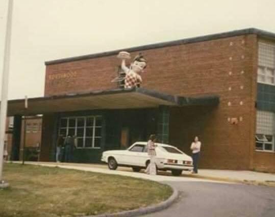
Northwood High School’s Senior Prank in 1977
The Bob’s Big Boy statue from the Hillandale location was taken and placed on the school.

Northwood High School’s Senior Prank in 1977
The Bob’s Big Boy statue from the Hillandale location was taken and placed on the school.

A Gaithersburg Observatory Was Part of a Global Scientific Endeavor
Gaithersburg is home to a site instrumental to the development of Earth science: the Gaithersburg International Latitude Observatory.

Part of the movie “All The President’s Men” was filmed in Chevy Chase.
In 1975, two scenes from the movie “All The President’s Men”, were filmed at 7009 East Avenue in the Town of Chevy Chase.

How much do you know about Montgomery County’s forts?
This map covers the surrounding area of forts Alexander, Franklin, and Ripley, each built within a few miles of Washington D.C. near Glen Echo. Fort Sumner can be seen scribbled on the map in ink. It was connected to the other three forts by trenches. The forts were built as part of D.C.’s defenses during the Civil War. The illustration was created by the United States Army Corps of Engineers.
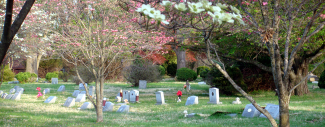
Nestled in the center of Aspen Hill, Md lies the Aspin Hill Memorial Park, the final resting place of more than 53,000 pets and people. Far from a Steven King novel, Aspin Hill Memorial Park is a place that honors the love between people and their pets. It’s owned by the Montgomery County Humane Society and is open to the public year-around.
Founded in 1921, the memorial’s name comes from a dog-kennel in England–this spelling of “Aspin” is not a typo! Aspin Hill Pet Memorial is thought to be the second-oldest pet cemetery in the United States. Typical pets such as dogs and cats are buried there, but animals like horses and monkeys can also be found.

Montgomery County History: Zadok Magruder
Colonel Zadok Magruder High School sits nestled in Derwood with a student body of just under 1,700 (2019-2020 school year numbers courtesy of MCPS). However, some of you may not know much about the man whom Magruder High is named for: Zadok Magruder, who is one of the founding fathers of Montgomery County.
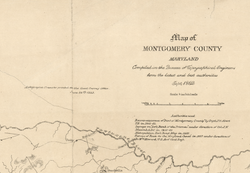
Do you recognize this area? This is a map of Montgomery County in 1863. Created by the Bureau of Topographical Engineers and the United States Coast Survey, this map contains the locations of rural households and natural landmarks, like ravines. This carefully crafted image would’ve been used as a general guide to Montgomery County’s landscape and for military purposes.
If you look closely, you can spot familiar names on the map such as Colesville, Poolsville, Rockville, Gaithersburg, Silver Spring, and even Sligo River.

The Capital of the United States of America was in MoCo on This Day in 1814
Brookeville was settled by Quakers late in the 18th century and was formally incorporated as a town in 1808. Just six years later, it became the “U.S. Capital for a Day.”
The Islamic Center of Maryland will be providing milk and produce to 1,000 MoCo families on Wednesday, August 26th from 12pm-2pm.
The event is free to all in MoCo and does not require an ID check, no questions asked.

Leisure World is an age-restricted, gated development primarily inhabited by retirees. The area was formerly known as the Rossmoor census-designated place for the 2000 census, at which time it had a population of 7,569– named after developer Ross Cortese, who had acquired the land for $5 million in the early 60s.
The sales office opened in 1965 and the shopping center broke ground in October of 1967 with Safeway, People’s, Hot Shoppes, and more signed on. The Leisure World Globe used to be colorful and even rotated (backwards). After years of security having to make people stop “riding” the globe, and multiple motor malfunctions, the change was made to the static globe we see today.
5 Historical Locations in MoCo That You Probably Didn’t Know Existed
Montgomery County is full of historical landmarks and buildings, many of which are well known outside of the county. But for every notable landmark, there are many more that are often overlooked by the public.