The National Weather Service has canceled the Winter Weather Advisory for C/SW MoCo, but the advisory remains in effect for NW MoCo until 11am.
The advisory now calls for up to an inch of snow to accumulate on grassy surfaces.


The National Weather Service has canceled the Winter Weather Advisory for C/SW MoCo, but the advisory remains in effect for NW MoCo until 11am.
The advisory now calls for up to an inch of snow to accumulate on grassy surfaces.
A Winter Weather Advisory remains in effect for us tomorrow morning. From 4am in Upper MoCo and 6am in C/SW MoCo until 11am.
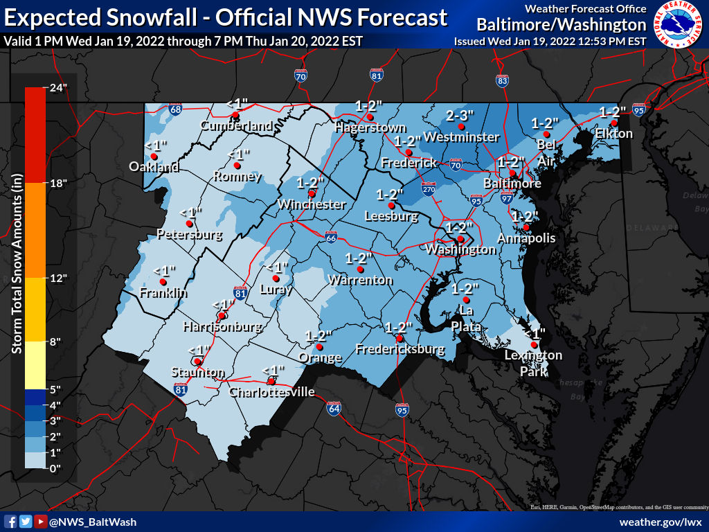
The National Weather Service has once again slightly increased its latest maps. About two thirds of MoCo is in the 2-3” range with a third in the 1-2” range. The “reasonable worst case scenario” map now shows up to 4 inches possible.
A winter weather advisory has been issued for MoCo starting 6am Thursday morning and going until 1pm (4am until 1pm for Upper MoCo).
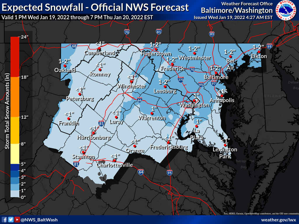
The latest National Weather Service maps show most of MoCo in the 1-2” range with the upper third of the county in the 2-3” range. The “reasonable worst case scenario” map shows 3 inches for the entire county.
The National Weather Service updated its maps overnight, increasing potential snow totals for most of the area.
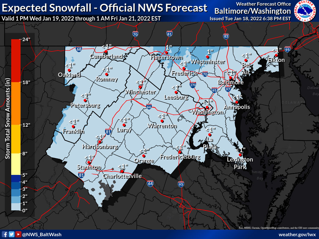
Per the maps, all of MoCo is in the 1-2” range for snowfall tomorrow morning. The “reasonable worst case scenario” map is now at just about 2 inches so confidence is increasing for 1-2” all around.
Rain is expected to develop overnight and change to a very brief period of sleet before the changeover to snow around 5am on Thursday morning. It should snow for a few hours, leaving anywhere between a coating to 3 inches of snow.
In the latest maps from the National Weather Service, they are still expecting less than an inch for most of the area, but have raised the “reasonable worst case scenario” totals to 2-4 inches for MoCo.
In yesterday’s update we mentioned the possibility of snow Wednesday into Thursday. “A few well-timed inches can throw a wrench into the Thursday morning commute.”
Today it looks like the possibility for a bit of snow on Thursday morning is there, but if it occurs it likely won’t be anything big.

More snow is possible this week as the GFS (North American model) and Euro (European model) are going head to head in their latest runs regarding potential snow on Saturday.
The National Weather Service has our area under the “Slight Winter Storm Threat” category for this upcoming Friday into Saturday (featured photo).

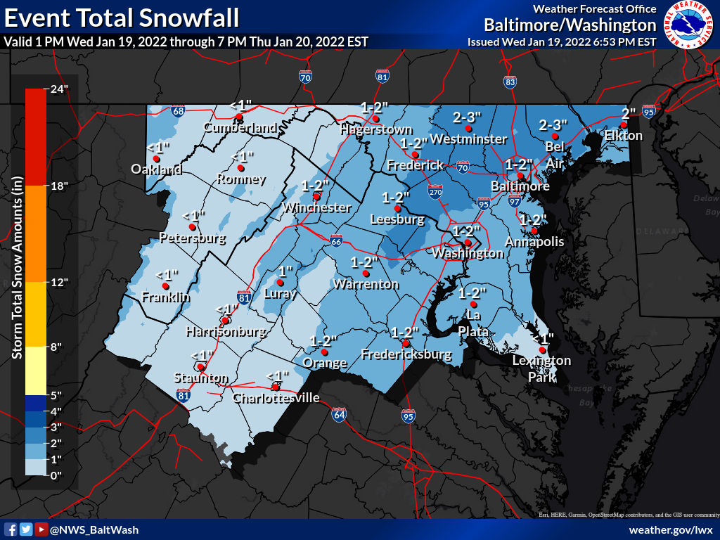
The National Weather Service has released snow totals from yesterday’s winter storm. These totals come from various times, so they may be different than what you experienced in the same area due to the changeover to sleet, freezing rain, and eventually rain.
Clarksburg came in with the highest total measuring at just under 4 inches.

A wind advisory is in effect for MoCo from 8am Monday, January 17th until 8pm Monday night.
Rain will continue overnight, washing away most of the snow/ice that accumulated earlier today. The high winds will also help with drying things off, but could lead to potential power outages.

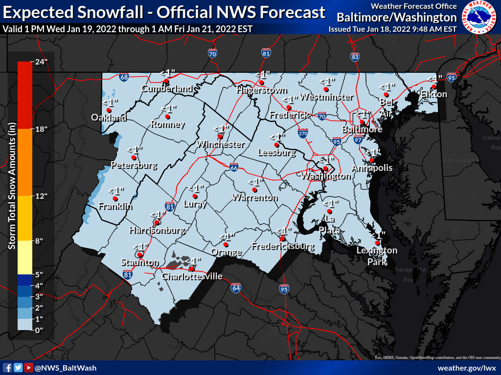
The Winter Weather Advisory remains in effect until 1am tomorrow morning.
The first flakes have started to fall, but prior to the storm starting the National Weather Service upped the projected totals for our area. Half of MoCo is now in the 3-4” range with the other half in the 2-3” range.

Snow is expected to start in our area sometime between 1pm-3pm as a Winter Weather Advisory is in effect from 1pm today until 1am Monday.
The latest Event Total Snowfall map from the National Weather Service has almost all of MoCo in the 2-3″ range with the far west sides of Dickerson and Poolesville in the 3-4″ range.