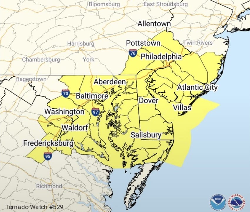
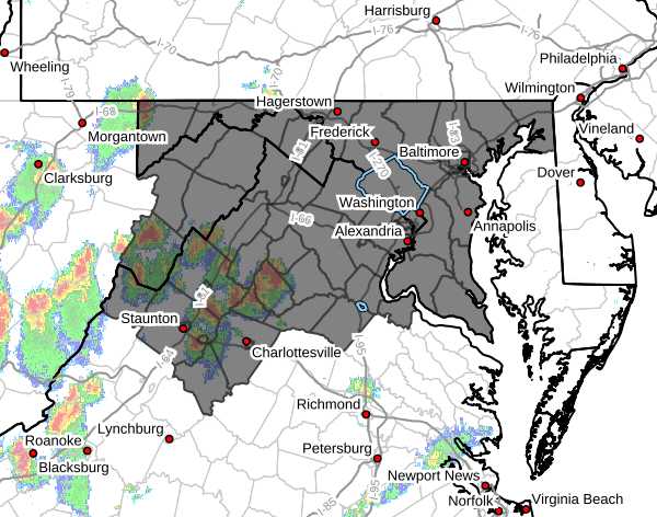
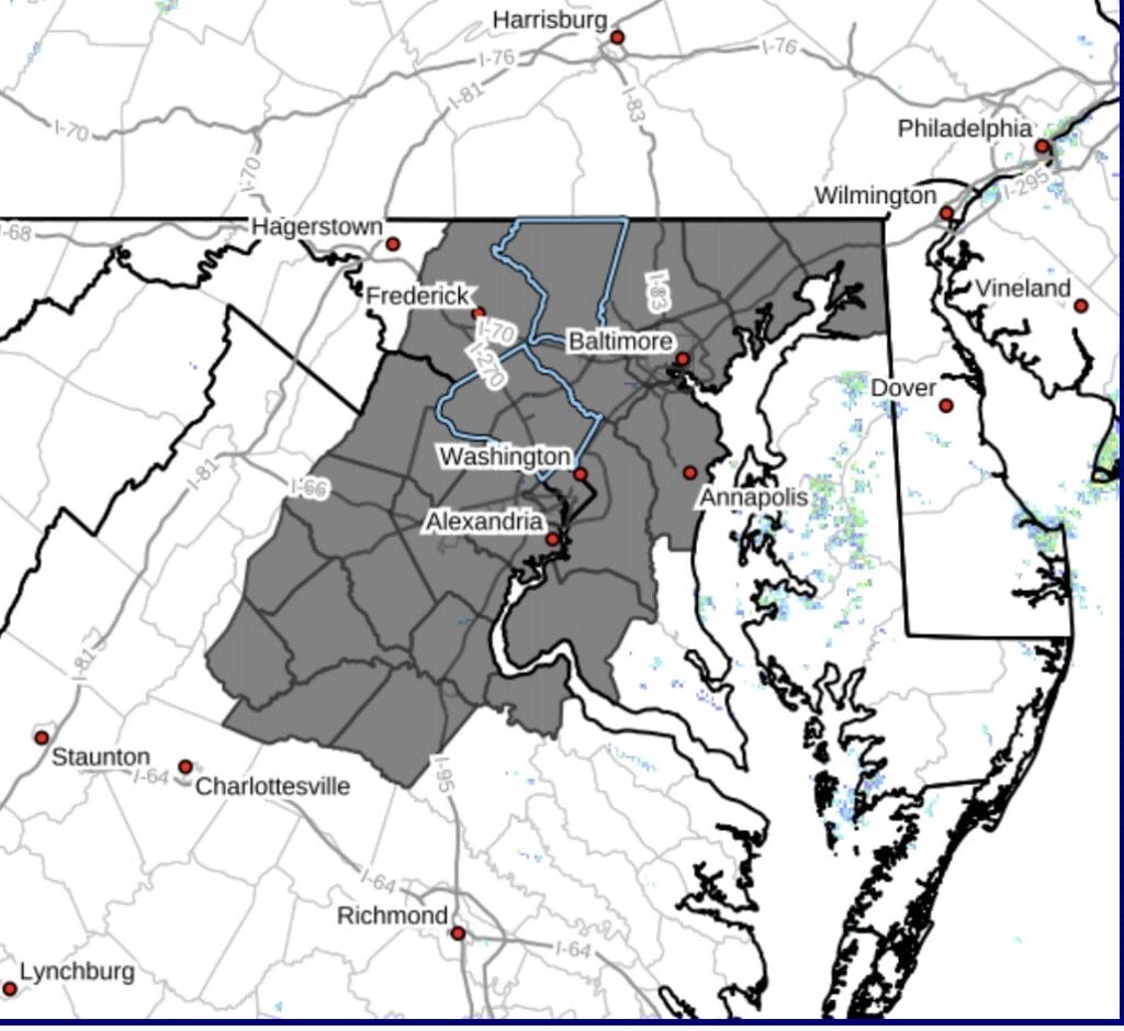
According to the Montgomery County Office of Emergency Management and Homeland Security, “Montgomery County has activated a Hypothermia Alert for extreme cold from 2am Monday, 4/22 until 8am Monday, 4/22. Expect the wind chill to be below 32 degrees. Wear layers if you go outside. Take extra precautions if you spend significant time outdoors”
The National Weather Service (NWS) has issued Freeze Warnings and Frost Advisories that are in effect for portions of the area from 2am tonight through 8am Monday morning.
The National Weather Service (NWS) has stated there’s a risk of severe weather in the area, with an “enhanced threat” in southern Maryland and parts of Virginia a “slight threat” in the DMV area including Bethesda and Silver Spring, and a “marginal threat” in the rest of Montgomery County and areas north.
The National Weather Service (NWS) has issued to wind advisory for most of the DMV and surrounding areas that will remain in effect until 6pm.
After a run of a couple pleasant days and some rain today, we are expected to see temperatures in the low 60s on Saturday and mid to upper 70s for most of next week… likely hitting 80° at least one of those days.
NASA will be broadcasting live as a total solar eclipse moves across North America today (April 8, 2024) traveling through Mexico, across the United States from Texas to Maine, and out across Canada’s Atlantic coast (link below).
According to the National Weather Service (NWS), “strong to severe thunderstorms will be possible later this afternoon into the evening, especially across areas along and south of the I-66 corridor and points westward. Main threats will be large hail, damaging winds and an isolated tornado possible.”
According to the National Weather Service (NWS), an active weather pattern next few days brings several rounds of thunderstorms to the area. The threat for strong to severe storms is marginal for today (Sunday) and Monday, then becomes higher for Tuesday.
Weather is pretty unpredictable in our area week to week and even day to day. The last week or two, we’ve been kind of stuck in the middle as winter has come to an end and we enter spring. Temperatures are about average, but it’s not necessarily warm or cold. Another one of those “stuck in the middle” weeks can be expected this week.
The National Weather Service (NWS) has issued a Flood Watch for the DMV area and beyond that begins at 2am this Saturday morning and lasts until 2pm Saturday afternoon.
The National Weather Service (NWS) has issued a Red Flag Warning for Montgomery County and many surrounding areas across the DMV and beyond until 8:00 pm Wednesday, 3/20.