
The Bicycle Master Plan Biennial Monitoring Report evaluates progress made in advancing the goals and objectives of the plan in 2019 and 2020
Montgomery Planning briefed the Montgomery County Planning Board on the 2019-2020 Bicycle Master Plan Biennial Monitoring Report at its November 18 meeting. The report is released every two years and evaluates progress in advancing the goals and objectives of the Bicycle Master Plan, as well as implementing recommendations for bikeways, bicycle parking, and bicycle-supportive programs and policies. It also includes recommendations for furthering implementation of the plan in the coming years. The Bicycle Master Plan was approved by the Montgomery County Council and adopted by M-NCPPC in 2018.
Read the 2019-2020 Bicycle Master Plan Biennial Monitoring Report.
In addition to briefing the Board on the Monitoring Report, Planning staff demonstrated a new data dashboard that tracks metrics measuring progress toward the goals of the Bicycle Master Plan. View the monitoring report dashboard.
View the Bicycle Master Plan bikeway map.
Key Findings from the Report
A few of the highlights in 2019 and 2020 are:
Master-Planned Bikeways:
- Constructed: 6.4 miles
- Under Construction as of 12/2020: 10.9 miles
- Funded for Construction: 8.4 miles
- Required as a Condition of Development Approval: 4.2 miles
Bicycle Parking:
Three secure bicycle parking stations are advancing, including:
- Bethesda Purple Line Station: a 460-space station was constructed by a development project
- Downtown Silver Spring: a 74-space station on Dixon Lane was in design
- Grosvenor Metrorail Station: a 100+ space station was a condition of a development project’s approval
Programs and Policies:
- In Spring 2019, the Department of Recreation initiated the Excel Beyond the Bell Program pilot to train elementary school students how to ride a bicycle. The pilot program trained 50 third graders at Oak View Elementary School.
- The County Council approved updated bicycle parking requirements and standards for new development projects.
Recommendations
The report also includes nine recommendations for advancing implementation of the plan, including:
- Prioritizing construction of bikeways with a focus on projects to improve connectivity to downtowns, upgrade the county’s temporary neighborhood greenways to permanent neighborhood greenways, and improve access to low-stress bicycling in Equity Focus Areas.
- Upgrading deficient bike racks at all public libraries and recreation centers over the next two years and expand and upgrade bicycle parking availability at all public schools over a ten-year period.
- Developing comprehensive design standards for bicycle facilities.
- Developing a Neighborhood Greenway Toolkit.
The next Bicycle Master Plan Monitoring report will be released in 2023.
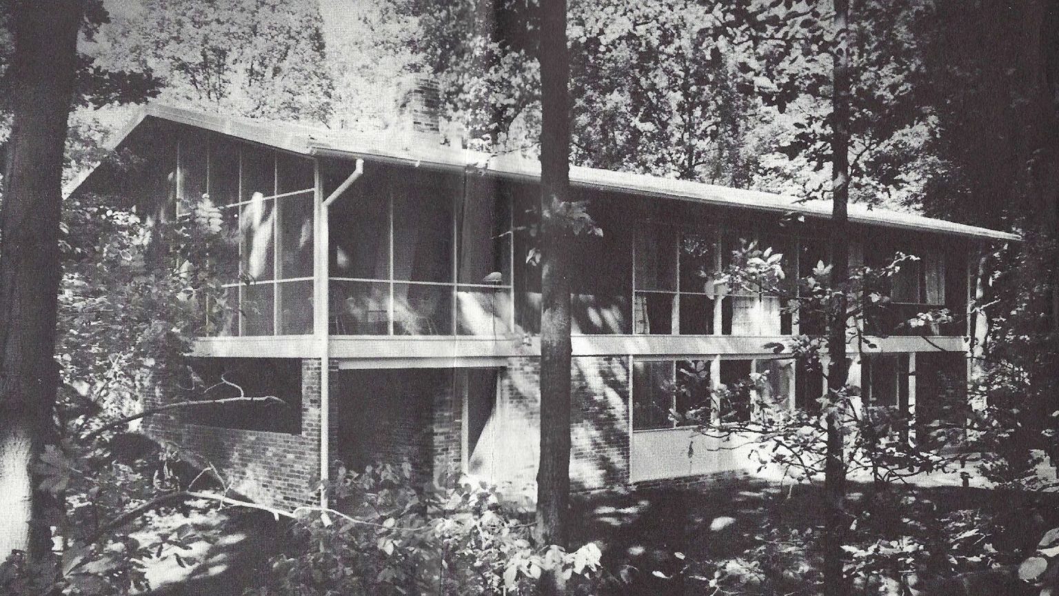
The Amendment is the first Mid-Century Modern historic district
Wheaton, MD — The Montgomery County Planning Board voted to list the Potomac Overlook Historic District in the Locational Atlas and District of Historic Sites and recommended that the County Council designate the district in the Master Plan for Historic Preservation on November 18, 2021.
The approval follows a process started by the community in 2019, studied by the Montgomery Planning Historic Preservation Office, and approved by the Historic Preservation Commission in June 2021.
Read the Public Hearing Draft for Potomac Overlook Historic District: An Amendment to the Master Plan for Historic Preservation. View the amendment’s appendix and the Potomac Overlook Design Guidelines.
“We are pleased that the Board voted to send forward our first midcentury modern historic district designation to the Council,” said Planning Director Gwen Wright. “This represents a true collaboration between our historic preservation team and the property owners, who worked together to create their design guidelines and collect community histories. Asian American and women’s histories are also celebrated in this nomination and we look forward to sharing these stories with the Council and general public.”
Builder Edmund J. Bennett and the architecture firm of Keyes, Lethbridge, and Condon developed Potomac Overlook in the late 1950s. The partnership celebrated the aesthetic design, functional advantages, and untapped commercial potential for modern architecture in tract housing and recognized the importance of creating communities respectful of the existing natural surroundings, topography, and tree canopy. The American Institute of Architects (AIA) and the National Association of Home Builders (NAHB) awarded them the “excellence of their cooperative efforts to create better homes and communities for Americans” award in 1961.
This amendment recognizes the achievements of six of the first owners who influenced local, state, and national affairs: Pao-Chi and Yu Ming Pien, Dorothy Gilford, Helen Wilson Nies, and Abraham M. and Helen W. Sirkin. Their achievements reflect the following themes: Asian American heritage, Jewish American heritage, women’s history, law, and mathematics, science, and engineering.
The Evaluation Process
Designation of resources to the Master Plan for Historic Preservation requires the approval of the Historic Preservation Commission, Planning Board and County Council. In June 2021, the Historic Preservation Commission recommended that the Planning Board lists the Potomac Overlook Historic District in the Locational Atlas and Index of Historic Sites and recommends that the County Council designates the resources as a Master Plan Historic District. Following the Planning Board’s approval, the County Council will move to review the amendment.
About the Historic Preservation Office
The Historic Preservation Office supports the Montgomery County Planning Board and the Historic Preservation Commission by providing for the identification, designation and regulation of historic sites in Montgomery County. Historic Preservation staff also maintains an archive and library of documentation on historic resources in Montgomery County and provides preservation outreach and guidance on preservation best practices to the public.
Public invited to provide testimony on the proposed plan for transit network along the I-270 corridor
Per Montgomery Planning:
Montgomery Planning will hold a public hearing for the Corridor Forward: The I-270 Transit Planon December 9 (starting at 6:30 p.m.).
The meeting will be held at the M-NCPPC Wheaton Headquarters, broadcast live online and will be available on demand after the meeting. Residents are invited to testify in person (vaccination proof is required) or virtually.
Sign up to testify for the December 9 Public hearing and learn more about testifying at the Planning Board. The public hearing was set on November 4 after a briefing to the Planning Board..
View the Public Hearing Draft of the Corridor Forward: I-270 Transit Plan.
The draft Plan, developed by the Montgomery County Planning Department, proposes a near-term transit network of dedicated bus lanes known as the Corridor Connectors that build on existing master planned projects, including the MD 355 and Veirs Mill Road Bus Rapid Transit (BRT) projects, to serve communities and employment centers along the I-270 corridor. Additionally, Corridor Forward includes an ambitious long-term recommendation for an extension of Metrorail’s Red Line to further expand transit options along the I-270 corridor. This Draft Plan re-envisions the master planned Corridor Cities Transitway (CCT) as the Corridor Connectors, a network of more buildable dedicated bus lanes which connect I-270 corridor communities to the county’s existing and planned rapid transit network.
Beyond the proposed network, Corridor Forward offers additional recommendations that support the proposed transit network and strengthen the potential to advance regional transit connectivity.
The Public Hearing Draft is the result of an iterative planning process, in which Planning staff:
- Compared transit vehicle attributes and inventoried transit options that could serve the I-270 Corridor.
- Completed a pre-screening analysis, which evaluated the initial list of inventoried transit options based on indicators such as travel time, population access, job access, ability to accommodate growth and equitable access and advanced six transit options for detailed analysis.
- Refined and analyzed the six transit options, including an evaluation of strategic metrics, economic and financial outlook, and potential implementation challenges and risks.
- Completed additional evaluation on combinations of the six transit options to inform the development of the Plan’s recommendations.
The draft Plan is a product of more than two years of transportation analysis, stakeholder coordination and community outreach.
Updated Corridor Forward Plan Schedule
The community will have the opportunity to continue to provide comment and testimony through the Planning Board process.
- December 9 – Planning Board Public Hearing
- December 16 – Anticipated Planning Board work session #1
- December 23 – Anticipated work session #2 and Planning Board vote to transmit to County Council
About the Corridor Forward Plan
The goal of Corridor Forward is to comprehensively evaluate, prioritize and advance transit options in the I-270 corridor area that achieve the best combination of the following values, consistent with the Planning Board Draft of Thrive Montgomery 2050:
- Strategic Connections: Serve high-demand origin and destination pairs, balancing costs of implementation with projected benefits.
- Economic Health: Enable existing development and master-planned communities to realize their potential as livable and economically vibrant places.
- Community Equity: Align with the county’s social equity goals and principles.
- Environmental Resilience: Operate sustainably and reduce negative environmental impacts.
To create the plan, Montgomery Planning has worked with state and county agencies, neighboring jurisdictions, county municipalities, advocacy groups, and community members as we analyzed and prioritized transit options to develop the Public Hearing Draft. Montgomery Planning has engaged community members about their needs and values related to transit through the Corridor Forward Plan’s Transit Values Questionnaire and Transit Stories campaign.
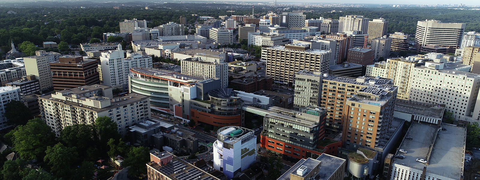
Montgomery Planning provided a brief history of Downtown Silver Spring in the recent Public Hearing Draft of Silver Spring Downtown and Adjacent Communities Plan. It can be seen below:
Indigenous peoples have lived in Montgomery County and the surrounding region for over 10,000 years. The Piscataway and Nacotchtank appear to have used the river valleys mostly for occupation and relied on the adjacent uplands for temporary camps associated with hunting and obtaining materials such as workable stone, until European colonization.
In the 1800s, Silver Spring consisted of a crossroads community and plantations, including that of Francis Preston Blair, built upon enslaved Black labor force. The opening of the Metropolitan branch of the B&O Railroad (1873) and the Washington, Woodside, and Forest Glen Railway & Power Company (1897)allowed for more housing and commercial opportunities in the area, limited primarily to whites. At the start of the twentieth century, developers of residential neighborhoods in Silver Spring often included racial restrictive covenants to bar Blacks (and people of other nationalities, ethnicities, and religious backgrounds) from the housing market. De jury and de facto segregation permitted Blacks to work in the plan area, but excluded them from owning or renting property within its boundaries.
The opening of the Silver Spring Shopping Center and Silver Theatre (1938) and Hecht’s Store (1947), along with associated infrastructure improvements, transformed Silver Spring from a bedroom community a regional retail center with offices, shops, hotels, and other businesses, and a successful manufacturing and light industrial area near the train station. Segregation and discrimination in various forms continued to exclude non-white residents from many of the benefits of his growth.
During the Civil Rights movement, County residents, Black and white, fought for fair access to housing and public accommodations. Notable individuals during this period include: Mary Betters who served as President of the local branch of the NAACP, J. Charles Jones who directed the Action Coordinating Committee to End Segregation in the Suburbs (ACCESS), David Scull who led the County Council to pass the Fair Housing Ordinance, Morris Milgram who built the first integrated apartment housing in greater Silver Spring, and Roscoe Nix who challenged business owners and held the County accountable for upholding its public accommodations law.
In the 1960s and 1970s, Silver Spring’s dominance as a regional shopping center waned with the opening of suburban malls. However, the arrival of new industries (such as financial institutions), increased federal services and reliance on contractors, and the shift of federal office space away from Washington, D.C. led to the rebranding of the plan area as a regional office destination, with several federal agencies establishing office buildings downtown. This office space, along with ample county-owned parking, and accommodating zoning led to the construction of several high-rise apartment buildings in the downtown. The Silver Spring Metrorail station opened in 1978, but its location away from the historic center of downtown limited additional development in the surrounding blocks.
The closing of major and mid-sized white-owned retailers in the 1980s and 1990s created commercial vacancies that began to be filled by the establishment of a rich, ethnically diverse, local- business community that continues today. While there are many immigrant communities in the plan area, the Ethiopian community has had particular success in Silver Spring and regards this urban area as a center for Ethiopian life and culture in the region.
Since 2000, revitalization efforts envisioned by the Sector Plan have seen the redevelopment of the Downtown Silver Spring retail core, the promotion of an arts and entertainment district and the reopening of the historic Silver Theatre, and the opening of the Discovery corporate headquarters. With this, the former light industrial areas west of Georgia Avenue have been redeveloped with multi-family housing and the Paul Sarbanes Transit Center has been completed at the Silver Spring Metro station. Planning and initial construction for the Purple Line light-rail system connecting Bethesda to New Carrolton in Prince George’s County has created new opportunities.

The Montgomery County Planning Department will present the Working Draft of the Silver Spring Downtown and Adjacent Communities Plan to the Montgomery County Planning Board at its Thursday, October 28 meeting.
The Silver Spring Downtown and Adjacent Communities Plan builds upon the success of the 2000 Silver Spring Central Business District Sector Plan, which envisioned a green, transit-oriented and pedestrian-friendly downtown with a strong commercial and residential development market.
During the meeting, Montgomery Planning staff will discuss the recommendations, the schedule for the plan, and the next steps with the Planning Board. This is the first time staff will present the plan’s draft recommendations to the Planning Board and follows the July 29, 2021 presentation to the Board on the plan’s big ideas and the October 25 virtual community meeting.
View the Silver Spring Downtown and Adjacent Communities Plan Working Draft
“Downtown Silver Spring has changed dramatically over the last 20 years to become the lively residential and business district it is today,” said Montgomery Planning Director Gwen Wright. “The Silver Spring Downtown and Adjacent Communities Plan builds upon that success while incorporating the feedback of over 500 stakeholders. This plan truly represents the comments of residents, community members, and business owners and we continue to welcome everyone’s feedback during the plan’s next steps.”
“We want to make sure we got the plan’s recommendations right to allow Silver Spring to continue to grow and prosper,” said Project Manager Atara Margolies. “We have learned so much from the community so far and now we are ready to take the next steps in the planning process.”
On October 25, Planning staff shared an overview of the draft recommendations for the plan during a virtual event called “Silver Spring Tomorrow.” The event, which was closed captioned live in multiple languages, also gave community members the opportunity to ask staff questions. This event followed “Silver Spring Today,” the planning team’s presentation of the existing conditions analysis in February, and a series of interactive Visioning Workshops held in the spring. The team also received hundreds of comments on an interactive, online map of the plan area.
The Working Draft includes both area-wide and district-specific recommendations. These eight districts are: South Silver Spring, Falklands District, Downtown North, Metro Center, Ripley District, Ellsworth District, Fenton Village and Adjacent Communities. As the first Sector Plan to follow the passage of Montgomery County’s Racial Equity and Social Justice Act, equity is woven throughout the plan and the four overarching themes that emerged after engaging with stakeholders:
- Diversity
- Resiliency
- Connectivity
- Community Health
Thrive Montgomery 2050 is a comprehensive update to the 1964 General Plan, which has guided growth and development in the county for the last 60 years.
It has been met with plenty of support and plenty of criticism, including criticism from the Office of Management and Budget (OMB) on their draft fiscal impact statement (FIS), which Montgomery Planning responded to in a statement.
Montgomery Planning recently released a Myth/Fact sheet to respond to specific points made against the plan. That can be seen below:
Myth: Thrive Montgomery 2050 will decide whether your neighborhood will have duplexes, triplexes, quadplexes, and apartment buildings.
Fact: Thrive Montgomery 2050 is a policy document and does not change any zoning in any neighborhood. Thrive recom- mends a diversity of housing types as well as preserving naturally occurring affordable housing, converting old office buildings into housing, collocating housing with other uses, and enhancing our existing moderately priced dwelling unit program. The Attainable Housing Strategies initiative is a separate project, requested by the County Council, for providing new housing options to residents at the right sizes, locations, and price points in Montgomery County.
Myth: Thrive Montgomery 2050 is anti-car and says everyone should use mass transit or a bicycle.
Fact: Thrive Montgomery 2050 seeks to create a transportation system that is safe, comfortable, and appealing for all res- idents, whether they drive, take transit, bike, walk or roll. For several decades, Montgomery County built streets and communities oriented mainly to driving, while underinvesting in other modes of transportation. Years of prioritizing auto travel has created areas where quality transit options are limited and/or it is unsafe to bike, walk, or roll. Thrive wants to correct this by providing safe and convenient options if travelers cannot or choose not to drive. Thrive focuses future growth on corridors, through infill and redevelopment, and retrofitting existing roads to be safer. While many people will still choose to drive, it will also be more comfortable and feasible to walk, roll, bike or take transit, and it will enable Montgomery County to accommodate more residents and workers more sustainably.
Myth: Thrive Montgomery 2050 does not include dedicated recommendations related to environmental resilience, racial equity, or economic health.
Fact: The three big goals of Thrive Montgomery 2050 – economic health, community equity, and environmental resilience – and specific recommendations to support them are woven throughout the entire plan. This was done intentionally to show how foundational each of these outcomes are to each of the chapters of the plan. In the work with Council, the plan is being enhanced to show the specific recommendations related to the three big goals in each chapter.
Myth: Thrive Montgomery 2050 neglects the importance of the county’s Agricultural Reserve.
Fact: Thrive Montgomery 2050 clearly supports the importance of protecting the Agricultural Reserve for agricultural use and environmental benefits. It directs future growth away from the Reserve so that it can maintain its rural character. The plan makes the case of why the Ag Reserve is more important than ever and strengthens the need for the rural pattern of land use while making it relevant and accessible for all residents.
Myth: Thrive Montgomery 2050 will cost too much.
Fact: Montgomery County will grow over the coming decades by an additional 200,000 people, based on forecasts devel- oped by the Metropolitan Washington Council of Governments before Thrive Montgomery 2050 launched. The goal of Thrive Montgomery 2050 is to change how we plan for development so that it is more compact and thus more ef- ficient, cost effective, and sustainable. The focus is on infill development along corridors that have or are planned to have infrastructure, so there will be less need to build new roads and extend infrastructure, cutting costs. In addition, if the recommendations in Thrive Montgomery 2050 are implemented, the county will be more attractive to business- es, employers, and prospective residents. The county’s current economic health is not good, and Thrive will improve it, resulting in an increased tax base by attracting new employers who will bring better job opportunities.

Update to 2000 Takoma Park Master Plan will guide future growth with focus on equity through partnership with City of Takoma Park
The Montgomery County Planning Board approved the Takoma Park Minor Master Plan Amendment Scope of Work during its September 30 meeting.
At the meeting, Montgomery Planning staff presented an approach to reimagine the Washington Adventist Hospital and University campuses in Takoma Park and the surrounding area along Maple Avenue.
Per Montgomery Planning:
The Takoma Park Minor Master Plan Amendment, which will update a small part of the 2000 Takoma Park Master Plan, will guide the area’s future growth with a focus on equity and climate impact, including reviewing housing options, considering access to parks and open space, and achieving Vision Zero walkability goals. The plan will be created in partnership with the City of Takoma Park.
View the Takoma Park Minor Master Plan Amendment Scope of Work staff report.
View the Takoma Park Minor Master Plan Amendment Scope of Work presentation
For the Takoma Park Minor Master Plan Amendment, Montgomery Planning and the City of Takoma Park have a partnership to work through the engagement and plan recommendations with the community throughout the planning process. The City of Takoma Park’s Mayor and Council must first review and approve updates to master plans and development projects. From there, the Montgomery County Planning Board conducts their review.
Learn about the Montgomery Planning master planning process.
Previously one of the largest employers in Takoma Park, the Washington Adventist Hospital was part of the community for over 100 years before moving to White Oak in 2019. The plan’s recommendations, offered in collaboration with the City of Takoma Park, Washington Adventist, community members, and other stakeholders, will guide the reuse and reinvestment of this site for the community in a holistic and comprehensive way. This will be done to meet the needs of property owners, residents, the University, and the local government.
“The vacant Washington Adventist Hospital site creates an exciting opportunity to reinvigorate the surrounding community with opportunities for potential housing, retail, and green space,” said Montgomery Planning Director Gwen Wright. “We are proud to partner with the City of Takoma Park on this plan, especially based on our strong history together of creating successful plans.”
In recent years, the Montgomery County Council and the M-NCPPC have approved and adopted two Sector Plans for communities in Takoma Park and adjacent areas, the 2012Takoma-Langley Crossroads Sector Plan and the 2013 Long Branch Sector Plan. These plans, in addition to the 2021 Retail in Diverse Communities Study, will inform the Takoma Park Minor Master Plan Amendment process. In addition to the Washington Adventist Hospital and University campuses and adjacent areas, the plan’s Scope of Work has outlined the following elements staff will explore to create the plan’s recommendations:
- Housing: This plan will examine the existing zoning and land use in and around the Plan Area to determine how, where, and what type of new residential development can be accommodated.
- Economic Development: The plan will analyze the existing economic profile of the Plan Area and explore ways to continue to build on Takoma Park’s commitment to its small neighborhood-oriented businesses.
- Transportation, Access and Connectivity: The plan will examine access to transportation systems and connectivity both within the Plan Area, between the Plan Area and the surrounding region to improve circulation, accessibility, and multi-modal safety at key intersections, consistent with Vision Zero.
- Energy and Environment: The plan will explore various approaches to realizing a sustainable Takoma Park consistent with the county’s net zero greenhouse gas emissions goal.
- Parks and Open Space: The team will assess current deficits in resources and will develop recommendations for the Plan Area that will support accessible green spaces of various types and sizes to meet the needs of the community.
- Historic Resources: The team will expand and recontextualize our understanding of the history of The Washington Adventist Hospital and University campuses and the surrounding area to include communities that may have been historically and systemically underrepresented.
- Community Identity and Character: The planning team will learn about all of the various communities during the engagement process to ensure that future development for this area is reflective of and responsive to these different identities.
Takoma Park is a diverse community with a mix of single-family and multi-family housing, and small-scale retail. The Study Area contains a population of about 29,402 residents. While 38 percent of the area’s population is White, over a quarter is Black or African-American (27 percent) as well as Hispanic or Latino (26 percent). Roughly one-third of the study area’s population (34 percent) is cost-burdened, meaning they spend more than 30 percent of their income on housing costs. About 50 percent of residents rent their home—26 percent of which are cost-burdened compared to 9 percent of homeowners who are cost-burdened.
Equitable Engagement
To ensure the plan is strongly rooted in the community’s identity and core values, planning staff will implement an inclusive Takoma Park Minor Master Plan Amendment engagement strategy over the two-year planning process. The planning team hopes to pilot new ways of reaching stakeholders and has been working with staff from recently completed plans to hear their “lessons learned” from reaching diverse populations thoughtfully. Engagement will be carried out in four phases—Listening, Visioning, Refining, and Sharing—to involve the community during all critical stages of the project.
Sign up for the Takoma Park Minor Master Plan Amendment eLetter.
Take the Takoma Park Minor Master Plan Amendment questionnaire.
Montgomery Planning and City of Takoma Park staff kicked off their first community event in support of the proposed master plan amendment in August at Takoma Park’s National Night Out event. Since that time, the planning team has attended local farmers markets to answer questions about the plan, give out educational materials, and gather feedback from the community through a questionnaire in multiple languages— English, Spanish, French, and Amharic. Now that the Scope of Work and Boundary for the plan have been approved, the team will next be at the Takoma Park Farmers Market on October 17 and the Crossroads Farmers Market on October 27. More community events will be announced soon.
About the Takoma Park Minor Master Plan Amendment
The Takoma Park Minor Master Plan Amendment, which will be created in partnership with the City of Takoma Park, will reimagine the vacant Washington Adventist Hospital site as well as parts of Washington Adventist University campus and the surrounding area along Maple Avenue. The plan, which will update a small part of the 2000 Takoma Park Master Plan, will guide the area’s future growth with a focus on equity. Its recommendations will guide the reuse and reinvestment of the Plan Area for the community in a holistic and comprehensive way. The update will examine and provide policies and recommendations on existing and future land uses and zoning, housing inventory and needs, transportation systems, historic preservation opportunities, area park facilities, and the environment.
About the Equity Agenda for Planning
Montgomery Planning recognizes and acknowledges the role that our plans and policies have played in creating and perpetuating racial inequity in Montgomery County. We are committed to transforming the way we work as we seek to address, mitigate, and eliminate inequities from the past and develop planning solutions to create equitable communities in the future. While it will take time to fully develop a new methodology for equity in the planning process, we cannot delay applying an equity lens to our work. Efforts to date include
- Developing an Equity Agenda for Planning. The Planning Board approved Equity in Master Planning Framework, and staff is working on action items.
- Prioritizing equity in Thrive Montgomery 2050. Community Equity is one of the three priority areas of our county General Plan update, Thrive Montgomery 2050.
- Focusing on equity in upcoming plans. Equity is a central focus of the Silver Spring Downtown and Adjacent Communities Plan, the first master plan to launch since Montgomery County’s Racial Equity & Social Justice Act passed. All upcoming plans and studies will have an equity focus.
- Created an Equity Focus Areas mapping tool and developing an Equity Opportunity Index. Equity Focus Areas in Montgomery County have high concentrations of lower-income people of color, who may also speak English less than very well. Montgomery Planning developed this data-driven tool to identify and map these areas to assess potential racial and social inequities and produce master plans that will foster more equitable outcomes for communities in Montgomery County.
- Viewing management and operations through an equity lens. Our efforts are not limited to the master planning process. Management and operational functions like communications and human resources are developing approaches, tools, plans, and training to ensure that we look at everything through an equity lens.
Montgomery Planning staff will present preliminary recommendations for Corridor Forward: The I-270 Transit Plan.
The Montgomery County Planning Department will hold a virtual public meeting for Corridor Forward: The I-270 Transit Plan on October 20 (7 – 8:30 p.m.).
Per Montgomery Planning:
At the meeting, Montgomery Planning staff will present preliminary recommendations, including a recommended transit network, to serve communities and employment centers along the I-270 corridor.
The community meeting will follow an October 7 briefing to the Montgomery County Planning Board, at which time Planning staff will present and receive guidance on the Plan’s preliminary recommendations. RSVPs are required to attend. The meeting will be held via Microsoft Teams.
The preliminary recommendations are the result of an iterative planning process, in which Planning staff:
- Compared transit vehicle attributes and inventoried transit options that could serve the I-270 Corridor.
- Completed a pre-screening analysis, which evaluated the initial list of inventoried transit options based on indicators such as travel time, population access, job access, ability to accommodate growth and equitable access and advanced six transit optionsfor detailed analysis.
- Refined and analyzed the six transit options, including an evaluation of strategic merits, economic and financial outlook, and potential implementation challenges and risks.
- Completed additional evaluation on combinations of the six transit options to inform the development of the preliminary recommendations.
About the Corridor Forward Plan
The goal of Corridor Forward is to comprehensively evaluate, prioritize and advance transit options that achieve the best combination of the following values, consistent with the Planning Board Draft of Thrive Montgomery 2050:
- Strategic Connections: Serve high-demand origin and destination pairs, balancing costs of implementation with projected benefits.
- Economic Health: Enable existing development and master-planned communities to realize their potential as livable and economically vibrant places.
- Community Equity: Align with the county’s social equity goals and principles.
- Environmental Resilience: Operate sustainably and reduce negative environmental impacts.
To create the plan, Montgomery Planning is working with state and county agencies, neighboring jurisdictions, county municipalities, advocacy groups, and community members as we analyze and prioritize transit options. Montgomery Planning has engaged community members about their needs and values related to transit through the Corridor Forward Plan’s Transit Values Questionnaire and Transit Stories campaign.
Is the Corridor Forward Plan part of the Managed Lanes project?
The purpose of Corridor Forward is to evaluate and prioritize transit options to serve communities and employment centers along the I-270 corridor. The Plan stands on its own and will provide guidance to the county regardless of the outcome of the Maryland Department of Transportation’s Managed Lanes effort. While the Plan will not specifically consider the role of transit in relation to the Managed Lanes study, it will identify transit options which offer an alternative to travel by car. Each of the options advanced for detailed study is anticipated to reduce vehicle miles traveled, and a combination of these options will further transit accessibility and competitiveness for communities along the corridor.
The Montgomery County Planning Department respectfully disagrees with the county’s Office of Management and Budget (OMB) on their draft fiscal impact statement (FIS) on Thrive Montgomery 2050. Discussed at the September 27 Montgomery County Council Planning, Housing and Economic Development (PHED) Committee virtual meeting, the draft FIS was presented by county staff as required by county law.
Per Montgomery Planning:
Montgomery Planning staff provided comments to the PHED Committee on the flaws with this approach, such as the draft FIS only focuses on the perceived costs but failing to account for the potential benefits of Thrive Montgomery 2050 in terms of the increased tax base.
“Thrive Montgomery 2050, by its nature as a policy document and not a typical master plan, is not conducive to producing a traditional cost estimate no matter what approach is taken to develop such an estimate,” said Montgomery Planning Director Gwen Wright. “The draft FIS does not provide a meaningful comparison between direct costs of Thrive Montgomery 2050 to the cost of a non-Thrive Montgomery 2050 alternative of continuing the current fiscal structure to accommodate the expected additional 200,000 residents and grow equitably and sustainably. It’s about looking at all of the options that we have and prioritizing not whether we grow but making choices on where and the methods.”
“We understand that OMB wanted to avoid speculating about numbers that are hard to pin down with certainty, but they made several assumptions about how much Thrive will cost without considering how much revenue it will generate,” said Planning Board Chair Casey Anderson. “You cannot have it both ways – if Thrive succeeds in making the county a more attractive place to live and work it may bring more people and jobs to the county, but those additional people and jobs will generate more tax revenue along with the need to provide more services and infrastructure. It is impossible to assess the net fiscal impact of a plan like this by estimating costs without also estimating benefits.”
Thrive Montgomery 2050 comprehensively updates the 1964 General Plan which has guided growth and development in the county for the last 60 years. Thrive Montgomery 2050 builds on the successes of the past and updates the county’s long-term framework for land use and development by envisioning a more economically competitive, environmentally sustainable, and more racially and socially equitable county over the next 30 years. It emphasizes maximizing the efficiency of the county’s land, creating a diversity of building types and design, and establishing complementary transportation infrastructure.
“I see little value in conducting a fiscal analysis of Thrive without comparing it to the status quo, which could easily be more expensive,” said PHED Committee Chair Councilmember Hans Riemer. “In general, communities that are not growing are declining, and fiscal problems are worse for communities that are declining than those that are growing. What we see with Thrive Montgomery 2050 is a plan to accommodate our future growth with vibrancy and success.”
The key points from Montgomery Planning staff regarding the issues in the county’s FIS include:
- A fundamental flaw with the FIS estimate is that it starts with an unfounded assumption that Thrive Montgomery 2050 is going to increase the cost of accommodating population growth over the next 30 years compared to the county’s current trajectory. The goal of Thrive Montgomery 2050 is to change how we plan for development so that it is more compact, and thus, more efficient, cost effective, and sustainable. The population growth estimate of an additional 200,000 people is based on the Cooperative Forecast produced by the Metropolitan Washington Council of Governments (MWCOG) that was conducted before the start of Thrive Montgomery 2050. The FIS extrapolates the estimates of current and planned capital projects and operating expenses over the next 30 years (with some credit for potential elimination of some of the projects due to Thrive), and then attributes ten percent of those costs to Thrive based on an arbitrary assumption that ten percent of the projected growth of 200,000 people will be caused by Thrive.
- The draft FIS only focuses on the perceived costs but fails to account for the potential benefits of Thrive Montgomery 2050 in terms of the increased tax base as a result of attracting new development and employers with better job opportunities resulting in increased property tax revenue or increases to other revenues. The goal of Thrive Montgomery 2050 is to enhance the economic competitiveness of the county to make it more attractive to businesses and future residents. Economic growth will increase property and income tax revenues to the county. The FIS clearly admits that it does not account for additional income from increased property taxes, income taxes or increases to other revenues, which results in an incomplete assessment of the fiscal impacts of Thrive Montgomery 2050.
- The FIS also does not consider potential savings from concentrating growth in infrastructure and amenity rich areas in a compact form of development. For example, under Thrive Montgomery 2050, reducing imperviousness through compact infill and redevelopment combined with improved transit will reduce the need for additional infrastructure upgrades such as more stormwater and flood mitigation measures. But under a non-Thrive Montgomery 2050 scenario, public costs for new stormwater measures and upkeep would continue to grow as storm events become more severe and road expansions alone could add significant amounts of new imperviousness. Another area of savings could come from Thrive Montgomery 2050’s push for greater use of collocated facilities envisioned to serve complete, walkable communities.
- The FIS narrowly focuses on the one-time capital costs of construction but does not consider ongoing maintenance costs under a non-Thrive scenario.The county already faces enormous maintenance costs. For example, the Washington Suburban Sanitary Commission’s (WSSC’s) rates continue to increase because of ongoing maintenance needs and debt service for already-necessary maintenance and capital improvements. WSSC noted in its fiscal year 2021 budget proposal to the Montgomery County Council that “40% of [its] water and sewer main (11,000 miles) are over 50 years old” (p. 13), that 73 cents of every water and sewer bill dollar is spent on debt service and operation/maintenance (p. 4-6), and that water and sewer rates are anticipated to increase by at least 6.5% each year through 2026 (p. 3-3). Likewise, the Montgomery County Department of Transportation already maintains 5,200 lane miles of roadway, 1,665 miles of sidewalk, curb and gutter, bridges, culverts, and an extensive storm drain system. For fiscal year 2022, the maintenance for this network is expected to require 102 full-time employees and cost almost $17 million. And this work is expected to yield ratings of “good or better” quality for only 30% of primary and arterial roads. While the FIS notes that retrofitting some of this existing infrastructure to accommodate compact development may require extra up-front costs, a primary goal of Thrive Montgomery 2050 is to reduce long-term maintenance costs for this infrastructure by limiting expansion of the County’s current inventory.
About Thrive Montgomery 2050
During summer 2019, the Montgomery County Planning Department launched the update of Montgomery County’s General Plan, the county’s long-term framework for land use and development. This effort, called Thrive Montgomery 2050, will result in new countywide policies to help Montgomery County thrive in the decades to come by addressing challenges and opportunities. A lot has changed in the county since the General Plan was originally approved in 1964. Thrive Montgomery 2050 will guide future growth in response to the demographic shifts, technological innovations, changing lifestyles and economic disruptions that have taken place in recent decades. The new General Plan will consider many issues framed by three pillars: economic health, environmental resilience, and equity. This framework will help guide the recommendations of the plan with input from the community.
View the Thrive Montgomery 2050 Planning Board Draft
View the Thrive Montgomery 2050 Planning Board Draft Recommended Actions and List of References
View the Thrive Montgomery 2050 webpage

Montgomery Planning staff presented big ideas to inform the recommendations for the plan’s working draft
Per Montgomery Planning:
The Montgomery County Planning Department briefed the Montgomery County Planning Board on the Silver Spring Downtown and Adjacent Communities Plan, which will envision the next 20 years of Silver Spring, during its July 29 meeting. The presentation included big ideas that will inform the recommendations for the plan’s working draft to be finalized this fall.
The ideas Montgomery Planning staff presented to the Planning Board focused on four major themes—diversity, resiliency, connectivity, and community health. Equity will also be an important part of the plan, with all recommendations to be written through an equity lens to carefully consider each recommendation’s impact. These themes emerged from engagement with stakeholders over the past year, including a series of online workshops last spring during the plan’s Visioning Phase. During these workshops, Planning staff presented the community with a set of challenges and opportunities and asked the community for their feedback. Roughly 150 people participated in these events and the team received over 500 comments on an interactive, online map of the plan area.
“The Silver Spring community has been very passionate and engaged with helping us shape what the area will look like over the next 20 years,” said Planning Director Gwen Wright. “We are proud to have heard from so many community members, even during the COVID-19 pandemic. This really speaks to the themes of resiliency, connectivity and diversity of Silver Spring.”
Planning staff told the Planning Board they will tailor their plan recommendations to seven districts. These include South Silver Spring, Falklands District, Downtown North, Metro Center, Ripley District, Fenton Village and Adjacent Communities. As the team develops the working draft, there will be both area-wide and district-specific recommendations.
During the briefing, Planning staff discussed the idea of establishing a public realm “Green Loop” that would connect the districts via a complete streetscape. They said this would be more comfortable for pedestrians and bikers and would enhance the experience of moving around downtown Silver Spring for residents, workers, and visitors. It would also strengthen the existing parks and open space network while also improving tree cover and stormwater management facilities along key local streets in the plan. This concept supports the plan themes of equity and diversity, connectivity, community health, and resiliency.
The team’s other preliminary ideas include new zoning tools that would help to encourage development of parcels that are currently under‐utilized, providing support for independent businesses as well as the arts and entertainment district and a concept plan for Jesup Blair Park.
Planning staff will now continue to develop these ideas based on the Planning Board’s feedback. They will present the working draft of the Silver Spring Downtown and Adjacent Communities Plan to the community and to the Planning Board in the fall.
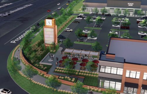
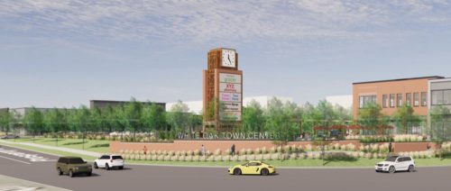
Yesterday our friends at Just Up the Pike shared a couple renderings from the upcoming White Oak Town Center (we have those and a few more below), so we wanted to provide you with a little more information on the project that was first accepted back in 2014.
The Montgomery County Planning Board will be looking at the preliminary plan in its meeting on July 29th– White Oak Town Center will be seeking approval to construct 105,000 square feet of commercial development.
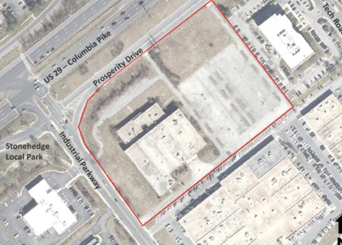
White Oak Town Center will be located at 12345 Columbia Pike, in the northeast quadrant of the intersection of Prosperity Drive and Industrial Parkway.
Here are some bullet points about what to expect:
• The Site Plan is limited to a maximum of 105,000 square feet of commercial development on the Subject Property.
• The development is limited to a maximum height of 40 feet, as measured from the building height measuring point(s), as illustrated on the Certified Site Plan. Each building will have its own building height measuring point.
• The Applicant must provide a minimum of 29,206 square feet of public open space (10% of the Site
Area)
• The proposed development will be comprised of two buildings – Building A and Building B, both oriented to Industrial Parkway. A surface parking lot is located between the two buildings
• The proposed development removes the existing free right turn from Industrial Parkway onto Prosperity Drive and provides for dedication on Industrial Parkway and Prosperity Drive.
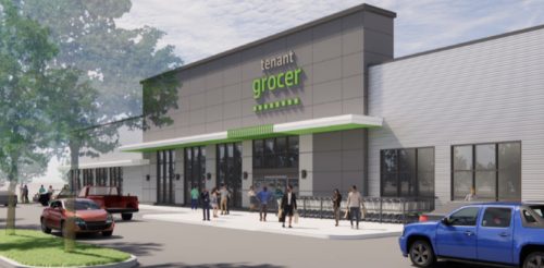
• Building A is a commercial building with approximately 63,100 square feet of density divided into 3 retail spaces. The space adjacent to Prosperity Drive is proposed to be a 41,000-square foot grocery store that anchors Building A and the entire development. Two other retail spaces complete the building, with outdoor tables for a potential restaurant. All front doors open onto the parking lot, with a loading area and additional parking to the rear.
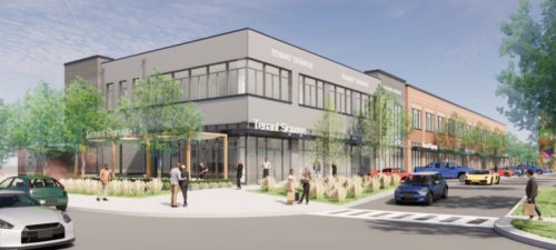
• Building B is a two-story commercial building with approximately 40,000 square feet of density, with retail and office uses. While Building B is oriented to Industrial Parkway, it can also be accessed from the parking lot. There is a plaza with a Sign/ Clock Tower at the west end of Building B, as well as a seating area at the east end.
• The Project will provide a sufficient number of on-site parking spaces to support the proposed development and visitors, in accordance with Division 59.6 of the Zoning Ordinance. The Zoning Ordinance requires a minimum of 368 parking spaces and allows for a maximum of 630 spaces. In total the Project will provide 405 spaces, which exceeds the minimum but remains within the maximum permitted amount.
Renderings
While renderings use generic logos that are examples for the types of stores that are expected to occupy the shopping center, the actual stores the renderings are based on sometimes find their way to the shopping center. In these updated renderings, you’ll see what looks like an Amazon Fresh design rather than the Trader Joe’s design that had been shown in previous renderings.
Full Montgomery Planning document can be seen here.

