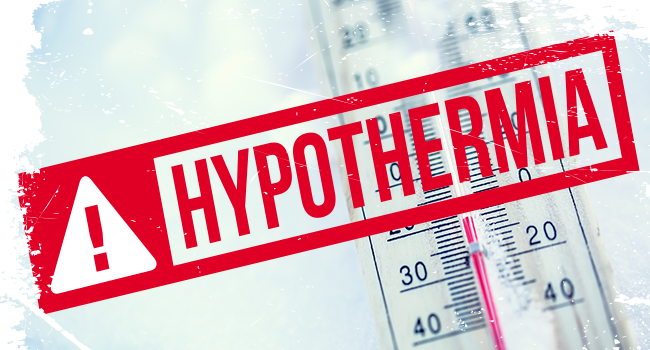
A Cold Emergency Alert is the highest level of extreme temperature alert issued by the County. It is activated when conditions—temperature combined with wind chill—are forecast to be below 20 degrees. These conditions pose a significant threat to exposed human and animal life. The conditions may include wind chill advisories or warnings from the National Weather Service and/or significant snowfall.

The County’s updated Hypothermia Alert page has more information on steps to take before and during the extreme temperature conditions.

The National Weather Service has also issued a Wind Chill Advisory for Friday afternoon through Saturday morning. Wind Chill Advisories are issued when wind chills are expected to be below minus-5 degrees or lower at times.

“Exposure to cold temperatures, even for a short time, can carry significant health risks to include hypothermia,” said County Executive Marc Elrich. “All residents should take extra precautions to stay warm, particularly our most vulnerable residents, including elderly and individuals with chronic health conditions such as diabetes and heart disease that may increase their risk of side effects related to cold temperatures.”

There is always a particular concern during periods of extreme cold for children, seniors, homeless individuals and animals. Everyone spending time outside should take necessary precautions against the extreme cold. Frostbite can occur with as little as 30 minutes of exposure to the cold. Anyone spending time outside should dress in layers of warm clothing and wear a hat. Nearly half of body heat is lost through the head. Cover mouths to protect lungs from extreme cold. Mittens, snug at the wrist, are better than gloves.

Individuals are advised not to ignore shivering, which is an important first sign that the body is losing heat. Persistent shivering is a signal to return indoors.

All Montgomery County facilities, such as libraries, recreation centers and senior centers, when open during their regular hours, can be used by anyone needing an escape from the cold. Due to the Christmas holiday, however, libraries will be closed on Sunday and Monday. Community Recreation Centers will close at 3 p.m. Saturday through Tuesday. Public shopping centers are also available as warm locations during their hours of operation.

Montgomery County Health and Human Services staff, as well as community-based providers, will continue to reach out to individuals who are experiencing homelessness to urge them to seek shelter during the extreme cold temperatures over the next several days. Residents concerned about the well-being of a homeless individual can call the 24-hour Line at 240-907-2688. Outreach partners will attempt to locate the individual and offer resources and support. Preparations are also being made in case emergency shelters are needed because of power outages or other emergencies.

If a resident is facing a utility shut off, the County’s Department of Health and Human Services’ Office of Home Energy Programs (OHEP) may be able to help. Call OHEP at 240-777-4450 or call 3-1-1.  Apply online at https://mymdthink.maryland.gov/home/#/

During a period of extreme cold temperatures, the Montgomery County Office of Animal Services (OAS)enforces Executive Regulation 17-17, Anti-Cruelty Conditions for Dogs and Other Pets. The executive director of OAS, Thomas J. Koenig, is authorized to provide resident notification when animals must not be left outside unattended.

In accordance with Executive Regulation 17-17, during a period of extreme cold temperatures, pets must not be left outside unattended. Leaving a pet outside unattended in these conditions may be considered an act of cruelty and pet owners could be charged and fined accordingly. This regulation is enforced by the Office of Animal Services, under the authority of its executive director.


0 Comments

Per the State of Maryland:
Anti-Icing Operations Complete in Western Maryland, Crews Monitoring For Icy Road Surfaces and Preparing For High Winds, Travelers Should Closely Monitor Forecast, Adjust Plans as Necessary

Governor Larry Hogan today announced that the state has activated emergency response operations ahead of the winter storm that is set to enter the region beginning overnight. With the storm expected to create hazardous conditions, state officials are urging Marylanders to closely monitor the forecast and adjust holiday travel plans as necessary, building in extra time in case of delays.

“We have activated emergency response operations in anticipation of this winter storm, which we view as a two-phase event, with the first wave of weather coming in overnight, and the second on Friday into Christmas Eve,” said Governor Hogan. “Marylanders should be prepared for significant impacts to holiday travel, and adjust plans as necessary. As always, it is especially important to give room to crews and plows. We are coordinating our response with local jurisdictions, and will continue to keep Marylanders informed throughout the storm.”

ssss

Winter storm warnings and advisories are in effect for Allegany, Frederick, Garrett, and Washington Counties. A flood watch is in effect for Anne Arundel, Baltimore, Cecil, Harford, Howard, Montgomery, and Prince George’s Counties. Follow the National Weather Service Baltimore/Washington office for a detailed forecast.

State Highway Administration (SHA) crews have completed anti-icing operations in Western Maryland, and will patrol statewide for icy road surfaces—especially on bridges, ramps, and overpasses. Brush and tree contractors are on standby in preparation for high winds, with gusts of 30 to 40 MPH expected. Drivers should expect wet roadway conditions to freeze. Drivers are urged to remain vigilant while traveling on the roads, make room for crews, and avoid crowding plows.

State law enforcement and emergency management officials are closely coordinating with local jurisdictions to ensure all storm-related needs are met. The Maryland Department of Emergency Management (MDEM) has issued an MDReady text alert regarding the storm.

Additional Resources For Travelers. The Statewide Transportation Operations Resource Map (STORM) identifies where contractual equipment are and where they have been, as well as real-time weather information. Information on road conditions and views of live traffic cameras are available at roads.maryland.gov. BWI Airport posts information about flight status, parking availability, and security wait times on its home page.

###

0 Comments

With winter weather, there are several factors that residents should be aware of and prepare for, such as: slippery road/sidewalks, cold temperatures, heavy snow and ice, frostbite, hypothermia, wind chill and power loss.

“During the winter months, it is important to be prepared and understand when you need to take action,” said County Executive Elrich. “I encourage everyone to sign up for Alert Montgomery to receive emergency updates and get the latest information.”

Know the terms:

  • Winter Weather Advisory: Cold, ice and snow are expected.
  • Winter Storm Watch: Severe winter weather is possible in the next 24-48 hours.
  • Winter Storm Warning: Severe winter weather conditions have begun or will begin soon.
  • Blizzard Warning: Sustained winds or frequent gusts to 35 miles per hour or greater and considerable amounts of falling or blowing snow (reducing visibility to less than a quarter mile) are expected for a period of three hours or longer.
  • Freezing Rain: Rain that freezes when it hits the ground, creating a coating of ice on roads, walkways, trees and power lines.
  • Sleet: Rain that turns to ice pellets before reaching the ground. Sleet also causes moisture on roads to freeze and become slippery.
  • Wind Chill: The temperature it “feels like” when you are outside.

Make sure to stay in the know. Alert Montgomery is the County’s emergency notification system. Subscribers can register to receive real-time information on their mobile devices, landlines or Everbridge app. The upgraded app offers immediate and anonymous opt-in and the opportunity to see what is happening in other areas, among other features. In addition to weather emergencies, subscribers can opt to receive alerts about school closures, government closures, gas leaks, severe weather, traffic, park closures, public health and other public emergencies. Regardless of the alerts chosen, all account holders will receive tornado warnings and other critical emergency notifications. The free service is available to anyone who signs up on the Alert Montgomery website.

Before snowstorms and extreme cold:

  • Make sure your emergency kit is stocked.
  • Make sure you have an emergency kit in your car.
  • Fully winterize your vehicle: Have a mechanic check antifreeze, brakes, heater and defroster, tires and windshield wipers to ensure they are in good shape. Keep gas tank at least half full.
  • Make sure to have a cell phone with an emergency charging option (car, solar, hand crank, etc.) in case of a power failure.
  • People who depend on electricity to operate medical equipment should have alternate arrangements in place in case power is out for an extended period of time.
  • Plan to bring pets inside.
  • Have a working carbon monoxide detectors and smoke detectors.
  • Keep space heater safety in mind: Use electric space heaters with automatic shut-off switches and non-glowing elements. Keep all heat sources at least three feet away from furniture and drapes.
  • Keep fire extinguishers on hand and make sure everyone in the house knows how to use them. House fires pose an additional risk, as more people turn to alternate heating sources without taking the necessary safety precautions.

During snowstorms and extreme cold:

  • Stay indoors and only travel if necessary. If you must drive, travel during the day. Do not travel alone. Keep others informed of your schedule and route. Stay on main roads and avoid back road shortcuts.
  • Walk carefully on snowy or icy walkways.
  • Avoid overexertion when shoveling snow. Overexertion can bring on a heart attack—a major cause of death in the winter. Use caution, take breaks, push the snow instead of lifting it when possible and lift lighter loads.
  • Keep dry. Change wet clothing frequently to prevent a loss of body heat.
  • If you must go outside, wear several layers of loose-fitting, lightweight, warm clothing rather than one layer of heavy clothing. The outer garments should be tightly woven and water repellent.
  • Wear mittens, which are warmer than gloves.
  • Wear a hat and cover your mouth with a scarf to reduce heat loss.
  • Maintain ventilation if using kerosene heaters or a generator. Refill heaters outside and keep them at least three feet from flammable objects.

Visit the OEMHS website for more information.

# # #

0 Comments

Per MDOT SHA: ​Crews to Perform Anti-Icing Operations on Major Roads in Advance of the Storm; Western Maryland May Experience Icing Conditions
The Maryland Department of Transportation State Highway Administration (MDOT SHA) crews are performing an anti-icing operation, which involves the use of salt brine and water in preparation for a potential winter storm that is expected to begin late Wednesday night into early Thursday morning.

The storm is expected to begin as a wintry mix for points north and west of the I-95 corridor. Garrett and Allegany counties are expecting icing conditions, so motorists are encouraged to keep updated with forecasts and delay travel in the event of icing. The application of salt brine is used to prevent precipitation from initially bonding to the pavement. Motorists are encouraged to remain home and off the roads so crews can effectively and efficiently treat the roads.

“We’re asking for motorists’ patience while our crews are out doing their jobs, clearing paths for drivers,” MDOT SHA Administrator Tim Smith said. “While we encourage everyone to stay home if travel becomes hazardous, those who must go out should remember that the safest spot for people that have to drive is safely behind our equipment.”

MDOT SHA is closely monitoring the forecast and making necessary pre-storm preparations as necessary. Motorists are advised to avoid or delay travel during inclement weather.  The entire state must stay on alert for potentially icy roads and bridges as the storm will coincide with cold air in place. Far Western Maryland is expected to feel the greatest impact while the lower Eastern Shore is expected to get mostly rain. MDOT SHA winter fact sheets and winter driving safety tips are available here.

For those who do have to travel, MDOT SHA offers the following guidelines:

  • Slow down. Posted speed limits are for ideal weather conditions.
  • Use extra caution on elevated surfaces, such as bridges, overpasses, and ramps. These areas freeze first.
  • Don’t crowd the plow. Leave plenty of space between your vehicle and MDOT SHA equipment.
  • Clear snow from the entire vehicle as remaining snow on hoods and roofs can become ice and dislodge during highway travel and pose a hazard to other motorists.

Commercial vehicle drivers are reminded that they can ride out storms that produce six inches or more in selected park-and-ride locations throughout the state. A list of these parks-and-rides are located here. During and after winter weather events, MDOT SHA crews work to clear and maintain the state’s numbered roadways while local jurisdictions attend to community and residential streets.

The Statewide Transportation Operations Resource Map  (STORM)  identifies where MDOT SHA and contractual equipment are and where they have been, as well as real-time weather information. MDOT SHA also invites motorists to get the latest travel information, including views of our live traffic cameras that enable smart travel decisions by logging onto our homepage, roads.maryland.gov​.

0 Comments

Montgomery County has activated a Hypothermia Alert for extreme cold for Wednesday 11/9 from 3AM until 8AM. Expect the wind chill to be below 32 degrees. Wear layers if you go outside. Per Montgomery County:

A Hypothermia Alert is issued for the County when forecasted temperatures, and/or wind chill, in at least part of the County fall below 32 degrees creating a hazardous situation in which hypothermia and frostbite are likely.

A Cold Emergency Alert could be issued for the County when dangerously cold conditions are present, including, but not limited to, sub-zero temperatures and wind chill for which it will be dangerous to be outdoors for prolonged periods of time.

There is always particular concern for children, seniors, homeless individuals and animals during periods of extreme cold.

  • Neighbors, friends or family members should check on the elderly, especially a senior living alone. Older people are particularly susceptible to hypothermia, even inside their homes and may need assistance.
  • Children engaged in outdoor activities should be carefully monitored by a responsible adult
  • Everyone spending time outside should dress appropriately to protect against the cold
  • Montgomery County provides a variety of sheltering opportunities for the homeless. Call the police non-emergency line, 301-279-8000 if an individual appears to be in danger.
  • Animals should not be left outside unattended.  See more information about animal care below.
  • Residents in need of a place to warm up can visit County facilities such as libraries or recreation centers, or ride a Ride On bus, during normal operating hours. Ride on bus fares are free at this time. Face Coverings are required.
2 Comment

Per the State of Maryand:
Coastal Flood Warning In Effect Beginning This Afternoon; Steady Rain Expected to Arrive
Today and Continue Through The Weekend
Drivers Advised to Avoid Rising Waters—’Turn Around, Don’t Drown’
State Has Deployed Personnel to Florida to Assist In Hurricane Response

ANNAPOLIS, MD—Governor Larry Hogan today announced statewide preparedness efforts as the remnants of Hurricane Ian move up the mid-Atlantic, leading to coastal flood and gale warnings in the region. Earlier this week, the governor announced the deployment of an Incident Management Team to the State of Florida to assist with the response.

“In addition to sending personnel to Florida to help with the response to Hurricane Ian, we have been preparing on all fronts to deal with the remnants of the storm,” said Governor Hogan. “As we always emphasize with potential flooding events, it is critical for drivers to avoid rising waters—‘turn around, don’t drown.’ We advise Marylanders to watch the forecast closely throughout the weekend and heed local warnings.”

According to the National Weather Service, steady rain is possible late Friday through Monday, accompanied by strong wind gusts. Beginning this afternoon, a coastal flood watch is in effect for St. Mary’s County, and a gale watch is in effect for lower portions of the tidal Potomac and Chesapeake Bay.

Marylanders are encouraged to sign up for the free MdReady text alert program by texting ‘MdReady’ to 211MD1, and visit md511.org for travel updates.

123

Maryland Department of Emergency Management (MDEM)

  • MDEM has activated the State Emergency Operations Center (SEOC) Partial Advance Team, and held Statewide Emergency Manager (SWEM) calls to address potential impacts.
  • MDEM reached out to Maryland search and rescue teams to ensure readiness, and facilitated the deployment of an Incident Management Team to the State of Florida.
  • MDEM has expanded outreach and messaging regarding Ian and storm preparations.

Maryland State Police (MSP)

  • Troopers will be deployed throughout the state as efficiently as possible to address any areas where there is a greater need.
  • MSP will monitor areas of flash flooding throughout the state and work with other state departments to set up detours if appropriate.
  • MSP will monitor social media and share/publish messaging: i.e., if traveling, drivers should reduce their speed, increase following distance, and avoid walking or driving through areas where water appears to be flooding or crossing the roads.

Maryland Department of Transportation (MDOT) 

  • The State Highway Administration (SHA) is clearing drainage ditches and stormwater management systems, especially inlets, to ensure positive drainage in the event of heavy rain.
  • SHA districts have contacted tree contractors to make sure they are prepared for the storm. Regional maintenance shops are preparing high-water signs, ensuring that generators are operational, chainsaws are ready, and fuel resources are adequate.
  • The Maryland Transportation Authority (MDTA) is monitoring weather and wind conditions and prepared to implement appropriate warnings or restrictions on bridges. Drains and ditches have been inspected and cleared of debris.
  • Maryland Transit Administration (MTA) crews are prepared to clear tracks and stations of debris, and will implement bus diversions should conditions warrant.
  • BWI Thurgood Marshall Airport is monitoring conditions, securing loose materials, and preparing to alert travelers regarding any delays and cancellations.

Maryland Department of the Environment (MDE)

  • MDE’s Water and Science Administration (WSA) will notify high and significant hazard dam owners and operators to monitor the weather and reduce pool levels if possible, check all emergency equipment (including backup power systems), review emergency action plans and update emergency contacts. WSA will also contact wastewater treatment plants and drinking water facilities to take precautions.
  • MDE’s hazmat team is prepared to respond statewide to chemical or oil spills as necessary during the event.
  • MDE’s Land and Materials Administration (LMA) advised landfill and other solid waste facility operators to take steps to prepare for the possible storm and associated precipitation by ensuring good coverage of waste, pumping down leachate storage facilities, and securing the site for possible high winds and heavy precipitation. LMA will also notify underground fuel storage tank owners and certified contractors to be prepared to protect excavations for tank removals and installations.

Maryland Department of Natural Resources (DNR)

  • DNR has trailer-able boats and experienced operators, if needed. Its coastal resiliency and restoration teams have already been in contact with sister states to discuss shoreline rebuilding and reconstruction. A team of water quality experts is on hand to assist with monitoring and sampling post-storm.
  • Natural Resources Police has equipment, officers, and supervisors available to assist affected states and communities. It can help with boat deployments, mission control support, search and recovery/rescue missions, and security.

Maryland Department of Human Services (DHS)

  • DHS has sent out situational awareness messaging to state and local partners, confirmed all fleet vehicles assigned for emergencies are operational, and prepared additional shelter supplies for deployment if needed.

Maryland Department of Disabilities (MDOD)

  • MDOD is pre-positioning assistive technology kits in case evacuation shelters are opened, raising awareness and preparedness in the disability community through social media channels, and preparing to stand up its constituent services hotline to receive requests and provide referrals for Marylanders with disabilities who are affected by the storm.
0 Comments

While it is possible for a hurricane or tropical storm to impact the County, the greater summer weather threats are flooding, hail, lightning strikes, thunderstorms, and strong winds. Thunderstorms can occur singly or in clusters or lines and typically produce heavy rain for a brief period. During severe thunderstorms there is a risk that a tornado could occur.

“During the summer months, it is important to know the difference between a weather watch and warning, and understand that when a warning is announced, it is important to take immediate action,” said acting OEMHS Director Marianne Souders. “I encourage everyone to sign-up for Alert Montgomery to receive emergency updates to protect you and your loved ones.”

NWS Watch/Warning:

Watch:

  • Be Prepared
  • Conditions are right for the event to happen
  • May last several hours
  • Time to plan for the possibility of the event

Warning:

  • The weather event is happening
  • Time to take immediate action
  • Usually limited to a short period of time (around 30 minutes)

Sign up for the County’s Alert Montgomery notification system to receive emergency alerts regarding weather and other emergency information. The Alert Montgomery System provides accurate and immediate emergency notifications from Montgomery County to your cell, work, or home phones via text, email, or voice message to receive notifications about emergencies that may affect your home, workplace, child’s school, or any other locations within the County.

Visit the OEMHS website for more information on severe summer storms.

# # #

0 Comments

MCPS sent the following community message on Friday morning:
“Dear MCPS Families,
The national weather service is predicting possible severe weather for Montgomery County throughout the day. MCPS, in times of severe or dangerous weather, may need to initiate a Shelter-in-Place to ensure the safety of students and staff. If this were to happen and affect school dismissal or any other activities the district will communicate these updates through email, text message, the MCPS website, and the Alert Montgomery (Alert MCPS) system. We encourage our entire community to be aware today and to stay safe.
Montgomery County Public Schools”

Per MoCoSnow:
A Tornado Watch has been issued for parts of District of Columbia, Maryland, North Carolina, Virginia and West Virginia until 2 PM EDT. This Watch includes Montgomery County. According to the National Weather Service, a few tornadoes are possible during this time in the Watch area. Isolated hail up to a quarter size is possible and scattered gusts of up to 70 mph winds are possible. Temperatures are expected to reach the low to mid 70s today with rain, including heavy thunderstorms, possible throughout the day. Rain is also possible early tomorrow, before a mix of clouds and sun and highs in the upper 70s take over. Sunday should be mostly sunny with temperatures in the mid 80s.

0 Comments

“We encourage residents to take precautions to protect themselves and their loved ones,” said Office of Emergency Management and Homeland Security Acting Director Marianne Souders. “Check on elderly friends, relatives and neighbors to ensure they are not showing signs of heat-related illnesses.”

Extreme heat affects the body’s ability to regulate temperature, which can create dangerous conditions if appropriate safety measures are not taken. Heat may affect air quality, especially in urban areas, and may have a stronger impact on the elderly, children. and sick persons.

During excessive heat, homeless shelters operate under a hyperthermia alert and residents may stay in the shelter 24/7. Individuals without shelter or residents concerned about the well-being of a homeless individual can call the 24-hour Homeless Information Line at 240-907-2688. Outreach partners will attempt to locate the individual and offer resources and support.

Residents are asked to check on elderly friends, relatives and neighbors who may be isolated to be sure they are not showing signs of heat-related illnesses. County facilities, including libraries, swimming pools, recreation, and senior centers, as well as regional services centers, and shopping malls are places to cool off during normal operating hours.

The County’s Office of Emergency Management and Homeland Security (OEMHS) issues heat-related alerts when conditions meet the following:

  • Hyperthermia Alert is announced when the National Weather Service forecasts temperatures and/or heat indices to be greater than 95 degrees.
  • A Heat Emergency Alert is issued when County-wide temperatures and/or heat index are forecasted to be 105 F or higher and at least one of the following conditions: hot temperatures are expected to last for two days or more; the nighttime temperature will not drop below 75 degrees, or there are other weather threats determined by OEMHS.

The following precautions will help residents remain safe and comfortable during excessive heat days:

  • Stay indoors, whenever possible. Visit nearby air-conditioned buildings in your community if your home is not air-conditioned. In addition to County facilities, residents can visit shopping malls, movie theaters and museums.
  • Be careful to avoid strenuous activities that can result in overexposure to the sun, such as sports and gardening. If you must do a strenuous activity, do it during the coolest part of the day, which is usually in the morning before 9 a.m.
  • Drink plenty of water. Dehydration, cramps, exhaustion, or heat stroke can result from not drinking enough fluids. Water is the safest liquid to drink.
  • Avoid drinks containing alcohol or caffeine.
  • When outdoors, wear proper protection from the sun. Light-colored clothing, a hat, sunglasses, and sunscreen protection are recommended.
  • Never leave pets, young children, or vulnerable adults in a car for ANY amount of time, even with the window open, because the temperature inside parked cars can reach 130 degrees in only a few minutes.
  • Monitor those at high risk. Those at greatest risk of heat-related illness include:
    • Infants and children up to four years of age;
    • Individuals 65 years of age and older;
    • Individuals who are ill or on certain medications; and
    • Individuals who are overweight.
  • Knowing the signs of heat exposure can prevent serious illness from becoming life threatening. Should any of the following occur, get out of the heat, loosen any tight or heavy clothing, and drink plenty of water:
    • Heat cramps: symptoms include painful muscle spasms, usually involving the abdominal muscles or legs;
    • Heat exhaustion: first signs are cool, moist, pale, or flushed skin, dizziness, nausea, headache, and weakness; and
    • Heat stroke: the most serious sign of overexposure. Symptoms include red, hot, dry skin, weak pulse, rapid breathing, and changes in consciousness. Seek medical attention by calling 9-1-1.

Sign up for the County’s Alert Montgomery notification system to receive emergency alerts regarding weather and other emergency information. The Alert Montgomery System provides accurate and immediate emergency notifications from Montgomery County to your cell, work, or home phones via text, email, or voice message to receive notifications about emergencies that may affect your home, workplace, child’s school, or any other locations within the County.

# # #

0 Comments

Montgomery County Public Schools are preparing for expected severe weather this afternoon. At this time, MCPS will not be dismissing students early, however they could activate a Shelter-in-Place if warranted. This morning Howard County Public Schools announced they would close three hour early today. MCPS sent the following community message on Monday at noon:

“The national weather service is predicting possible severe weather for Montgomery County later today and likely occurring during school dismissal time. MCPS in times of severe or dangerous weather may need to initiate a Shelter-in-Place to ensure the safety of students and staff. If this were to happen and affect school dismissal or any other activities the district will communicate these updates through email, text message, the MCPS website, and the Alert Montgomery (Alert MCPS) system. We encourage our entire community to be aware today and to stay safe.
Montgomery County Public Schools”

0 Comments

After 36.5 years, legendary local meteorologist Sue Palka will give her final weather report tonight on FOX 5. “We know you don’t like it when we “disappear” so that’s why we’re giving you this heads up. My last day will be March 23, so I’m going to help get you through the winter,” Sue said during the initial announcement of her retirement.

Fox 5’s Chief Meteorologist began her career in Richmond in 1983 before being hired by Fox 5 in 1985– and place she has remained for over three and a half decades. “Maury Povich and James Adams anchored our only newscast at 10 pm and Ronald Reagan was the President. I’ve been here so long I’ve seen the Brood X cicadas emerge three times!” said Palka in the announcement from Fox 5.

After she steps down from her current role, she’ll continue to make appearances, per the request of Fox 5 general manager Patrick Paolini. Palka, a longtime Gaithersburg resident, will certainly be missed.

0 Comments
×

Subscribe to our mailing list