The National Weather Service (NWS) has issued its first set of graphics for this weekend’s winter storm, highlighting an elevated risk for accumulating snow across much of Maryland, including most of Montgomery County. The storm is expected to arrive Saturday night into Sunday morning, with the potential for lingering impacts into Monday due to very cold temperatures.
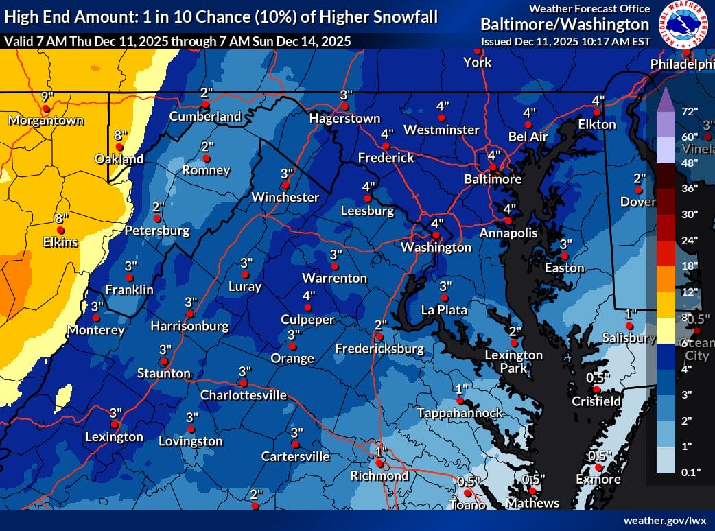
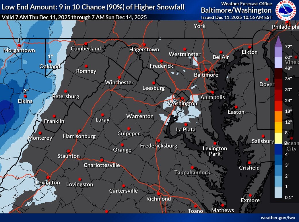
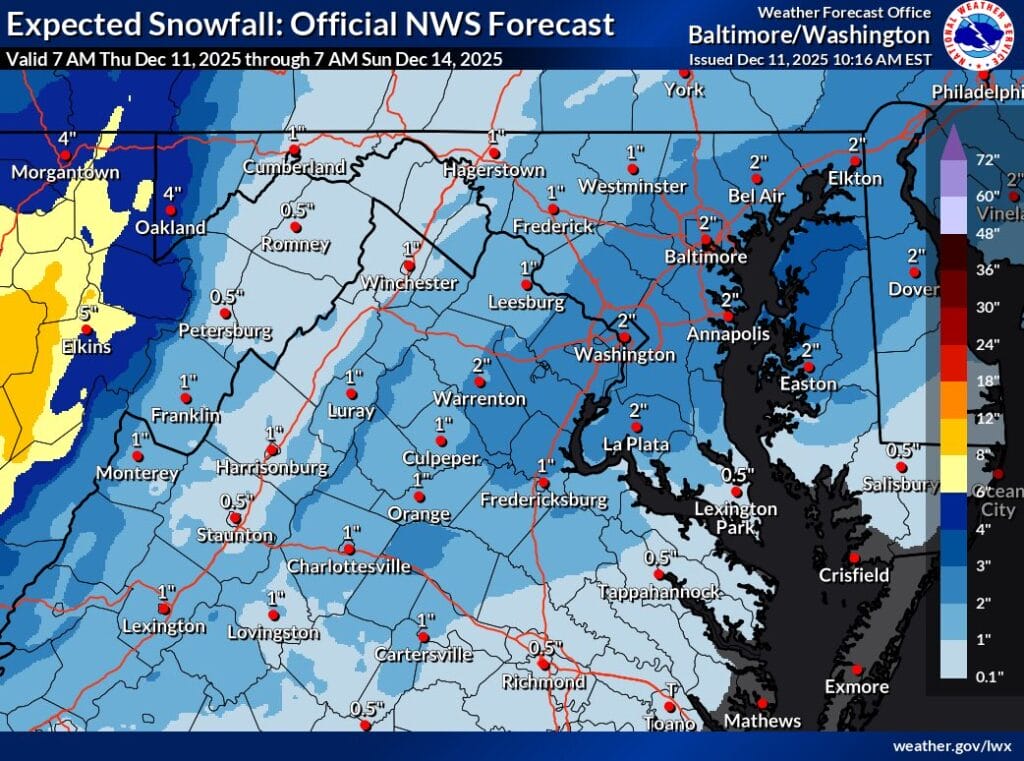
The first NWS official snowfall forecast that covers this potential storm now calls for approximately 2 inches of snow across a wide portion of central Maryland, including the Washington DC metro area. The agency has also released its high-end and low-end snowfall projections:
High-end (10% chance): Up to 4 inches of snow possible across Montgomery County, Frederick County, Howard County, Baltimore, and the I-95 corridor. Low-end (10% chance): Almost no snow for some areas, showing how sensitive this storm remains to track and temperature changes.
This spread highlights the uncertainty still involved with the system, although confidence is growing that most of the region will see at least some accumulation. The latest NWS Forecaster’s Discussion notes that “there does appear to be an increasing signal of accumulating snows heading into early Sunday.” Forecasters are monitoring upper-level energy and the interaction of cold air behind the storm, which could help enhance snowfall rates during the overnight hours.
One of the biggest storylines may come after the snow. Temperatures are expected to drop sharply late Sunday into Monday, with the potential for icy patches on untreated roads, sidewalks, and parking lots. This may cause lingering travel issues for the Monday morning commute, even if snow totals remain modest.
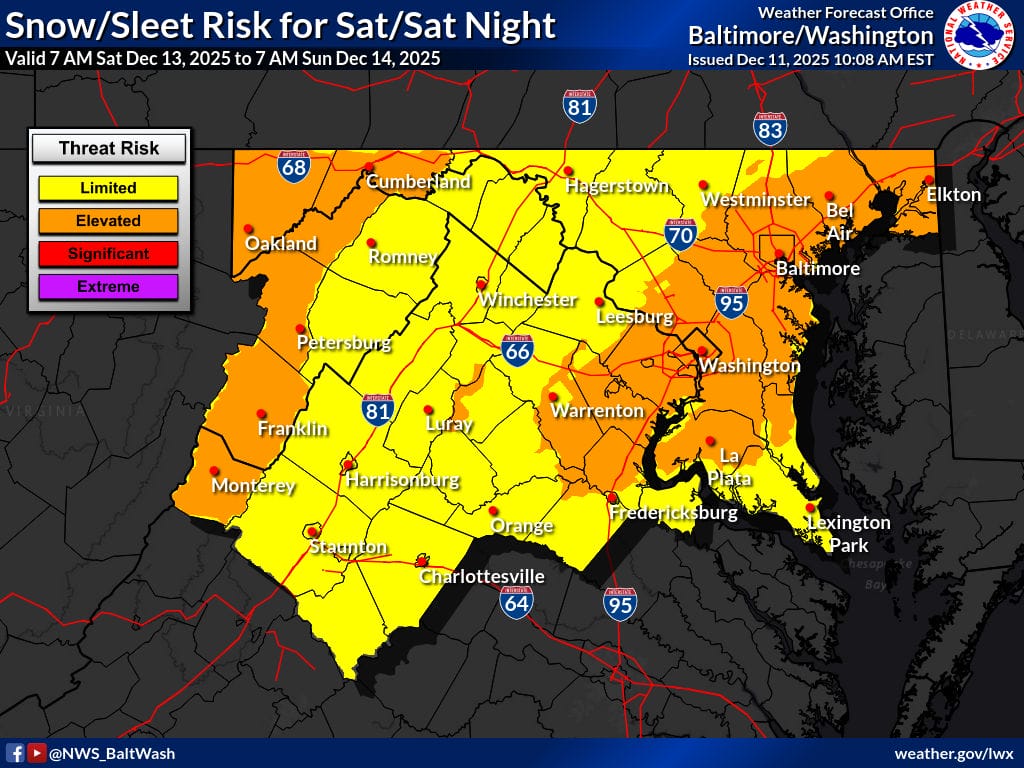
The NWS Snow and Sleet Risk map places most of Montgomery County, along with the entire DC-Baltimore corridor, in the elevated risk zone for Saturday night and early Sunday. Forecast confidence is expected to improve over the next 24 to 36 hours as models refine the storm’s track and temperature profile. Even a slight shift could influence whether parts of the region end up closer to the low-end or high-end forecast range.