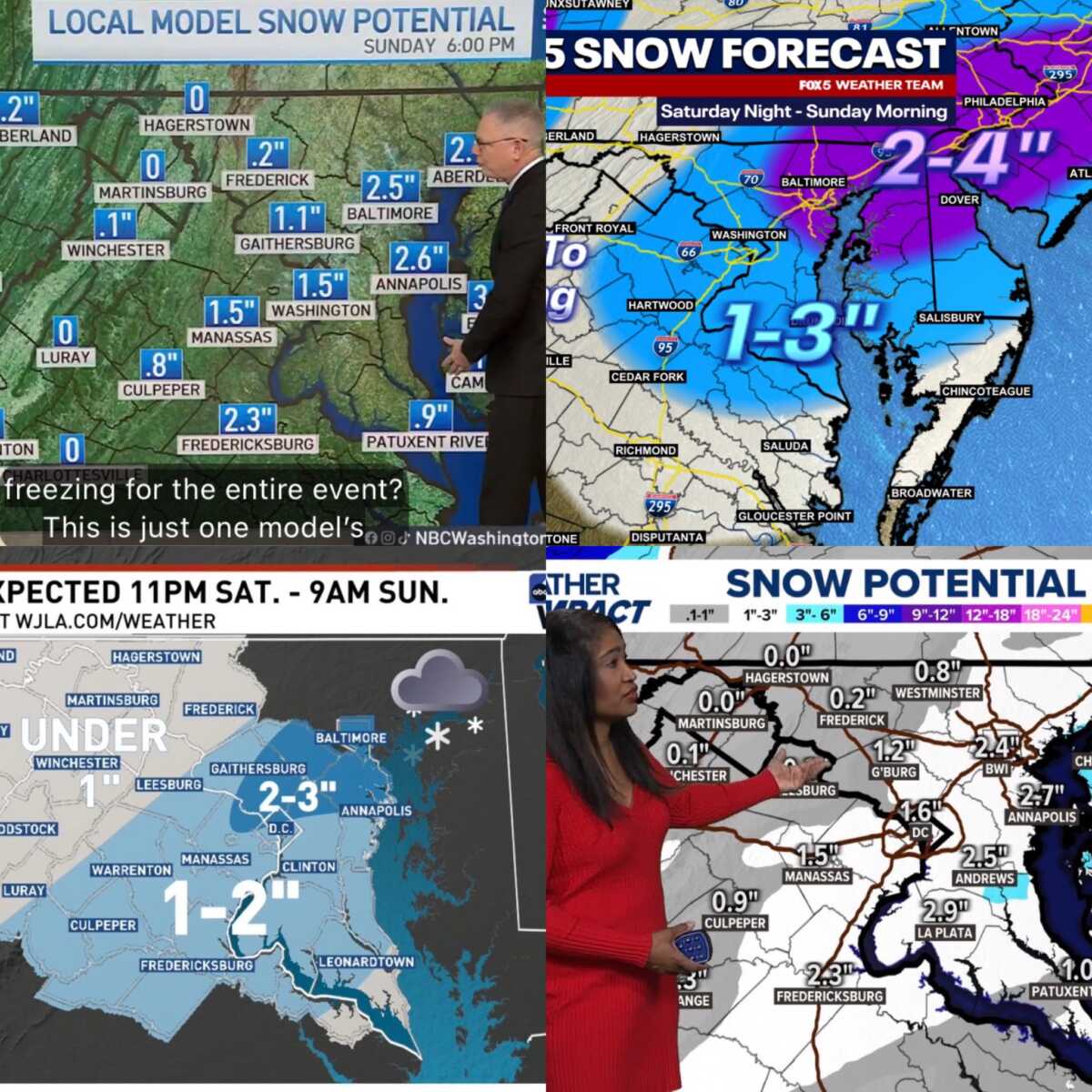
Several of the region’s major TV weather teams are starting to roll out early snowfall maps for a system expected to move through the DMV area late Saturday night into early Sunday morning. Some are from last night and others are from this morning, with all likely to be refined throughout today and tomorrow.
NBC4’s Storm Team 4 is showing a generally light event across much of the region, with many lower-elevation areas ranging from around one to two inches, and higher totals possible west of the metro area, especially in the mountains.
FOX 5’s early snowfall map places most of the immediate DC metro and central Maryland in the one-to-three-inch range, with lighter amounts possible farther south and west. Their forecast emphasizes the narrow overnight window for snow, suggesting precipitation will taper off quickly as the system moves offshore early Sunday.
ABC7’s First Alert Weather team is also forecasting a brief overnight event, with much of the region projected to see about one to two inches, and localized spots closer to the Bay potentially pushing a bit higher. Their maps show the sharp cutoff on the western side of the storm, reinforcing the idea that this will not be a long-duration snowfall.
WUSA9’s Weather Impact team similarly shows totals generally hovering around one to three inches for much of central Maryland and the DC area, with slightly higher amounts closer to the Eastern Shore. Their forecast also notes that this is an overnight system, which could still impact early Sunday travel despite the quick exit.
The National Weather Service Baltimore/Washington office currently has around two inches forecast for much of the area, aligning closely with what the local TV stations are showing. The NWS notes that the storm is expected to arrive late Saturday night and be largely gone by daybreak Sunday morning, limiting overall totals but still bringing the potential for slick conditions during the overnight and early morning hours.
As with any winter system, small shifts in timing or temperature could lead to localized differences. Forecasts are expected to be updated frequently as the storm approaches. Very cold temperatures/wind chills could impact commutes into Monday, but that would depend on how much snow actually falls. We’ll continue to monitor.