A potentially significant winter storm is increasingly likely to impact the Mid-Atlantic this weekend, with confidence continuing to grow as the event draws closer.
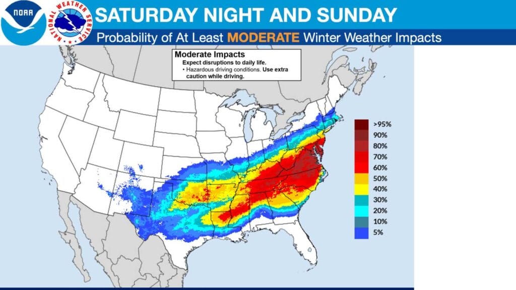
According to the National Weather Service, a wide-ranging winter storm is expected to produce large swaths of heavy snow, sleet, and dangerous freezing rain beginning Friday across the southern Rockies, Plains, and Mid-South. The storm will then shift eastward, impacting the Mid-Atlantic and East Coast through Sunday. Forecasters stress that with several days remaining, details will continue to evolve.
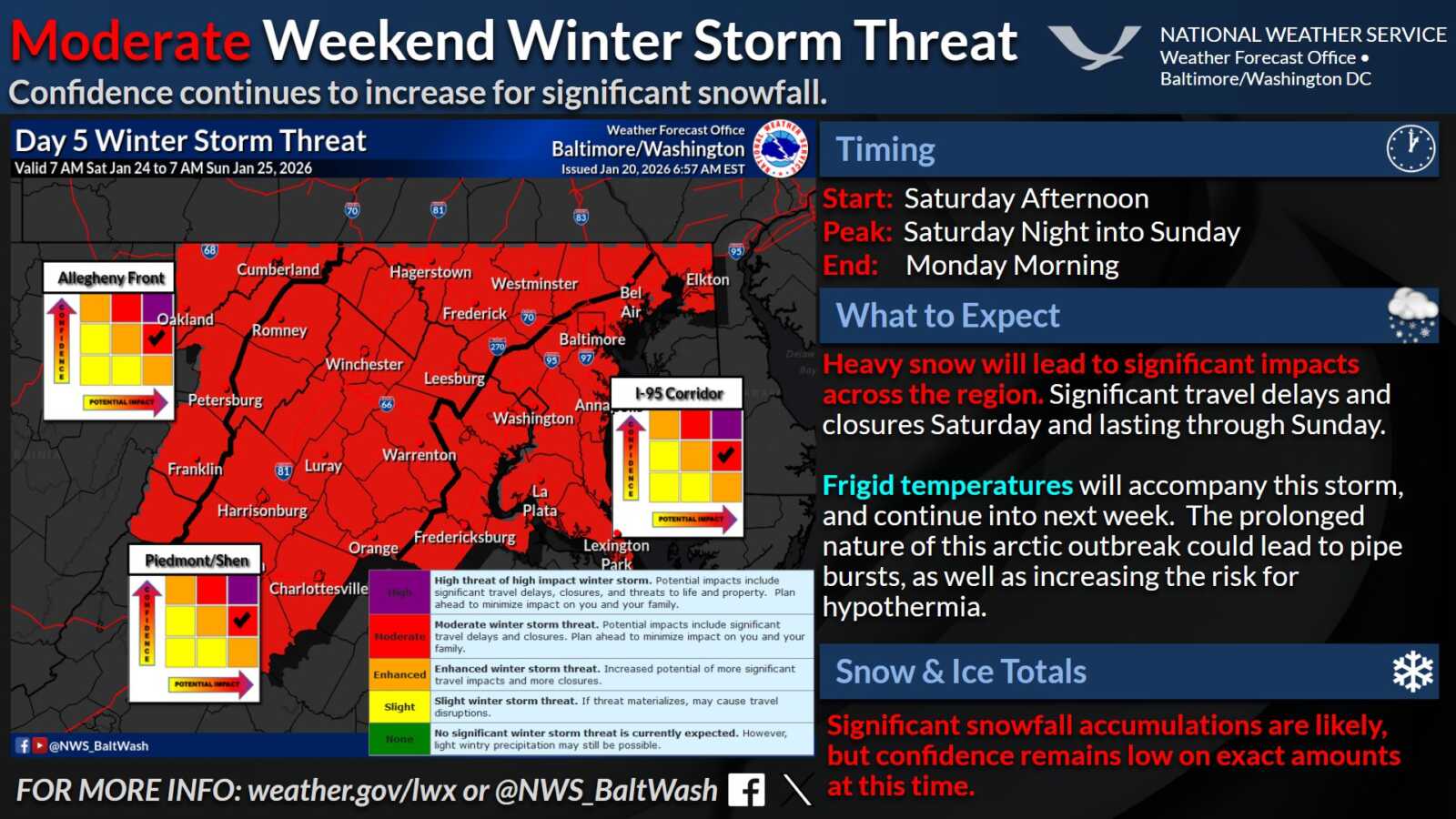
The National Weather Service Baltimore/Washington office says confidence is increasing for a significant winter storm affecting the region from Saturday into Sunday. Current outlooks show a moderate winter storm threat across much of the area, including the I-95 corridor, with the potential for widespread and impactful snowfall.
Timing currently points to snow developing Saturday afternoon, intensifying Saturday night, and continuing into Sunday, with lingering impacts possibly extending into Monday morning. Peak impacts are expected Saturday night into Sunday, when hazardous travel conditions are most likely.
Forecasters warn that heavy snow could lead to significant disruptions across the region, including major travel delays and possible closures. Frigid temperatures are also expected to accompany the storm and persist into next week, increasing the risk of hypothermia and other cold-related hazards. The prolonged cold may also raise concerns about frozen or burst pipes.
While significant snowfall accumulations are increasingly likely, the National Weather Service notes that confidence remains low on exact totals at this time. Residents are urged to monitor forecasts closely and begin planning now to minimize impacts on travel, work, and family schedules.