The National Weather Service (NWS) has issued a Winter Storm Watch for the District of Columbia and large portions of Maryland and Virginia from Saturday evening through Monday morning.
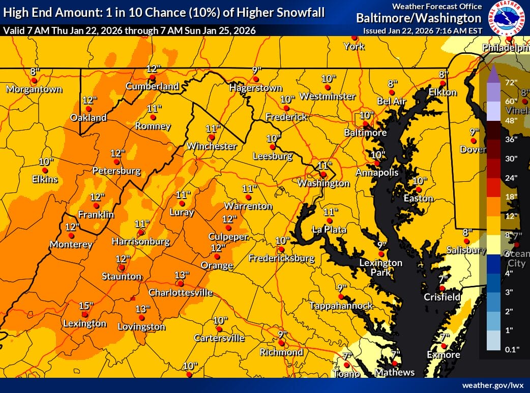
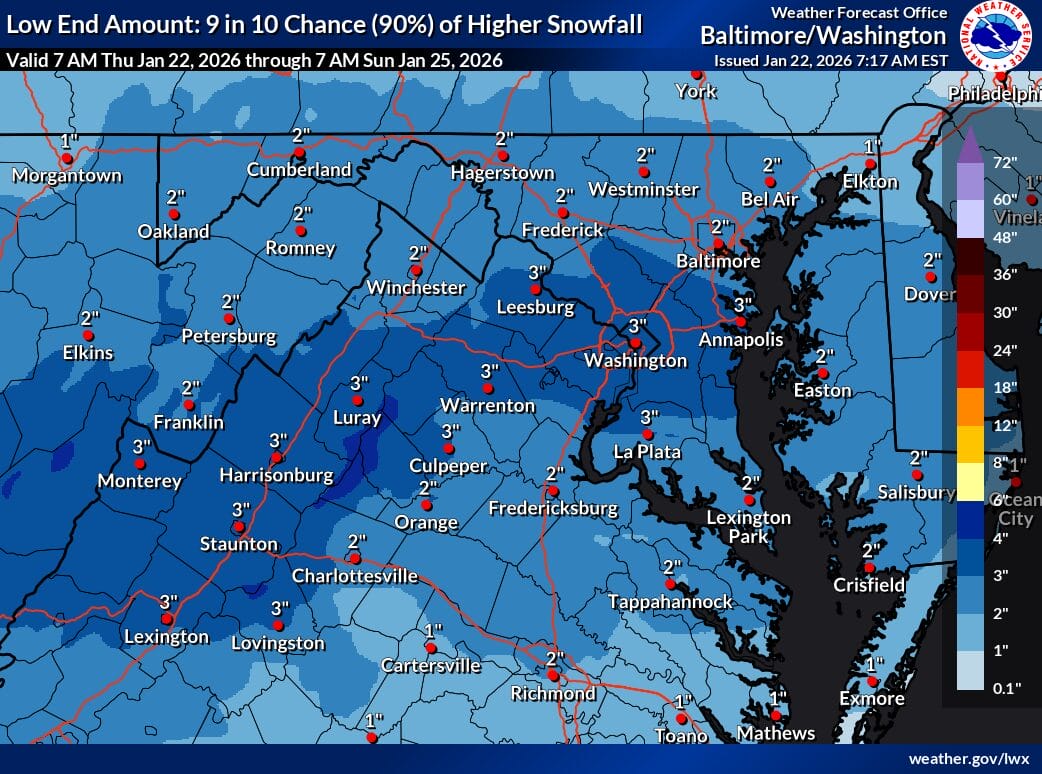
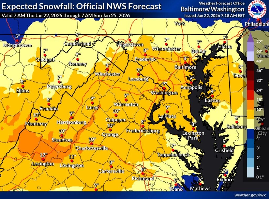
The NWS has also released its first expected snowfall maps that cover the first half of the storm until 7am Sunday, with much of the area at 9 inches. The “high end amount” (10% chance) is at 10/11 inches and the “low end amount” (10% chance) is at 2-3 inches depending on the area you’re in. These maps do not cover snow amounts expected to call after 7am Sunday. Maps that cover almost all of the storm should be out this evening.
According to the Winter Storm Watch, forecast guidance indicates a large area of precipitation will overrun entrenched Arctic air, a setup that strongly favors widespread, significant winter weather. Snow is expected to overspread the region Saturday evening and intensify overnight, with periods of heavy snowfall late Saturday night. Snowfall rates could reach one to two inches per hour at times.
There is a high likelihood of at least five inches of snow across much of the region, with the potential for totals exceeding ten inches in some areas. As the storm evolves on Sunday, sleet and freezing rain may mix in, particularly south of Route 50 and near and east of Interstate 95. Forecasters note that significant ice accumulation is possible in these southern zones, which could worsen travel conditions and increase the risk of power outages.
Visibility could drop to a quarter mile or less during the heaviest precipitation, making travel very difficult. Impacts may extend into the Monday morning commute due to lingering snow, ice, and untreated roadways.
Beyond the precipitation, the cold will be a major concern. Very cold temperatures are expected to settle in Friday night and persist through the middle of next week. Wind chills are forecast to fall into the teens and single digits for extended periods, with sub zero wind chills possible at times, adding to the danger for anyone outdoors.
Officials urge residents to closely monitor forecast updates from the National Weather Service and begin preparations now. That includes stocking up on groceries and medications, preparing vehicles with emergency kits, ensuring cars are fueled or charged, and checking on elderly neighbors and pets ahead of the prolonged cold and potential disruptions.