A powerful winter storm is expected to intensify rapidly along the Southeast coast this weekend, bringing major impacts to parts of the Carolinas and southern Virginia, but it now appears likely to largely miss the DC Metro area and much of Maryland.
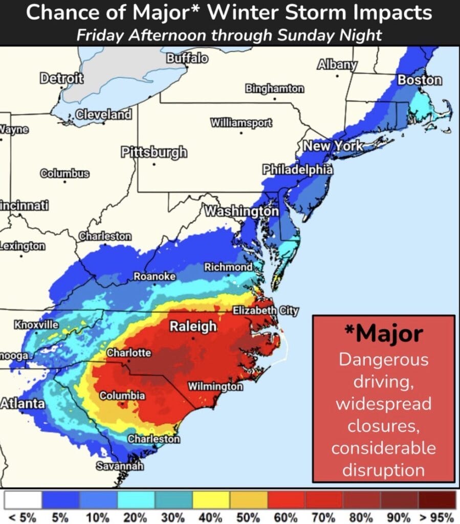
According to the National Weather Service (NWS), the storm will deepen quickly just off the North Carolina coast from Friday night through Saturday night. Widespread heavy snow and strong winds are expected from the southern Appalachians through the Carolinas and into southern Virginia, where the risk of more than eight inches of snow exceeds 50 percent in some areas.
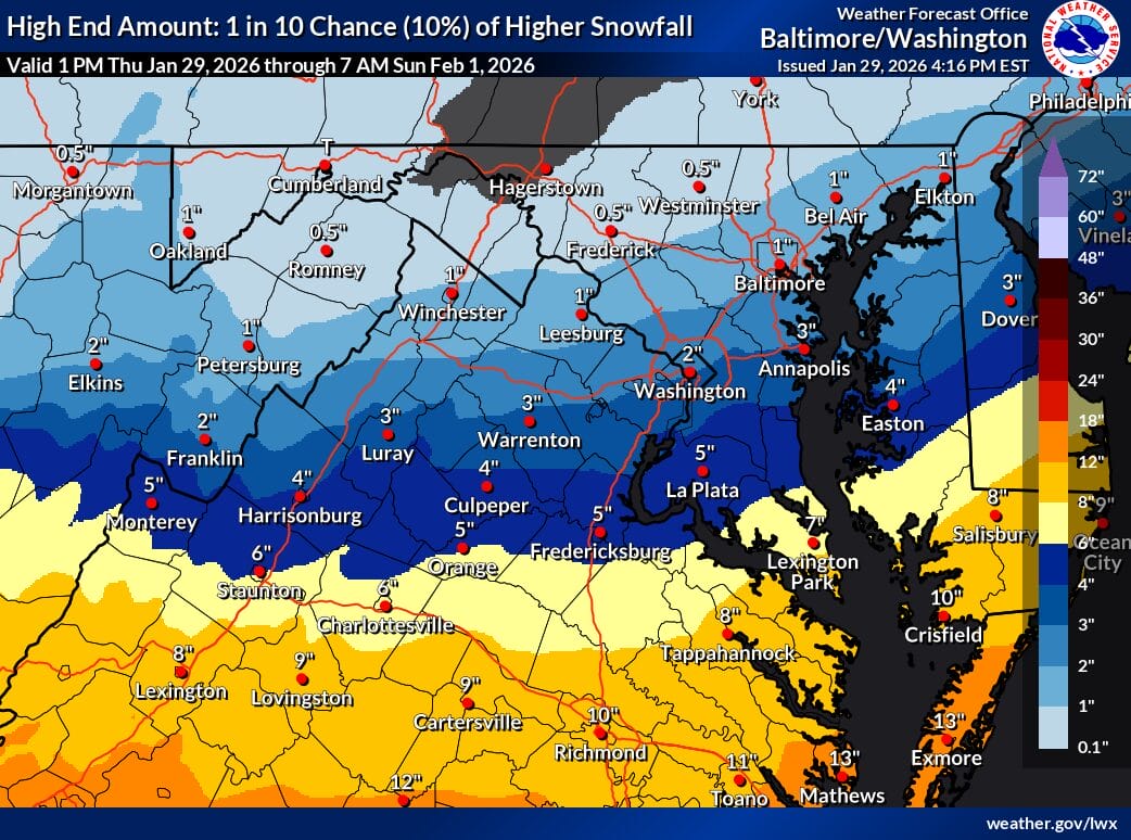
For the DC Metro area, confidence continues to increase that most of the snow will remain south and east. The National Weather Service currently gives the region only a 10 percent chance of two inches of snow, with a much greater likelihood that measurable snow misses the area entirely.
NWS Forecasters note that the DC region will sit on the northwestern edge of the storm, where small shifts in track can matter. Some very light and intermittent snow is possible as early as midday Friday, particularly along the I-64 corridor, driven by warm air advection ahead of the system. The main window for any potential snow locally would be late Saturday into early Sunday morning, but higher end accumulation scenarios are currently considered unlikely.
The greatest chance for light accumulations extends from the I-64 corridor into Fredericksburg and parts of southern Maryland. A relatively sharp cutoff is expected, meaning many locations across the Baltimore and Washington metro areas could see little to no snow, while others closer to the southern fringe could pick up minor amounts.
Farther south and east, impacts will be significant. Blizzard conditions are likely from Saturday afternoon into Sunday along portions of the North Carolina Outer Banks, coastal South Carolina, and into parts of the Delmarva. Powerful onshore winds, potentially damaging in strength, combined with heavy snow and blowing snow will create extremely dangerous travel conditions.
In addition to snow, the storm will bring gusty winds and bitter wind chills across a large portion of the eastern United States. As the system pulls away Sunday, some upslope snow may develop along the Alleghenies, though precipitation amounts there are also expected to be light.
While this storm will be one to watch closely, especially given its strength, current guidance suggests the DC Metro area avoids a major impact, with the worst conditions remaining well to the south and east.